Heavy snowfall in the Upper Midwest
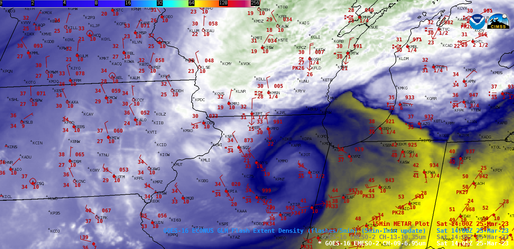
GOES-16 Mid-level Water Vapor (6.9 µm) images with an overlay of GLM Flash Extent Density, and 15-minute METAR surface reports plotted in red [click to play MP4 animation]
The corresponding 1-minue GOES-16 “Clean” Infrared Window (10.3 µm) images below helped to highlight areas of mesoscale banding where precipitation rates were enhanced (some sites reported snowfall rates of 1 to 2 inches per hour).
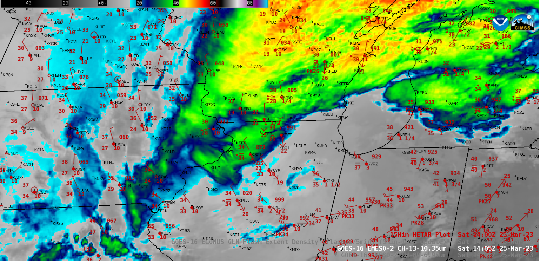
GOES-16 “Clean” Infrared Window (10.3 µm) images, with 15-minute METAR surface reports plotted in red [click to play MP4 animation]

GOES-16 Day Snow-Fog RGB and Day Cloud Phase Distinction RGB images [click to play animated GIF | MP4]
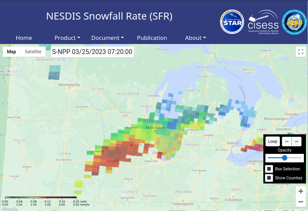
Microwave estimates of snowfall rate (SFR) are available at this website, and imagery during the day on the 25th are shown below. The heavy band of snow is apparent early in the morning of 25 March; by afternoon, it has shifted eastward to hug the Lake Michigan shoreline in Wisconsin.