Hurricane Carlotta and Flooding Potential
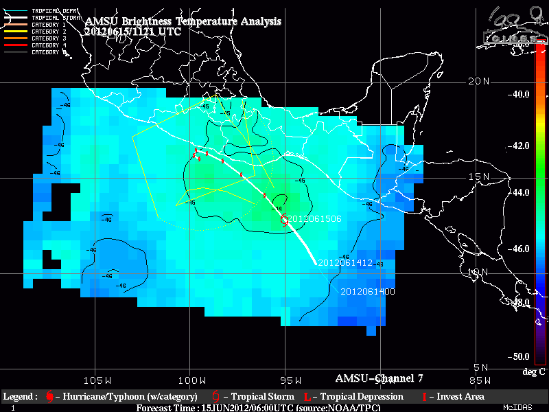
Carlotta is the third named system, and second Hurricane, of the young eastern Pacific Tropical Season. Hourly imagery from GOES-East shows the increase in organization in the storm as it approaches the coast of Mexico on the morning of June 15 2012. AMSU imagery from Channel 7 at 11UTC on 15 June shows the characteristic warm core usually found... Read More
