SAR data views of the North Wall of the Gulf Stream
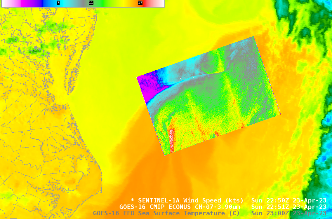
Sentinel-1A’s overpass just east of North Carolina right after sunset on 23 April 2023, above, shows a sharp delineation in wind speeds, with wind speeds at the western edge of the SAR winds dropping from around 8-9 knots (cyan enhancement) to 2-3 knots (magenta enhancement). The animation below includes the... Read More