Scattering and Shadows

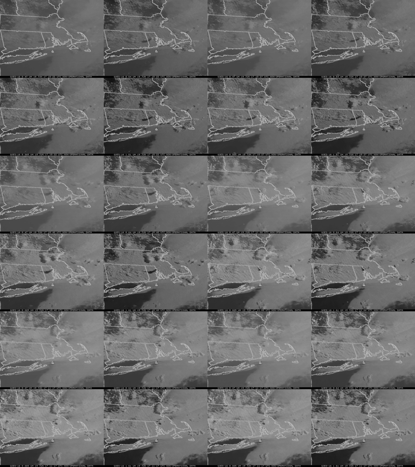
GOES-16 Imagery over New England from 1022 through 1117 UTC on 19 June 2017. Blue Band (0.47 µm), upper left; Red Band (0.64 µm), upper right; ‘Veggie’ Band (0.86 µm), lower left; ‘Snow/Ice’ Band (1.61 µm), lower right. Click to enlarge.
GOES-16 data posted on this page are preliminary, non-operational data and are undergoing testing
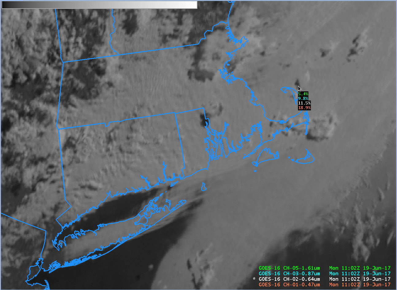
The animation of GOES-16 imagery, above, showing, clockwise from upper left, the GOES-16 0.47 µm, 0.64 µm, 1.61 µm and 0.86 µm channels, shows lows clouds over southeast New England, with a few mid-level clouds aloft. The moving mid-level clouds are casting shadows on the lower clouds beneath. Note that the shadows appear darkest at the longest wavelength. This is shown in the AWIPS cursor readout below as well — for the point selected, the 1.61 µm reflectance is 5.4%, and it increases to 18.9% at 0.47 µm. Why does it change by wavelength?

AWIPS read-out of reflectance in a shadow east of Cape Cod. Note the reflectance increases as wavelength decreases. (Click to enlarge)
Rayleigh scattering in the atmosphere is a function of wavelength: scattering is more effective at shorter wavelengths. Thus, the atmosphere is scattering the greatest amount of 0.47 µm radiation (compared to the longer wavelengths shown here). Shadows are darker (there is less detected reflectance) at longer wavelengths because less longer-wavelength radiation is scattered towards the satellite sensor.
The tweet from the National Weather Service in Melbourne, below, shows another shadow scene with 0.86 µm imagery.
Offshore showers & storms cast long shadows across the Florida peninsula just after sunrise, as seen on GOES-16 visible channel 3 imagery. pic.twitter.com/NAhLwexx5h
— NWS Melbourne (@NWSMelbourne) June 18, 2017

