Satellite Data in STEM Education
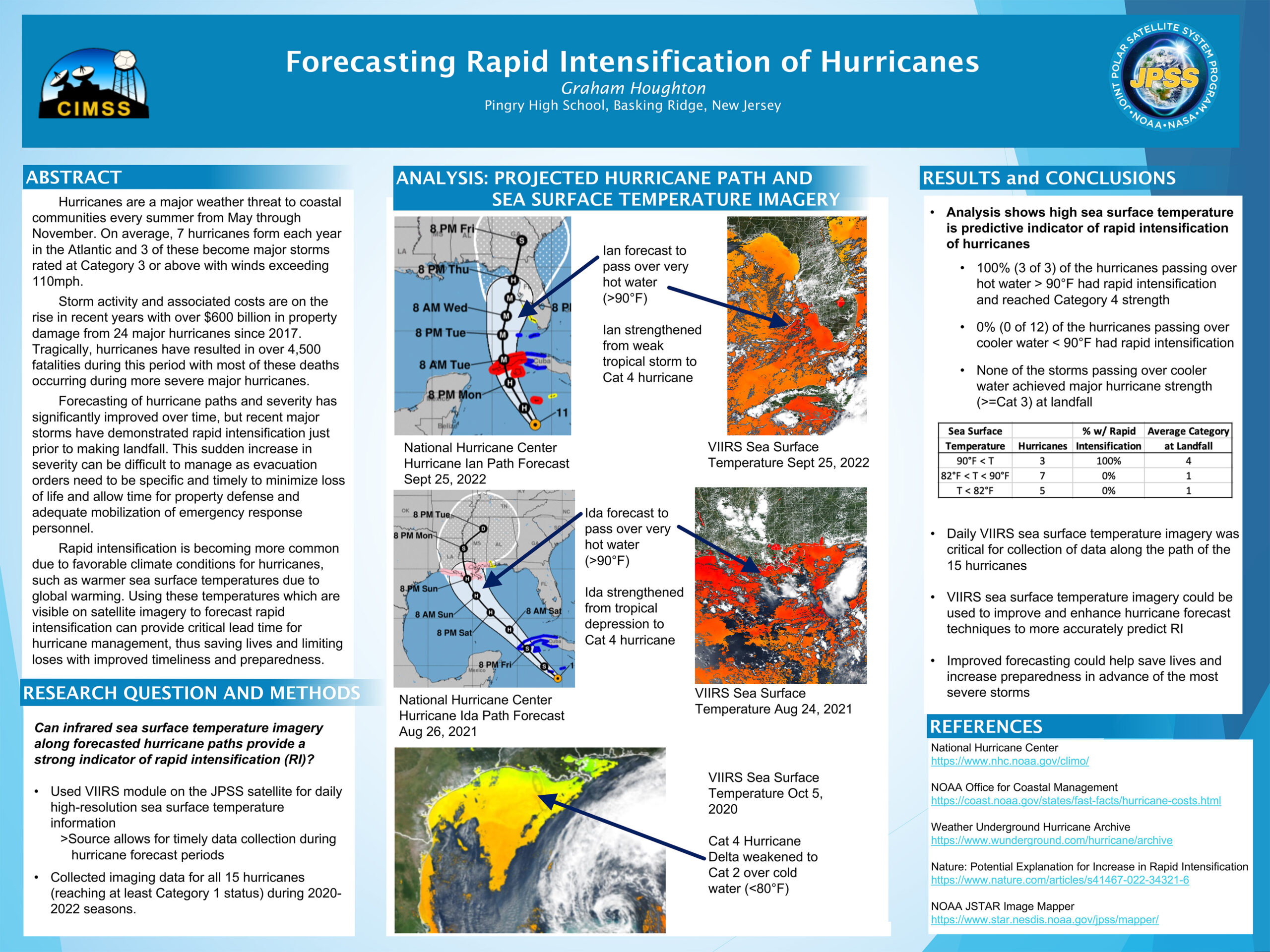
The 2023 NOAA Satellites Virtual Science Fair (VSF) concluded this month with top projects identified. The VSF involves middle and high school students (G6-12) working with GOES (geostationary) or JPSS (polar-orbiting) satellite data in projects of their own design conveyed via a scientific poster. High school submissions also require a short video where students... Read More