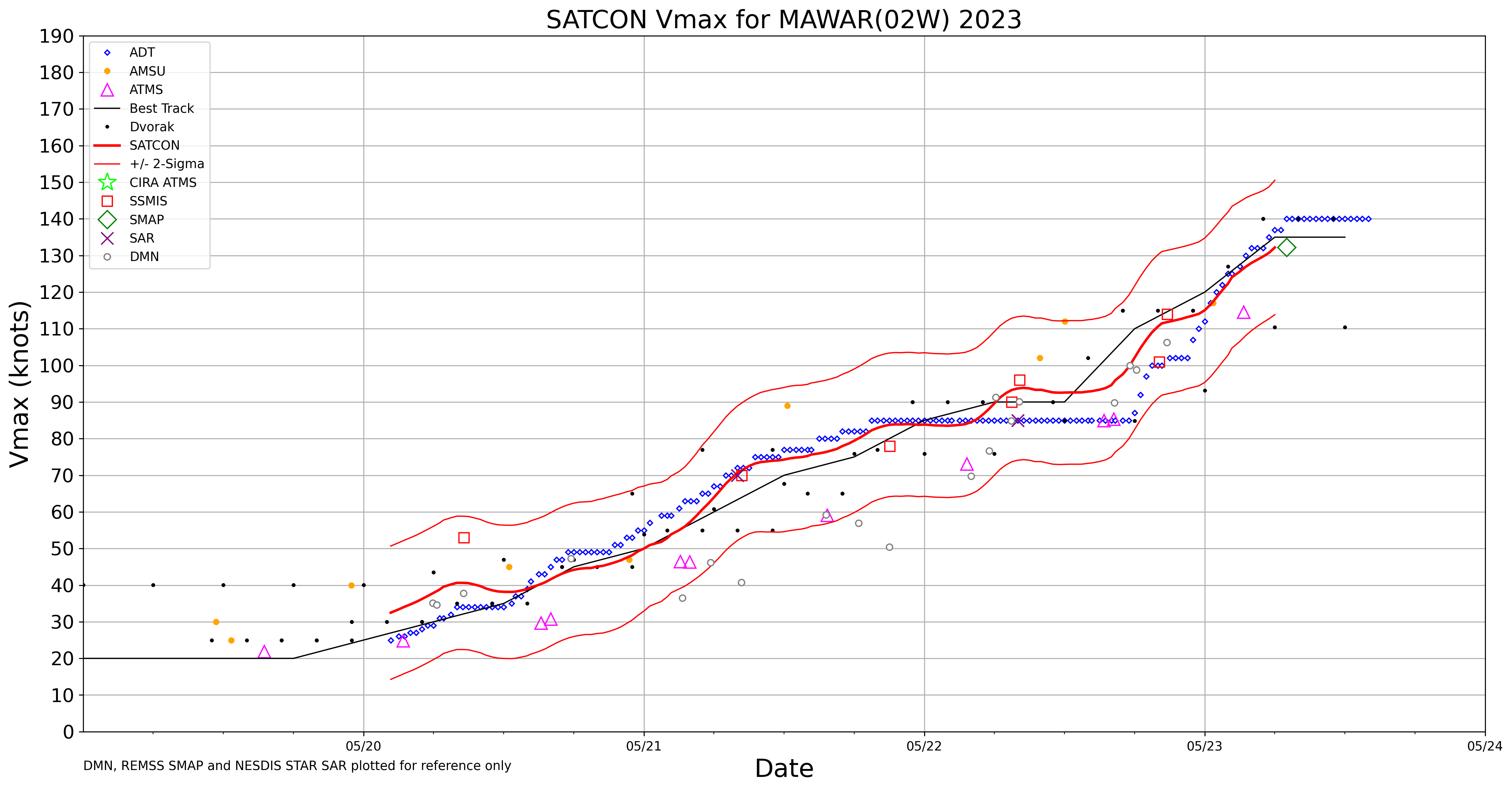
Typhoon Mawar reaches Category 4 intensity
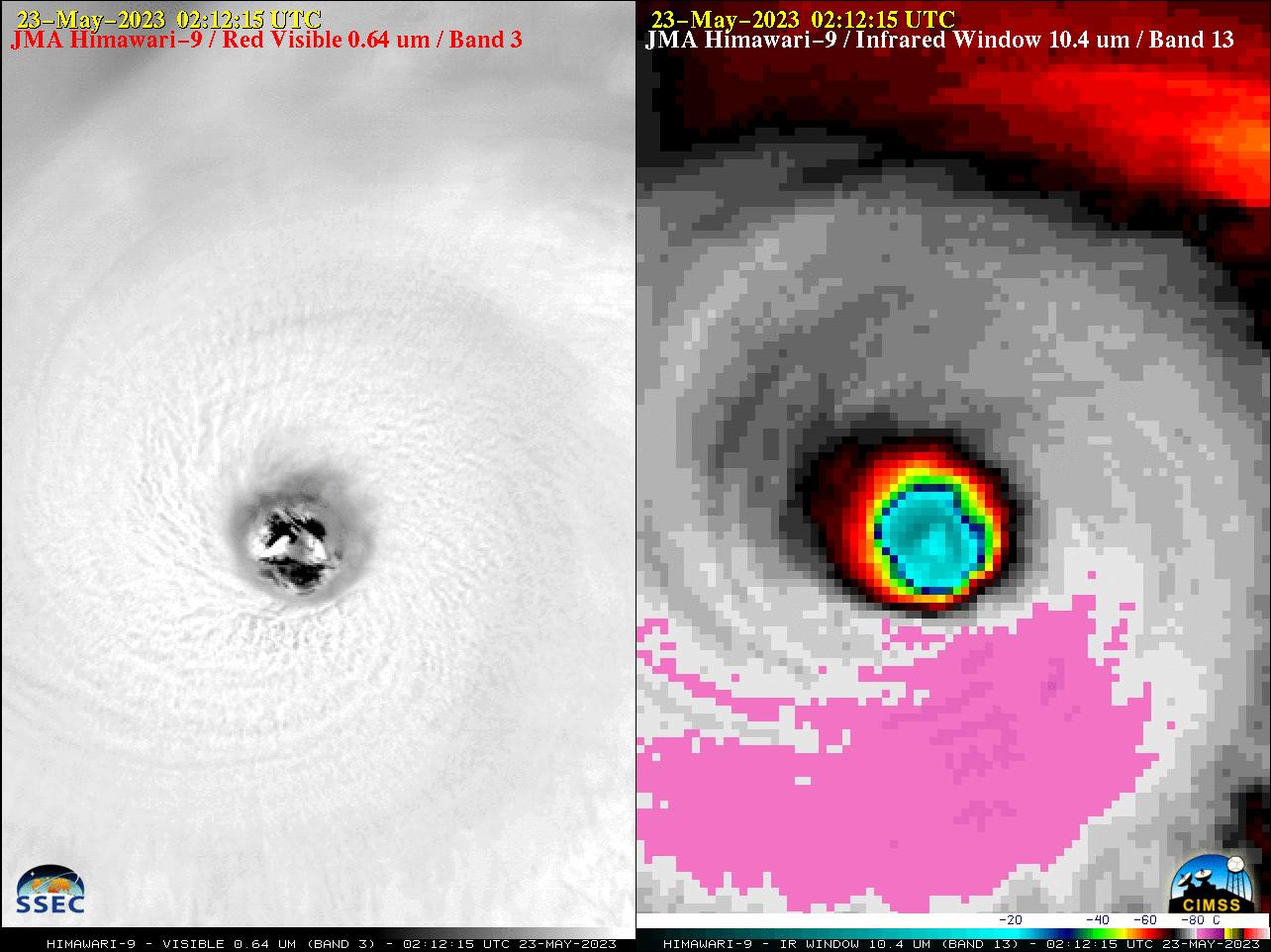
Target Sector (2.5-minute interval) JMA Himawari-9 Visible and Infrared images (above) covered the period when Typhoon Mawar reached Category 4 intensity at 0000 UTC on 23 May 2023 (JTWC advisory | SATCON | ADT). Mesovortices within the eye were evident in the Visible imagery, and cloud-top infrared brightness temperatures surrounding the eye were... Read More
