Cyclone Batsirai reaches Category 4 intensity
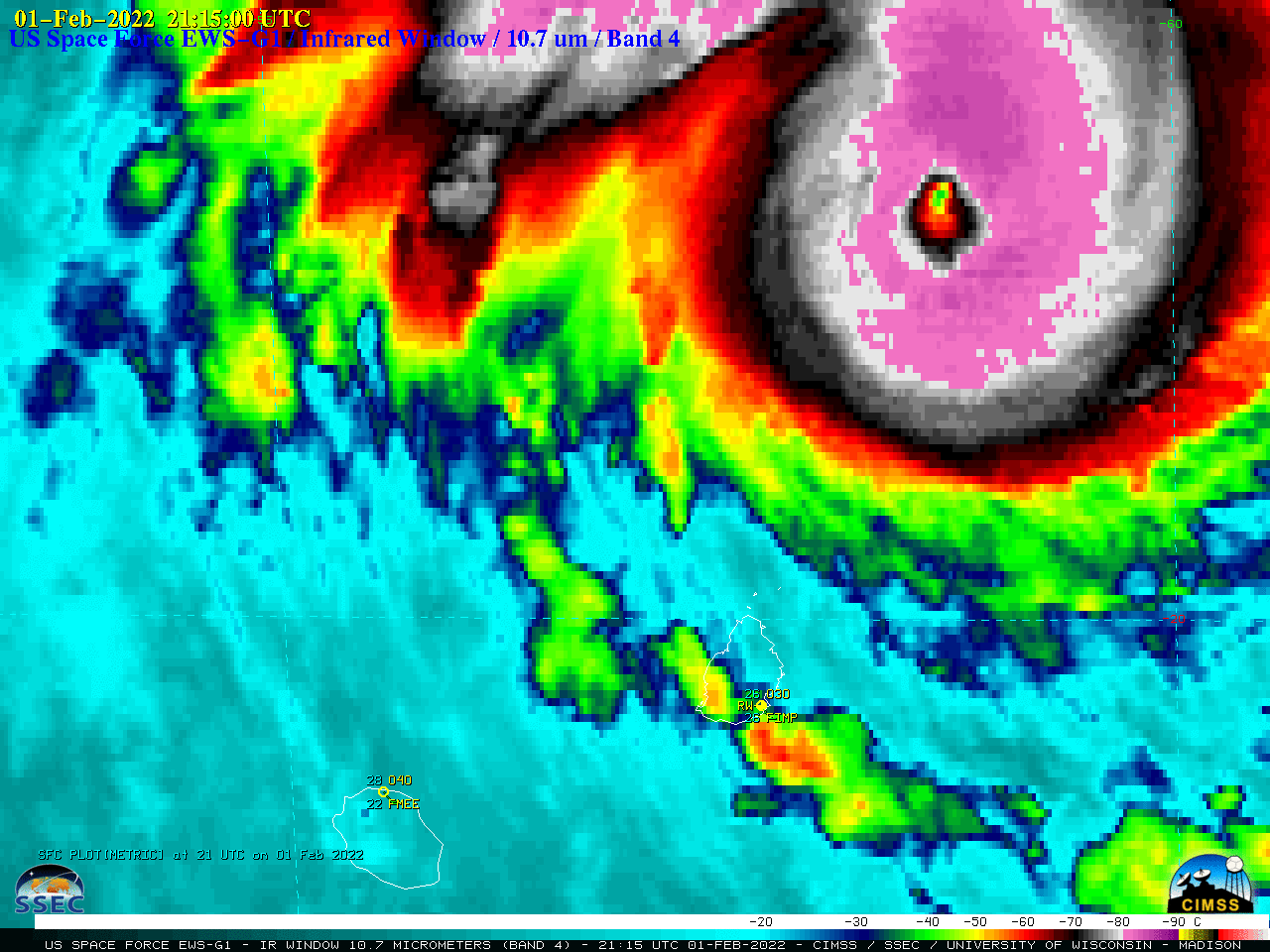
EWS-G1 Infrared Window (10.7 µm) images [click to play animated GIF | MP4]
A DMSP-17 SSMIS Microwave (85 GHz) image from the CIMSS Tropical Cyclones site (below) displayed evidence that Batsirai had recently completed an eyewall replacement cycle (ERC), with the faint signature of the original small-diameter eye surrounded by the new large-diameter eye. This ERC process — seen in a 48-hour MIMIC-TC animation — initiated Batsirai’s gradual decline in intensity.
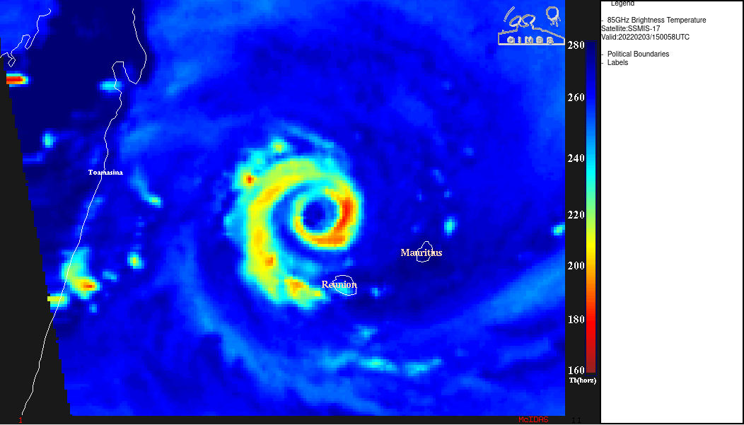
DMSP-17 SSMIS Microwave (85 GHz) image [click to enlarge]
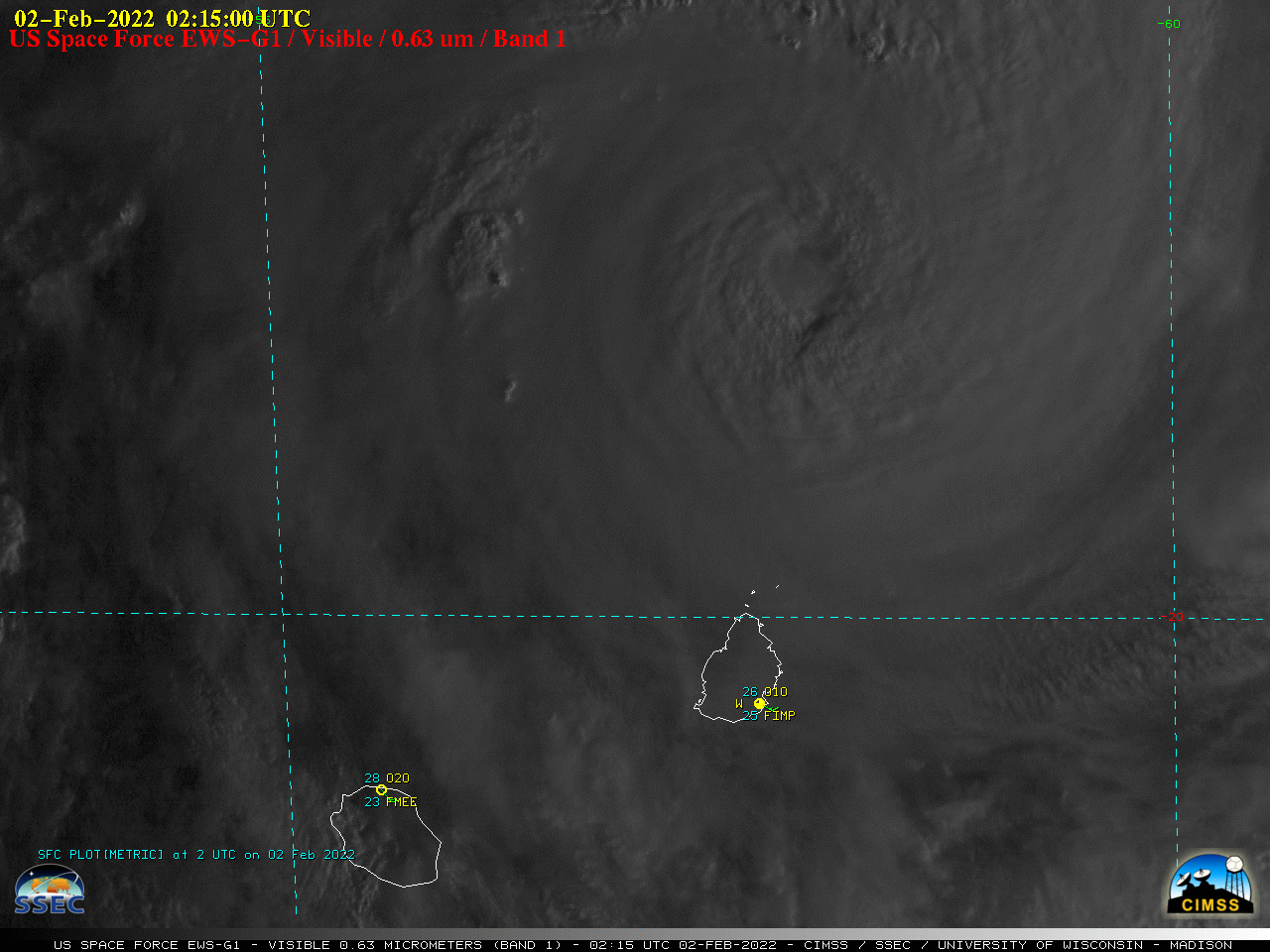
EWS-G1 Visible (0.63 µm) images [click to play animated GIF | MP4]