Typhoon Koinu reaches Category 4 intensity as it approaches Taiwan
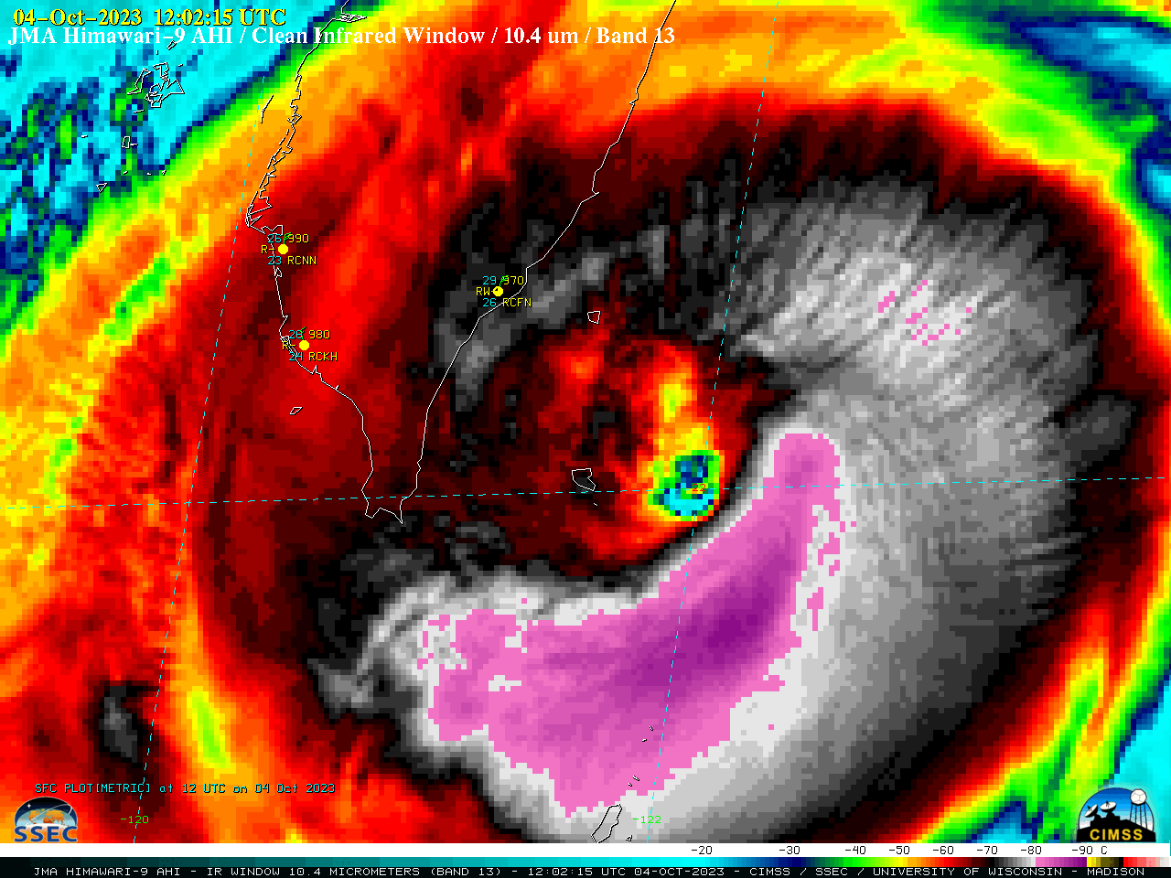
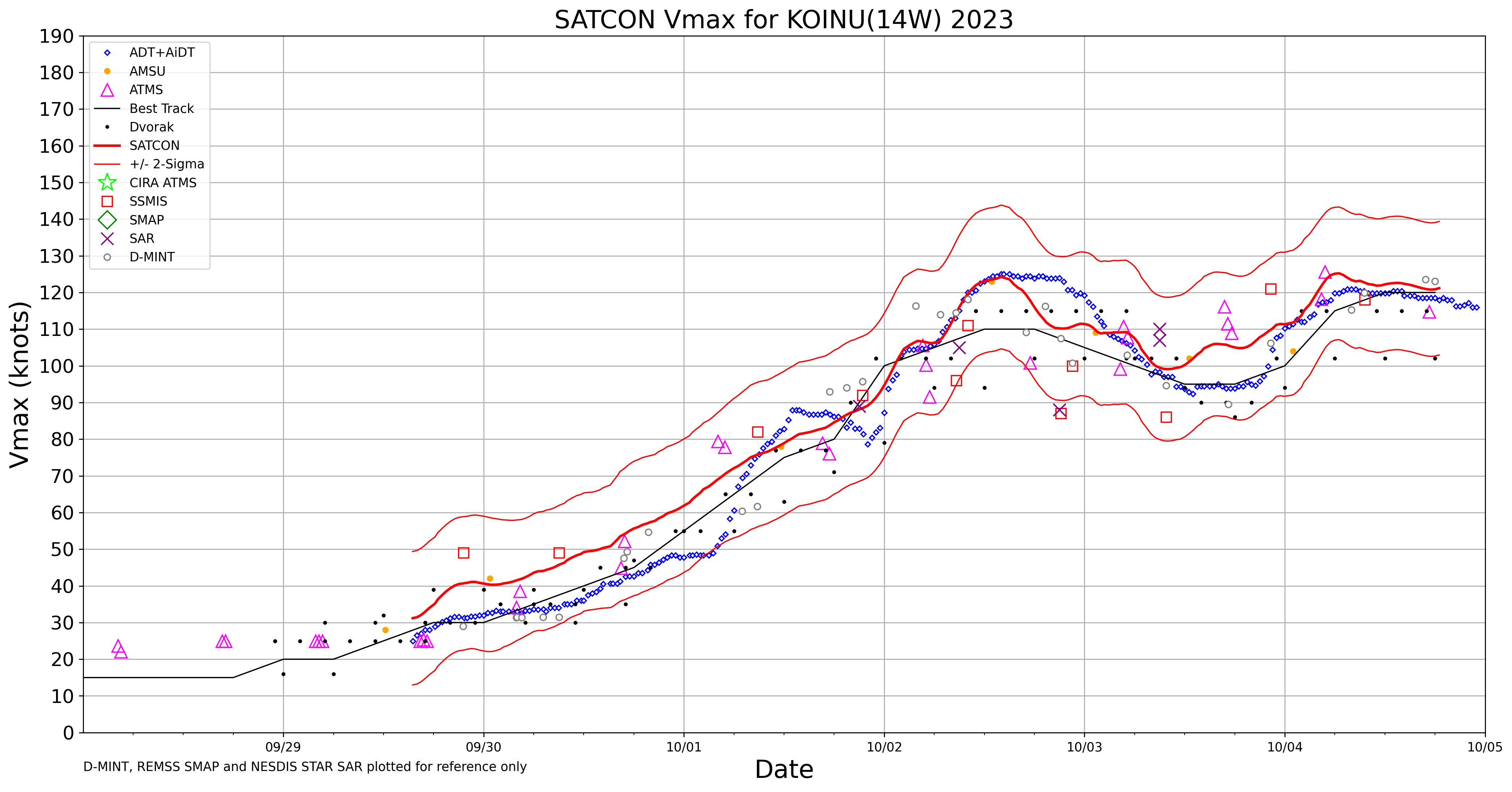
Target Sector (2.5-minute interval) JMA Himawari-9 AHI Clean Infrared Window (10.4 µm) images (above) showed Typhoon Koinu after it reached Category 4 intensity at 0600 UTC (SATCON) on 04 October 2023. The coldest cloud-top infrared brightness temperatures (-80 to -89C, shades of violet to purple) were generally confined to the southern semicircle of the storm.... Read More
