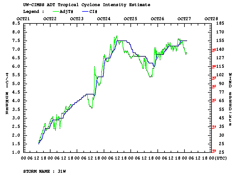
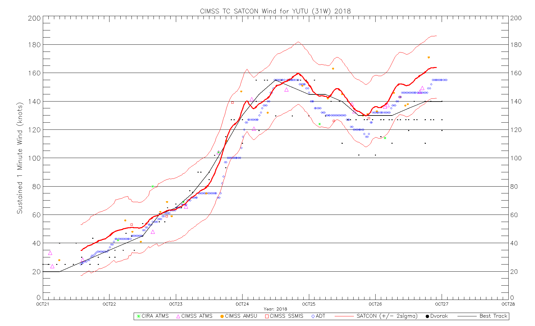
Super Typhoon Yutu re-intensifies to Category 5
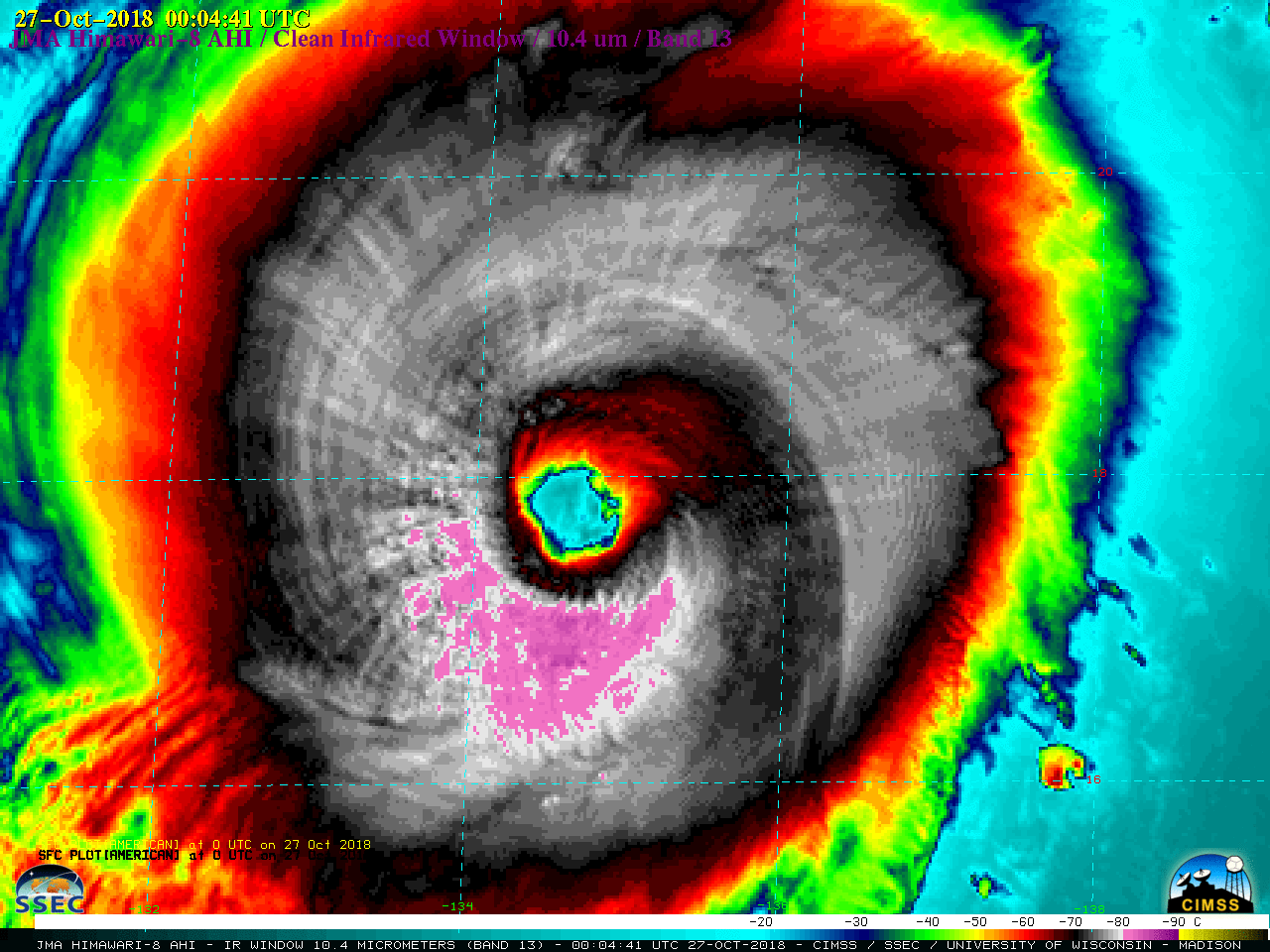
After making landfall in the Northern Mariana Islands on 24 October, Super Typhoon Yutu underwent eyewall replacement cycles that brought about a drop to Category 4 intensity on 25 October. However, during the day on 26 October 2018 the storm again re-intensified to Category 5 (ADT | SATCON). Himawari-8 “Clean” Infrared Window (10.4... Read More
