Great Lakes ice
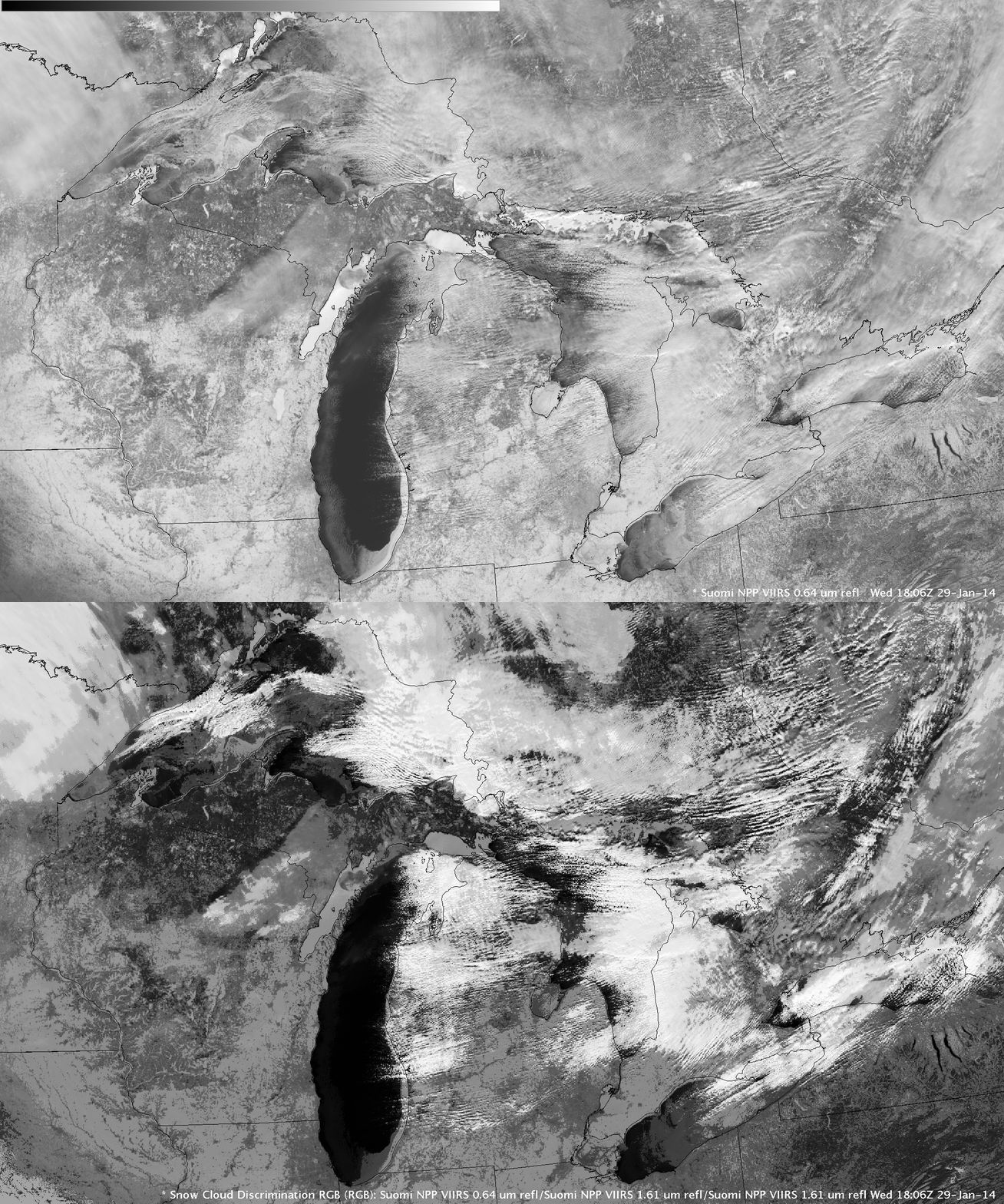
An AWIPS II image comparison of Suomi NPP VIIRS 0.64 µm visible channel data and the corresponding “Snow/cloud discrimination” Red/Green/Blue (RGB) product (above) provided a glimpse of many of the areas of ice coverage on the Great Lakes at 18:06 UTC on 29 January 2014. Ice began to increase (especially across the western Great Lakes) in late January following one of the more significant arctic outbreaks of the 2013/2014 winter season. On the RGB image, snow and ice appear as varying shades of red, in contrast to supercooled water droplet clouds which appear as shades of white.
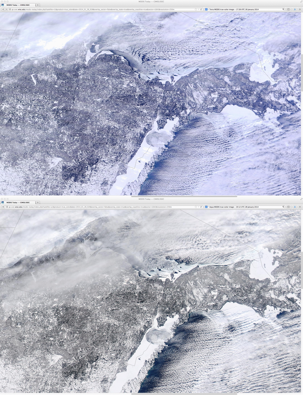
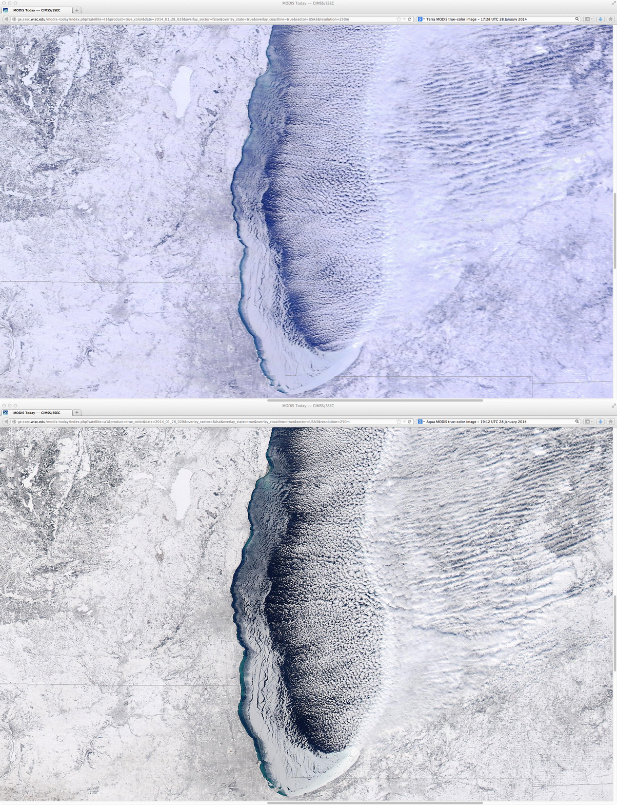
On the previous day (28 January), comparisons between 17:28 UTC Terra and 19:12 UTC Aqua MODIS true-color RGB images from the SSEC MODIS Today site revealed the amount of sea ice motion in the relatively short time (approximately 100 minutes) between the 2 images, a result of fairly strong winds blowing over the nearshore waters. The MODIS image comparisons are centered over the Upper Peninsula of Michigan (above), and over southern Lake Michigan (below).
——————————–
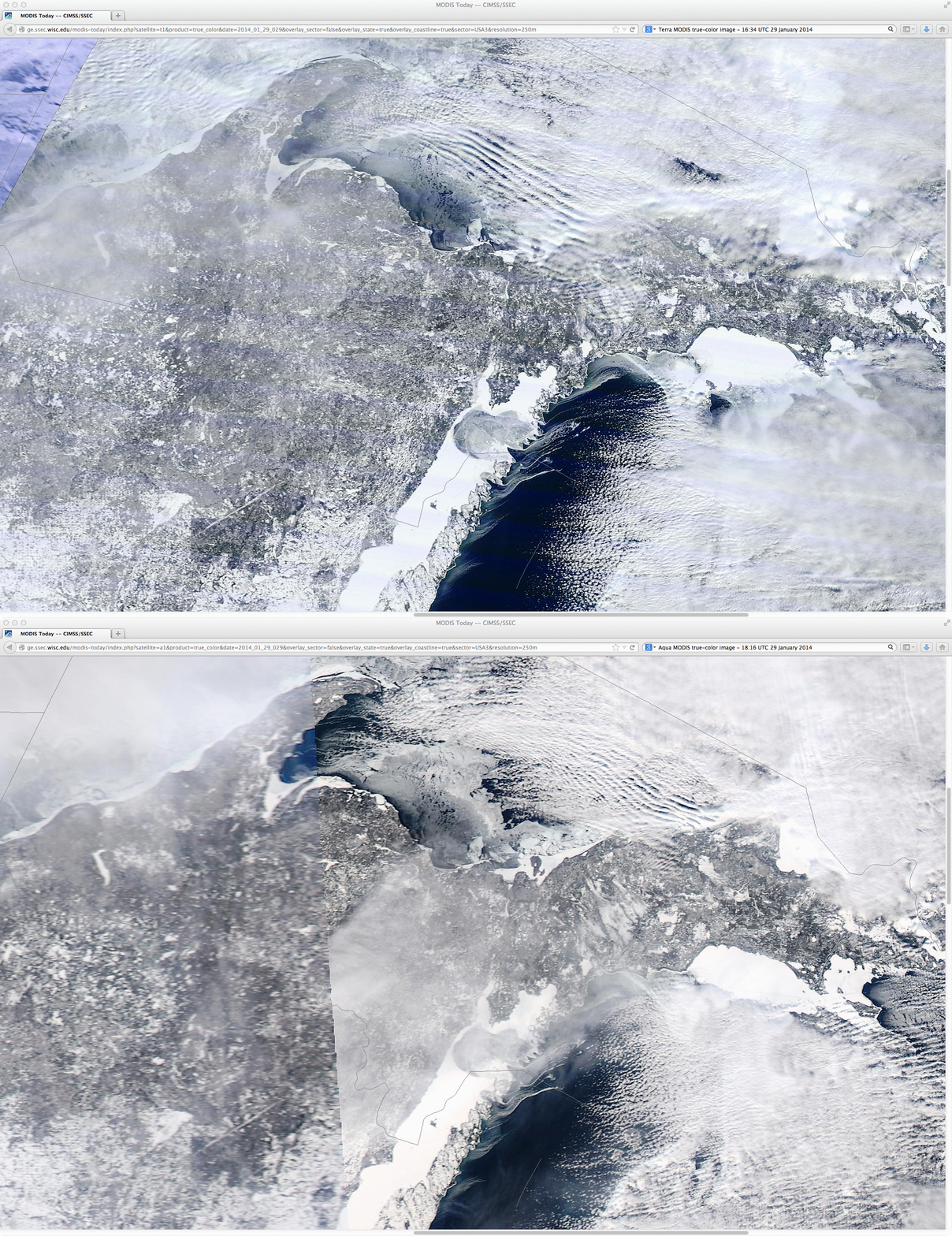
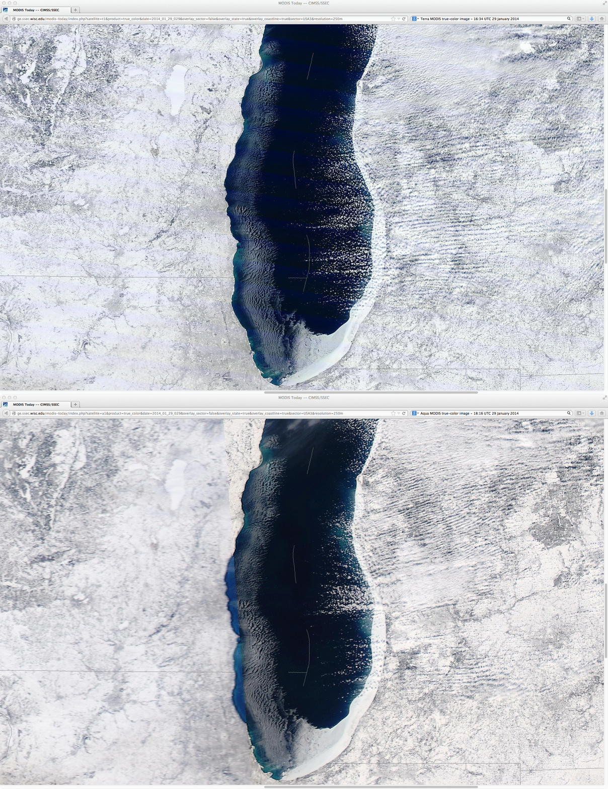
On 29 January, similar comparisons of the 16:34 UTC Terra and 18:16 UTC Aqua MODIS true-color RGB images showed a better view of the multiple long and narrow ice floes in northern lake Michigan (above), and showed how much ice in southern Lake Michigan had been blown across the lake and against the southeastern shore (below).
===== 31 January Update =====
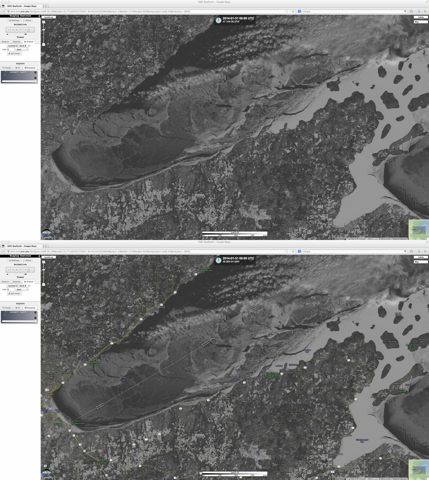
A 15-meter resolution Landsat 8 Panochromatic (0.59 µm Band 8) image from the SSEC RealEarth web map server (above) showed the ice coverage in the far western portion of Lake Superior on 31 January. Land-fast ice in the Apostle Islands area of Wisconsin (located in the eastern part of the image) was thicker and snow-covered, giving it a brighter white appearance.


