Severe weather over the northern Plains (including an EF-5 tornado near Enderlin, North Dakota)
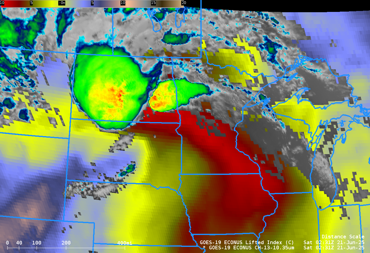
A fast-moving thunderstorm complex raced across North Dakota and Minnesota in the late afternoon/evening/overnight on 20-21 June 2025, as shown above. GOES-19 band 13 (10.3 µm) imagery and derived stability (Lifted Index) show the development of notable instability with an alignment over North Dakota along the direction of convective movement.... Read More
