Smoke Plume across Canada
True-Color imagery and GOES-R Aerosol Optical Depth (AOD) imagery from early on 5 June 2025 (the imagery was captured from the CSPP Geosphere site) from GOES-West, above, and GOES-East, below, shows the a smoke plume emanating from fires in western Canada and spreading over all of southern Canada. The smoke has occasionally pushed south into the United States, as noted in recent CIMSS Blog Posts (and elsewhere). The smoke plume can be thick enough that it is misclassified as cloud in the AOD algorithm. The misclassification is affected by both satellite view angle and solar zenith angle.
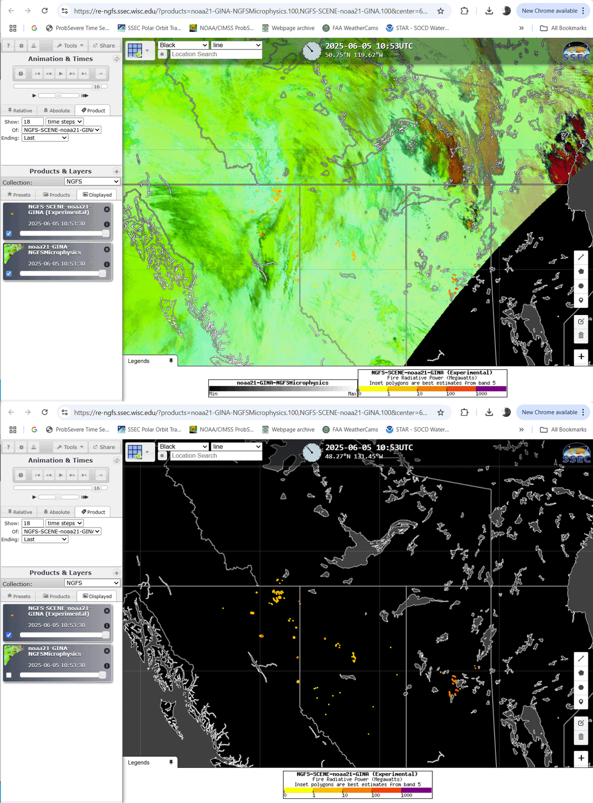
What do NGFS detections look like for this ongoing event? NGFS can detect fires using observations from GOES-R or JPSS Satellites; the imagery below from the NGFS RealEarth site shows NGFS microphysics RGB imagery computed using NOAA-21 data. NOAA-21 data are downloaded at direct broadcast antennas with fire detections and imagery created in a very timely manner. Many detections are shown for this widespread wildfire event.

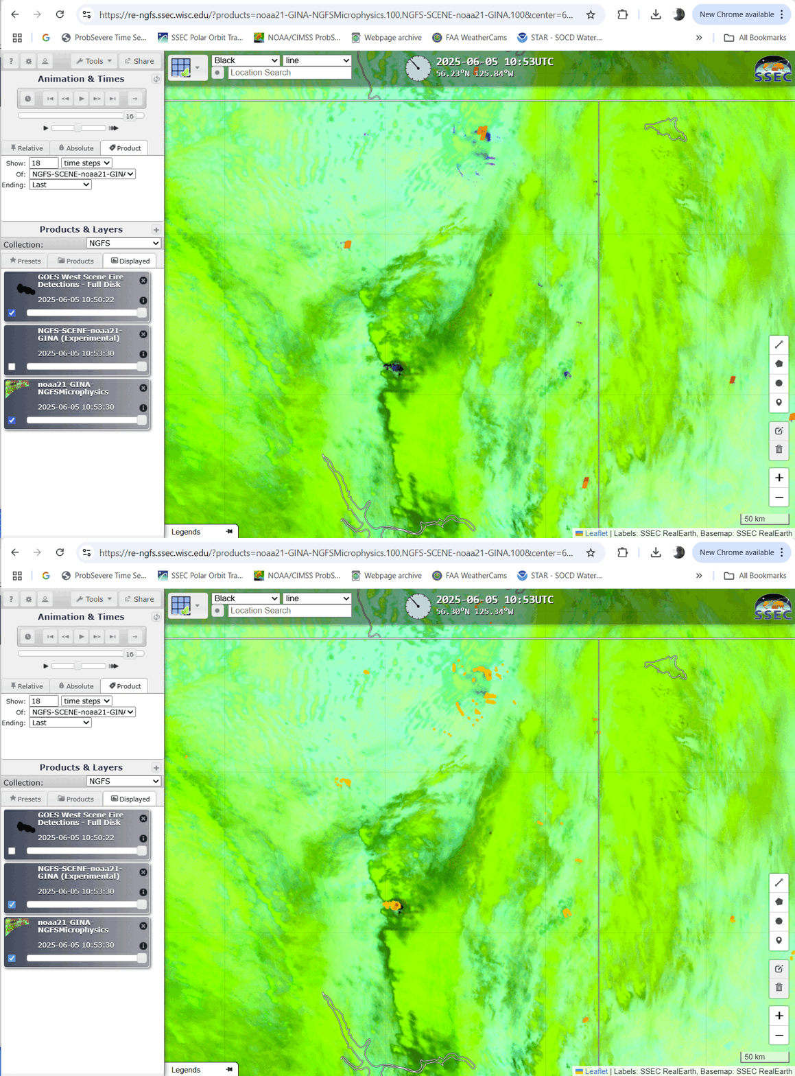
The zoomed-in view below highlights the much greater horizontal resolution of NOAA-21 v. GOES-18 over northern Canada. The higher resolution is the great advantage of JPSS satellites at high latitudes in describing the horizontal extent of a fire . The NGFS microphysics RGB imagery shows well-defined hot regions as purple that are also identified as detections. GOES-18 struggles to see many of the fires at such a high latitude.

The toggle below compares the NOAA-21 and GOES-18 NGFS detections only (that is, it doesn’t include the NGFS microphysics RGB only image that is included in the toggle above).


