This website works best with a newer web browser such as Chrome, Firefox, Safari or Microsoft Edge. Internet Explorer is not supported by this website.

Stories by Scott Lindstrom

The GOES-R Day Cloud Type RGB

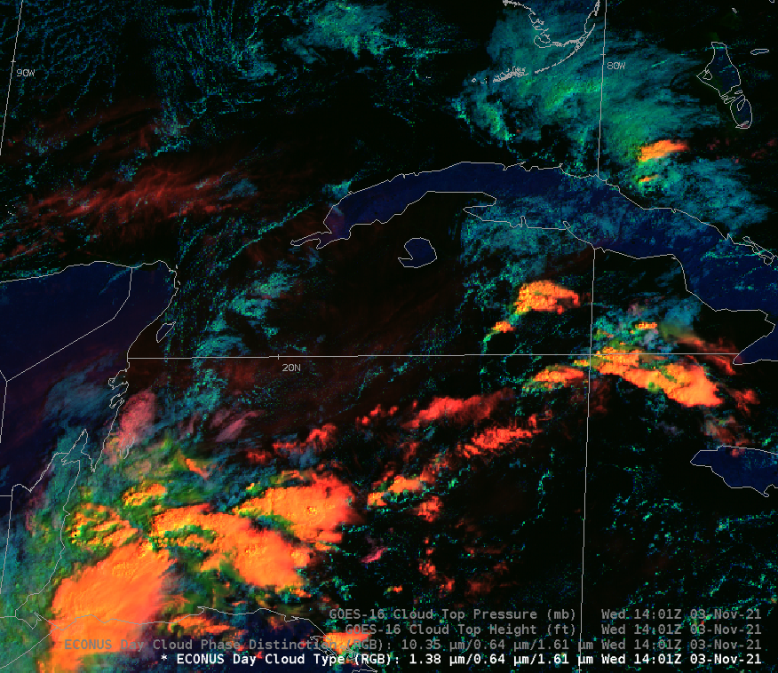
A new RGB will be implemented into AWIPS in the near future: it is scheduled for the next TOWR-S build to be released in December. Developed by NESDIS Geo Senior Scientist and Cirrus Channel (GOES-R Band 4, 1.38 µm) aficionado Dr. Andy Heidinger, the Day Cloud Type RGB starts with... Read More

Tropical Storm Wanda

CSPP GeoSphere imagery, above, (click here for a direct link to the animation above in CSPP Geosphere; it will remain there for about 2 weeks before the data are overwritten) shows the evolution of Tropical Storm Wanda on 2 November 2021. (Wanda had transitioned to a Subtropical Storm on 31 October). Convection... Read More

Moisture returns to the US West Coast

A sequence of two intense storms in the north Pacific Ocean, noted in the GOES-17 airmass RGB below, has drawn moisture into the northwestern United States. A MIMIC (Morphed Integrated Microwave Imagery at CIMSS) Total Precipitable Water rocking animation, above (rocking animation from this site), shows the development of a ribbon... Read More

Using NUCAPS to diagnose threats in a region of Enhanced/Moderate risk

The Storm Prediction Center in Norman issued a convective outlook on 12 October 2021 that included a large area of Enhanced Risk over western Kansas and Oklahoma, noting the expected development of a strong low-level jet creating favorable shear profiles for supercells. (SPC increased the threat to a Moderate Risk for a small part of southwestern Kansas and parts of the Oklahoma and Texas panhandles at 2000 UTC). The Band 10 low-level water vapor image above, from 1931 UTC. An... Read More