Using NUCAPS to diagnose threats in a region of Enhanced/Moderate risk
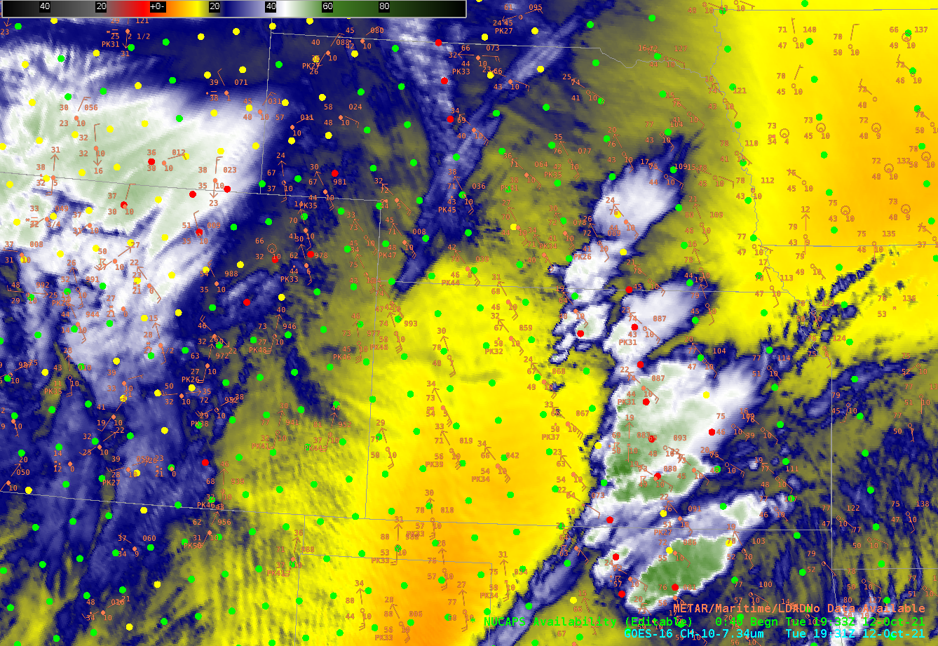
The Storm Prediction Center in Norman issued a convective outlook on 12 October 2021 that included a large area of Enhanced Risk over western Kansas and Oklahoma, noting the expected development of a strong low-level jet creating favorable shear profiles for supercells. (SPC increased the threat to a Moderate Risk for a small part of southwestern Kansas and parts of the Oklahoma and Texas panhandles at 2000 UTC). The Band 10 low-level water vapor image above, from 1931 UTC. An initial round of convection is moving eastward over central Kansas. Did that convection stabilize the atmosphere? NUCAPS profiles can give information on that, information that is not dependent on numerical model simulations.
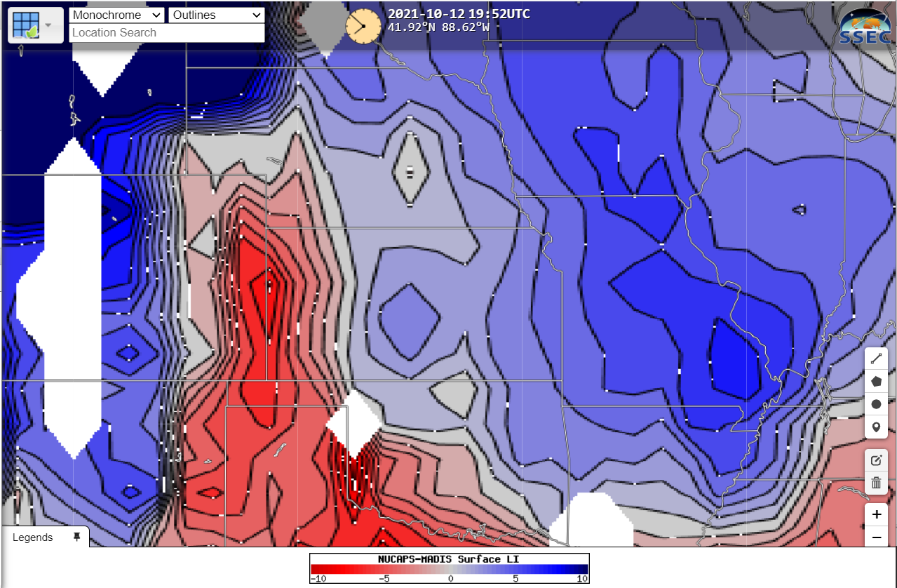
The plot below, taken from RealEarth, shows the Lifted Index computed from NUCAPS soundings blended with MADIS surface observations. The greatest instability, shaded in red, lies along the Kansas/Colorado border, and it extends to the southeast along the western Oklahoma/north Texas border. (Click here to see surface-based CAPE at the same time).
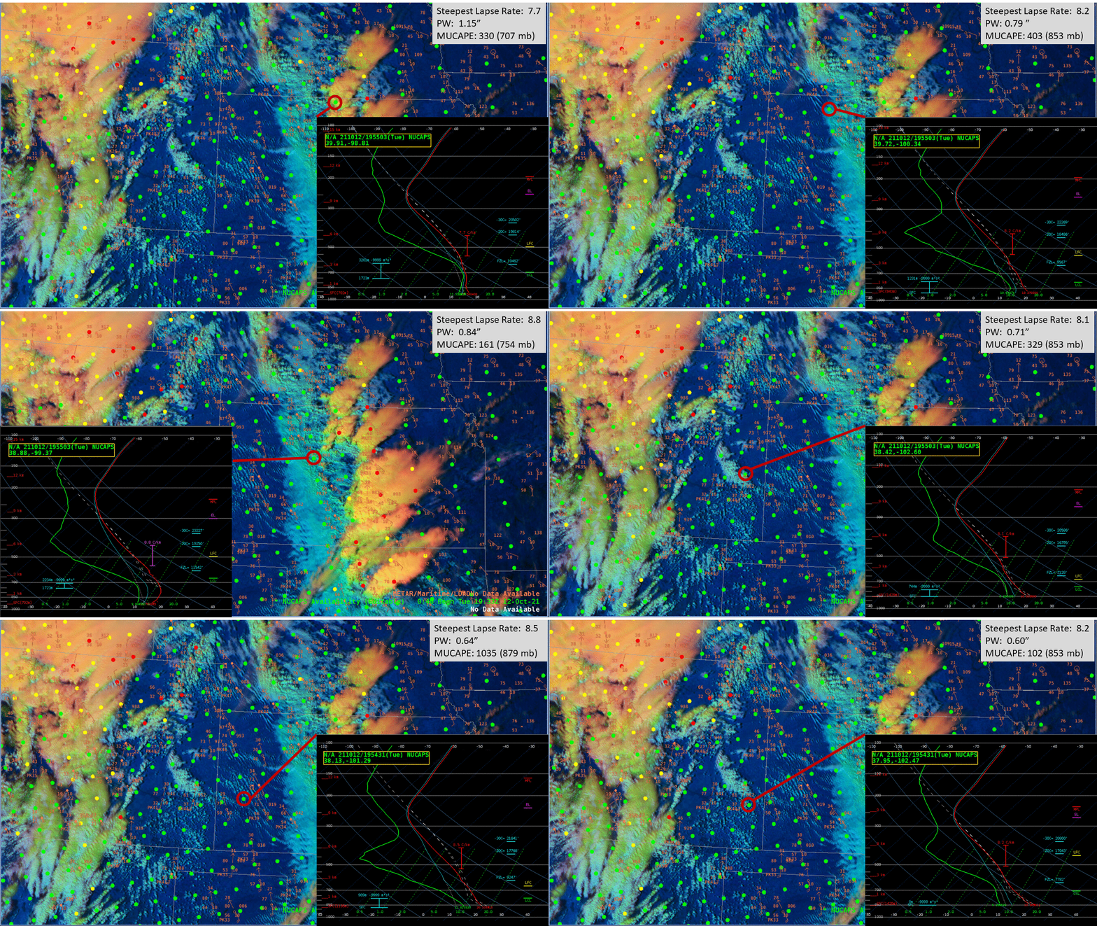
What do individual profiles show? 20 different profiles over southwestern Kansas are in the stepped animation below. Steep mid-level lapse rates (greater than 8 K/km) are indicated in the soundings, and Most Unstable Convective Available Potential Energy (MUCAPE) values persist in the lower troposphere. It also appears that moisture is pooling along the Kansas/Colorado border: precipitable water values from two soundings (at 38.42 N/102.60 N and 38.04 N /101.89 W) and are greater than surrounding values. So: instability is present, and moisture is available. Model-independent information like this can help a forecaster during the wait for initiation.
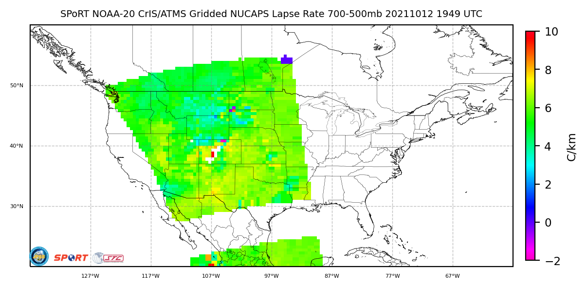
It can be time-consuming in AWIPS to look through multiple soundings (the Pop-up SkewT functionality can be helpful, but for subtle changes in precipitable water, or in lapse rate, that use is limited). Gridded NUCAPS fields are available in AWIPS, and also online. The 700-500 mb lapse rate, shown below, from this website, diagnoses the steep lapse rates that were present (perhaps to be expected given the suggestion of an elevated mixed layer in the water vapor imagery at the top of this blog post!)
So what happened with this event? Convection developed along the Colorado/Kansas border, and spawned severe weather over western Kansas, western Oklahoma, and western Texas. GOES-16 clean window infrared imagery (10.3 µm), below, shown on top of the Level 2 stability Lifted index product, shows the instability and the development of the convection (Click here for a Band 13 animation only).
