Wind and waves over Lake Superior
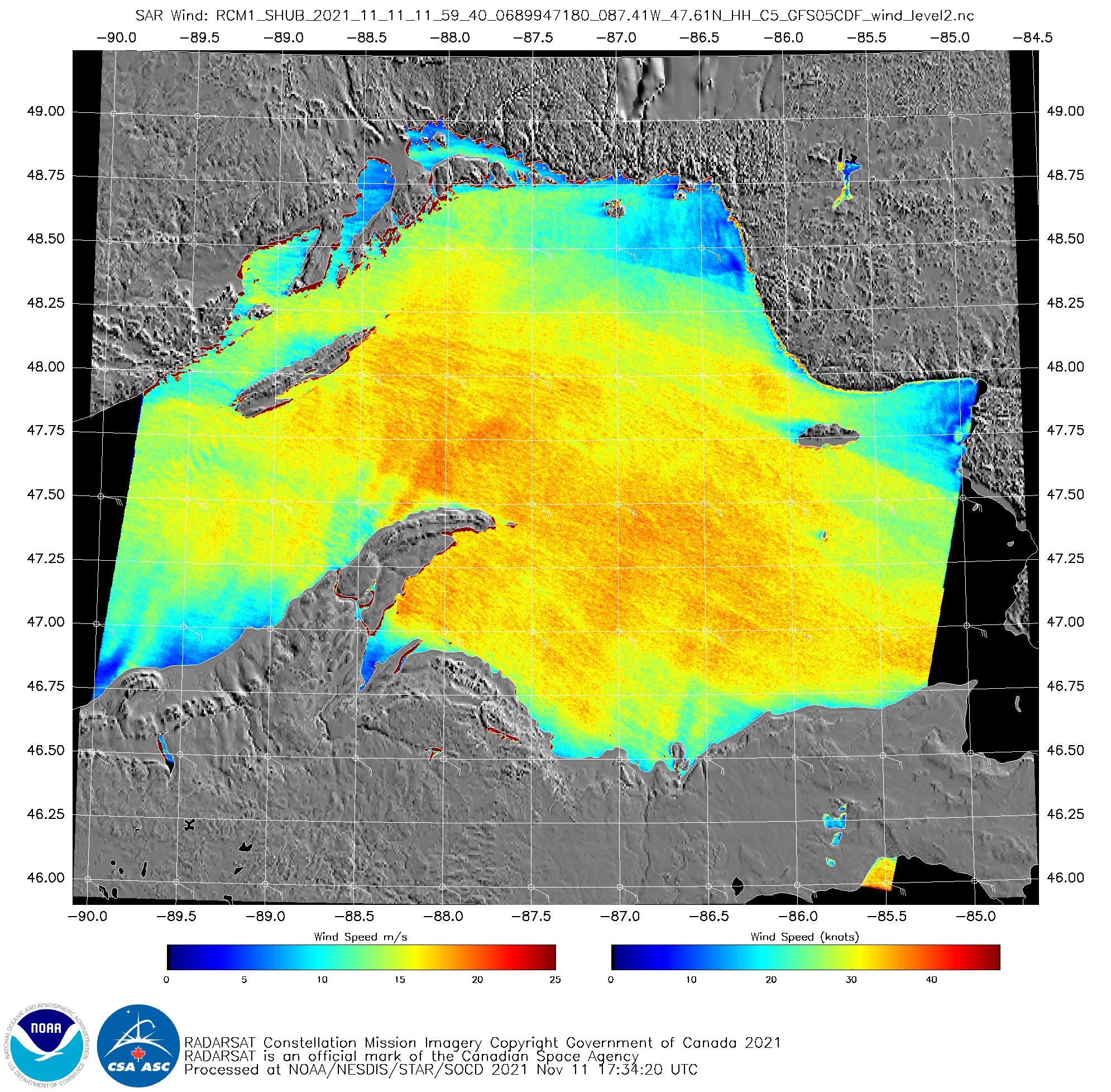
A vigorous extra-tropical cyclone moving towards the western Great Lakes on 11 November 2021 generated significant winds and waves over Lake Superior. RADARSAT winds, above, from RCM1, (available at this website) show a large area of southeasterly winds between 30 and 40 knots at 1159 UTC on 11 November. Regions of... Read More