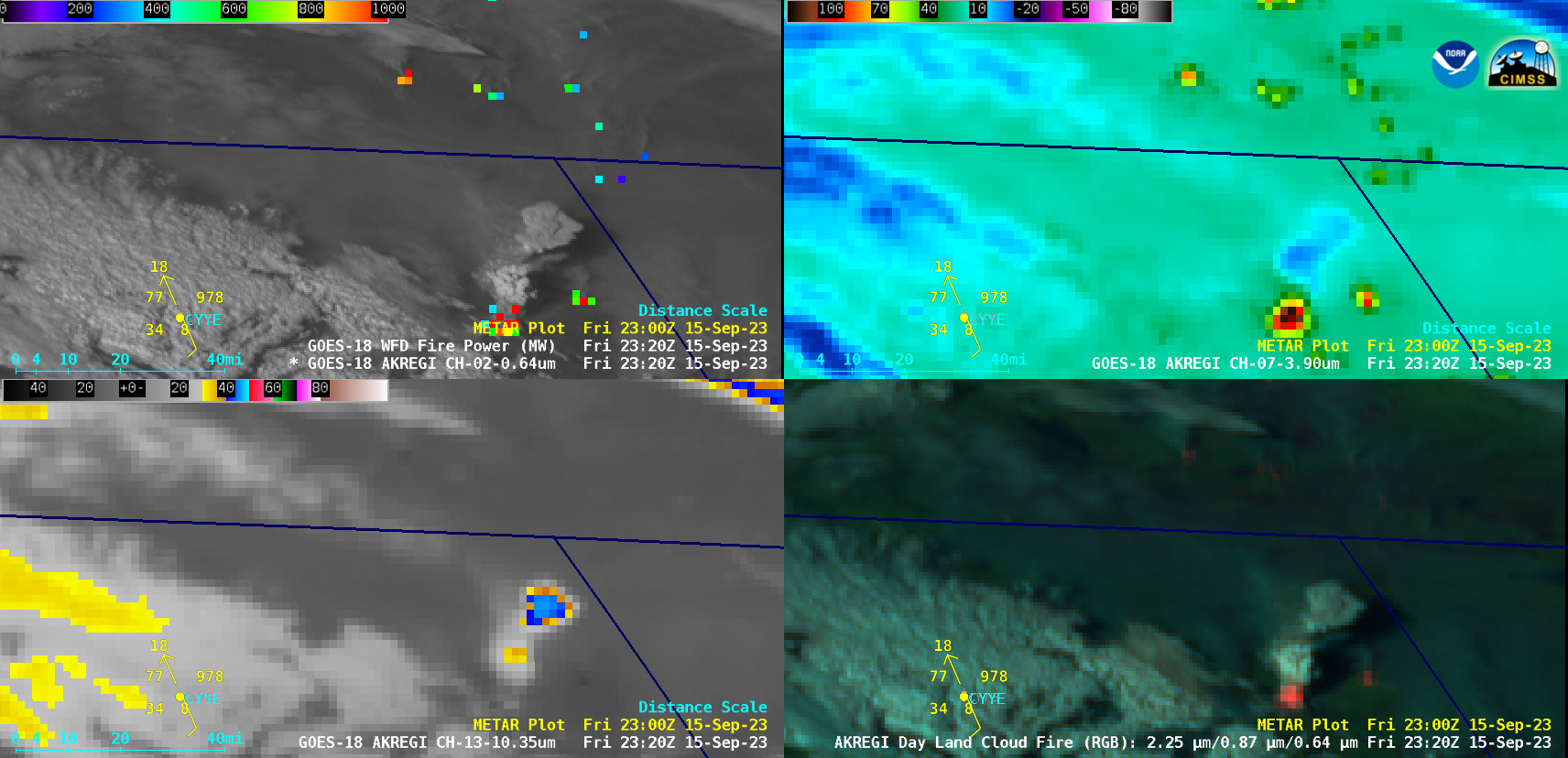
Wildfires in British Columbia and Alberta produce numerous pyrocumulonimbus clouds
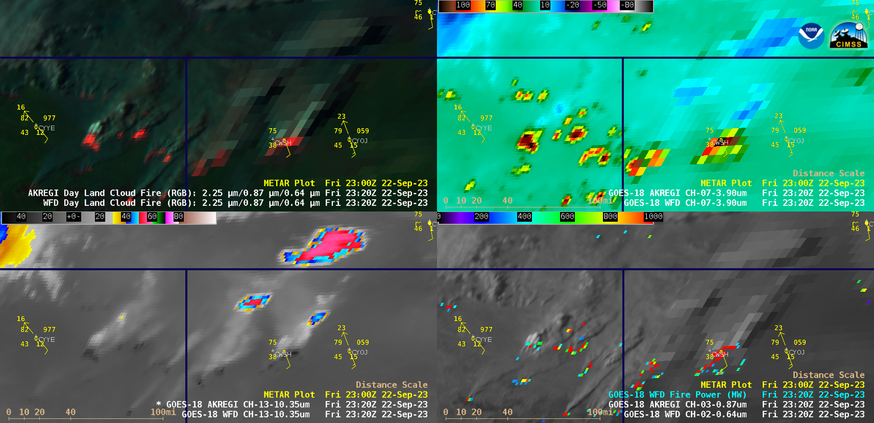
10-minute Full Disk sector GOES-18 (GOES-West) Day Land Cloud Fire RGB, Shortwave Infrared (3.9 µm), “Clean” Infrared Window (10.3 µm) and “Red” Visible (0.64 µm) + Fire Power derived product (a component of the GOES Fire Detection and Characterization Algorithm FDCA) images (above) showed signatures of multiple wildfires across northeastern British Columbia (BC) and northwestern Alberta (AB), some of which... Read More