Pyrocumulonimbus clouds produced by wildfires in British Columbia and Alberta
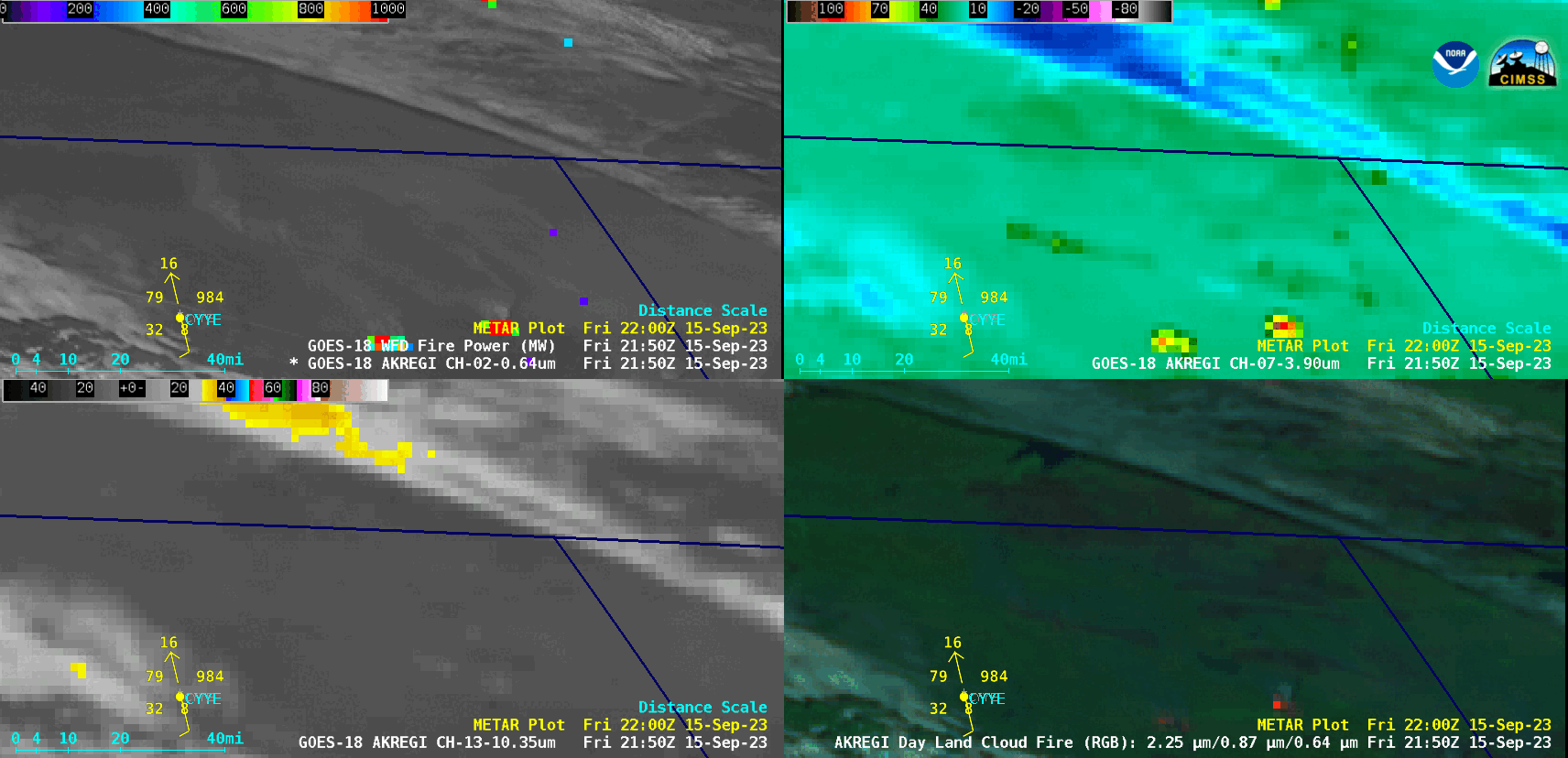
GOES-18 “Red” Visible (0.64 µm) + Fire Power derived product (top left), Shortwave Infrared (3.9 µm, top right), “Clean” Infrared Window (10.3 µm, bottom left) and Day Land Cloud Fire RGB (bottom right), from 2150 UTC on 15 September to 0110 UTC on 16 September [click to play animated GIF | MP4]
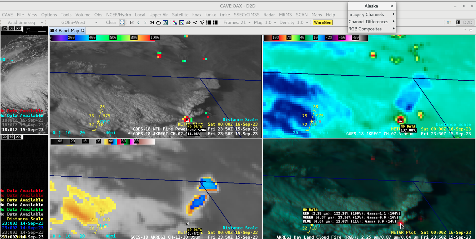
Cursor-sampled values of GOES-18 “Red” Visible (0.64 µm) + Fire Power derived product (top left), Shortwave Infrared (3.9 µm, top right), “Clean” Infrared Window (10.3 µm, bottom left) and Day Land Cloud Fire RGB (bottom right), at 2350 UTC on 15 September [click to enlarge]
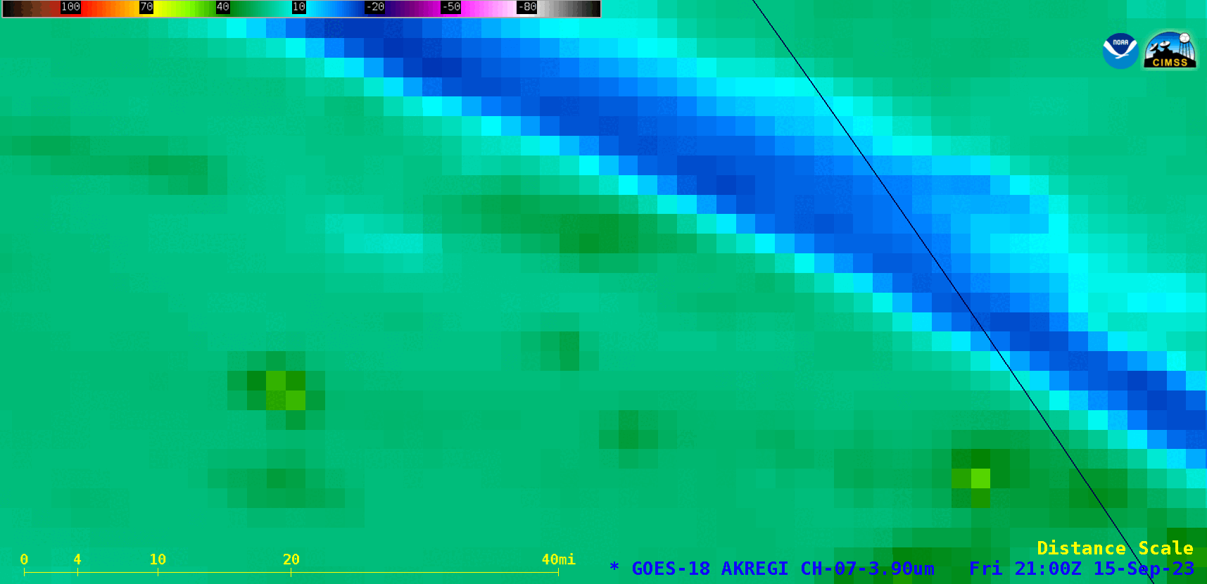
GOES-18 Shortwave Infrared (3.9 µm) images, from 2100 UTC on 15 September to 0700 UTC on 16 September [click to play animated GIF | MP4]
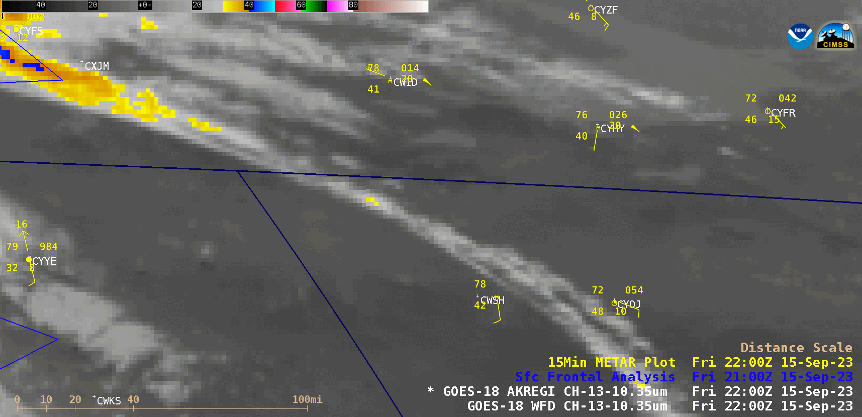
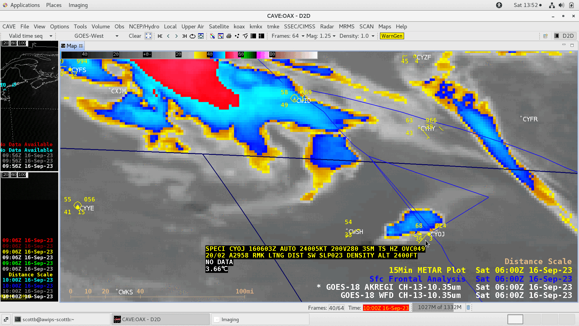
GOES-18 “Clean” Infrared Window (10.3 µm) images, with 15-minute METAR surface reports plotted in yellow and 3-hour Surface Frontal Analyses plotted in blue, from 2200 UTC on 15 September to 1000 UTC on 16 September [click to play animated GIF | MP4]
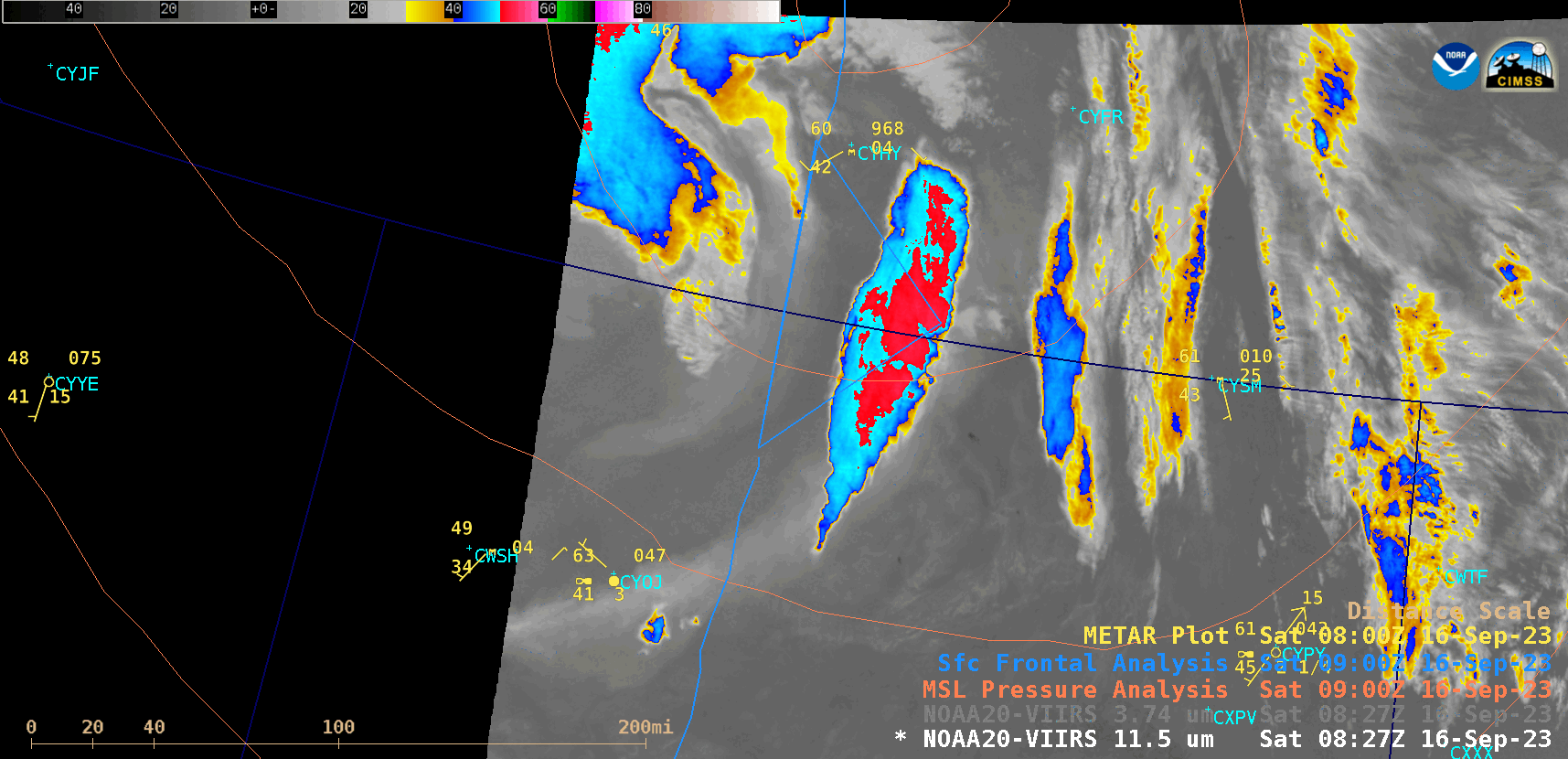
GOES-18 “Clean” Infrared Window (10.3 µm) images from 0600-0650 UTC on 16 September, with cursor-sampled METAR reports from High Level, Alberta (CYOJ) [click to enlarge]
VIIRS Infrared Window (11.45 µm) images from NOAA-20 (valid at 0828 UTC) and Suomi-NPP (valid at 0919 UTC) [click to enlarge]
____________________________________________
GOES-18 True Color RGB images [click to play MP4 animation]
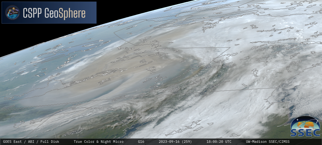
GOES-16 True Color RGB images [click to play MP4 animation]
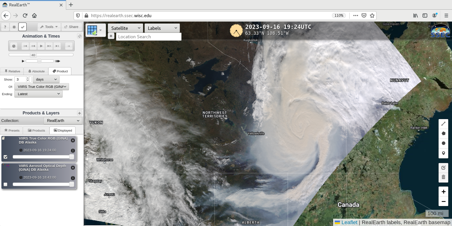
Suomi-NPP VIIRS True Color RGB image valid at 1912 UTC [click to enlarge]