Severe thunderstorms in Kansas, Oklahoma and Texas
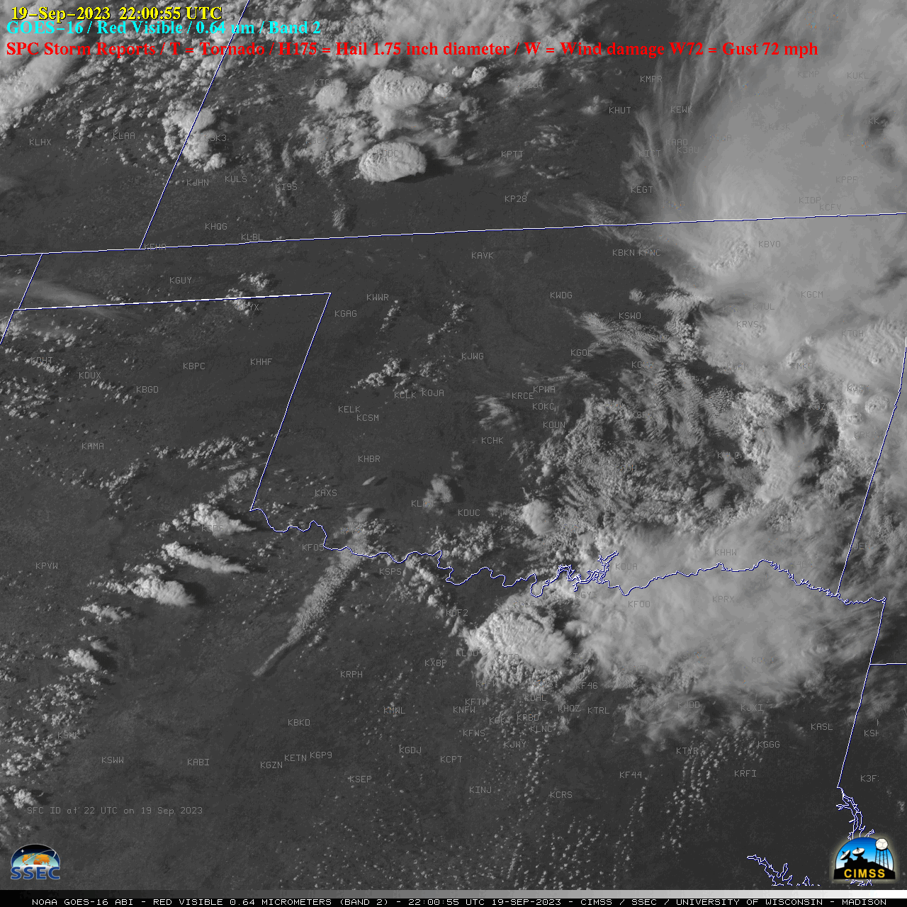
GOES-16 “Red” Visible (0.64 µm) images, with time-matched SPC Storm Reports plotted in red [click to play animated GIF | MP4]
1-minute GOES-16 “Clean” Infrared Window (10.3 µm) images (below) indicated that the coldest pulsing overshooting tops associated many of the storms exhibited infrared brightness temperatures in the -60 to -65ºC range (darker shades of red). These thunderstorms produced a tornado in Kansas, hail up to 2.75 inches in diameter in Texas and damaging winds up to 74 mph in Oklahoma.
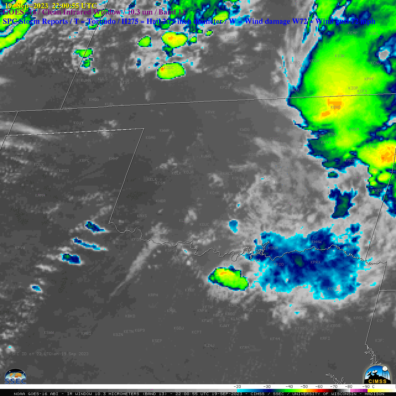
GOES-16 “Clean” Infrared Window (10.3 µm) images, with time-matched SPC Storm Reports plotted in blue [click to play animated GIF | MP4]
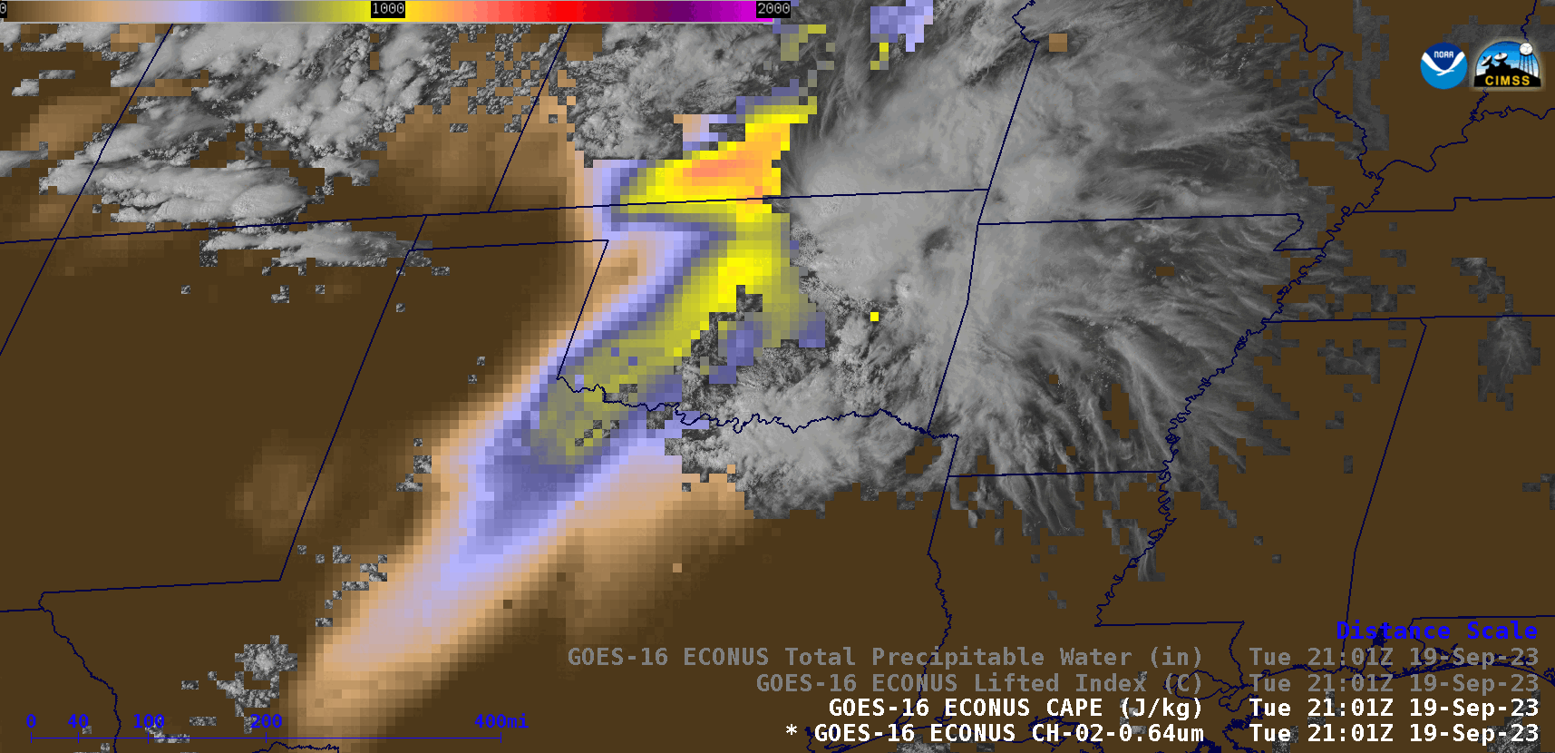
GOES-16 “Red” Visible (0.64 µm) images, with overlays of the CAPE, Lifted Index and Total Precipitable Water derived products [click to play animated GIF | MP4]