Post-Tropical Cyclone Lee makes landfall in Nova Scotia

GOES-16 “Red” Visible (0.64 µm) images from 1100-2200 UTC, with 15-minute METAR surface reports plotted in yellow and hourly Fixed Buoy reports plotted in cyan [click to play animated GIF | MP4]
A longer animation of 5-minute CONUS Sector GOES-16 Air Mass RGB images (below) portrayed the large size of Lee, which transitioned from a Category 1 Hurricane to a Post-Tropical Cyclone by 0900 UTC. Shades of orange in the RGB imagery indicated that dry air had wrapped into the southern and eastern quadrants of Lee.

GOES-16 Air Mass RGB images, from 0101-2201 UTC [click to play animated GIF | MP4]
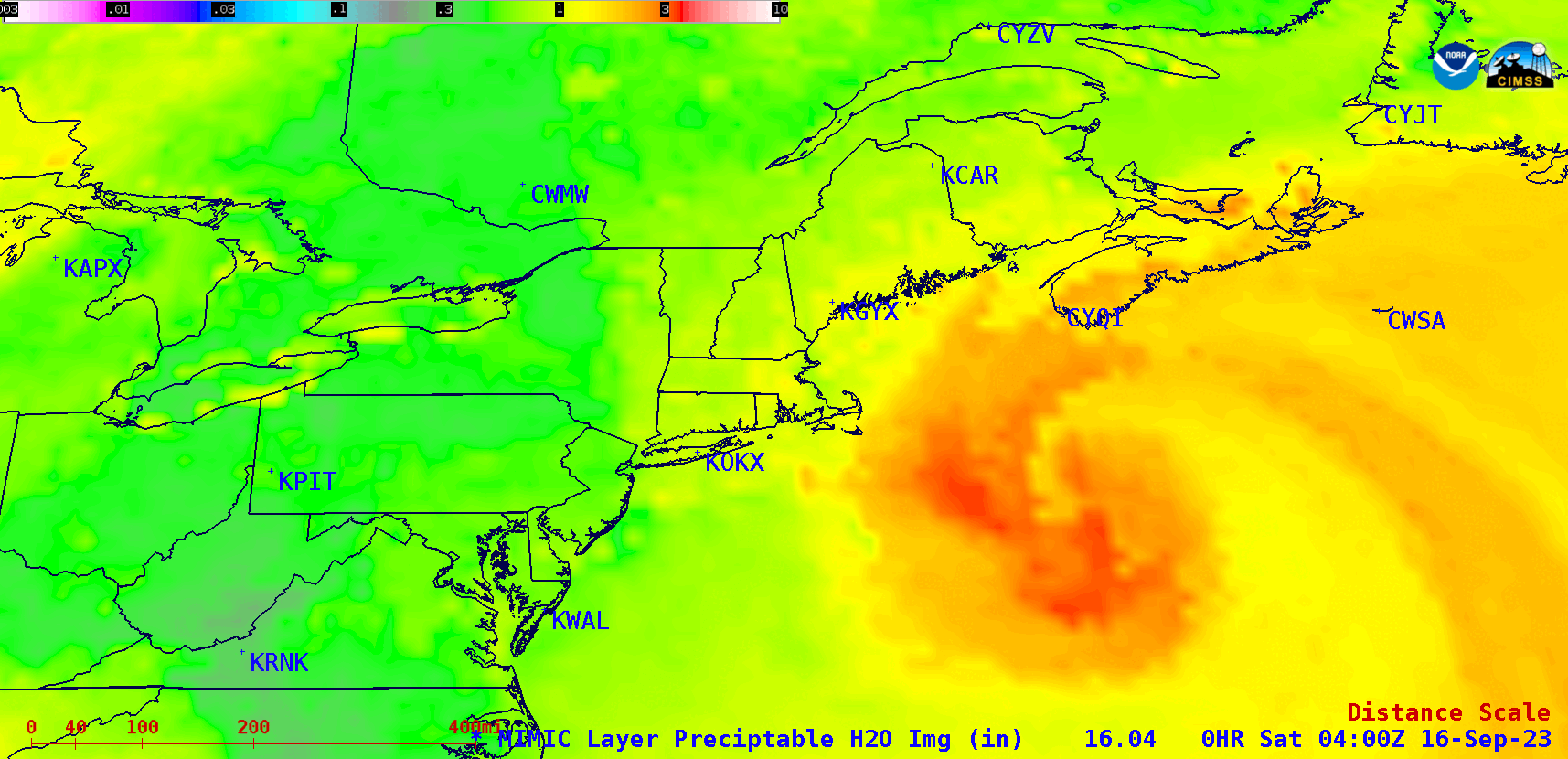
MIMIC Total Precipitable Water images, from 0400 UTC on 16 September to 0000 UTC on 17 September; rawinsonde sites are plotted in blue [click to play animated GIF | MP4]
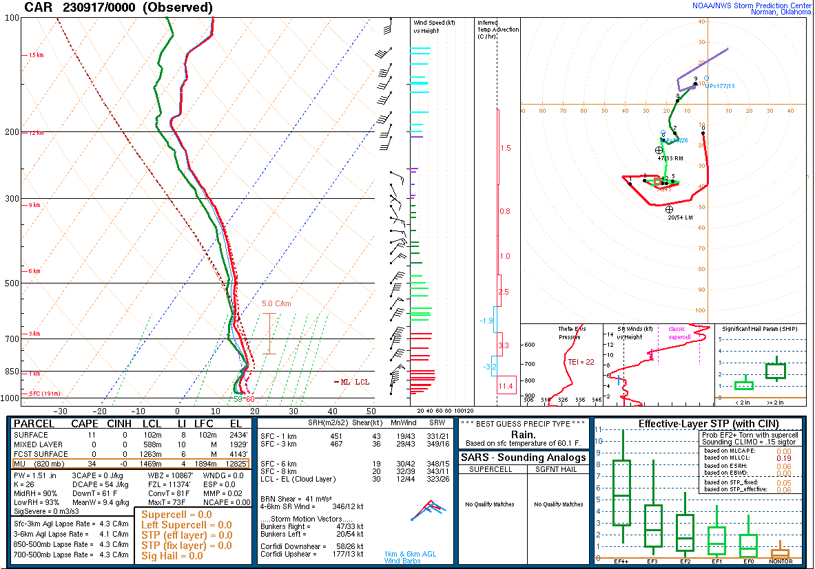
Plot of rawinsonde data from Caribou, Maine at 0000 UTC on 17 September [click to enlarge]
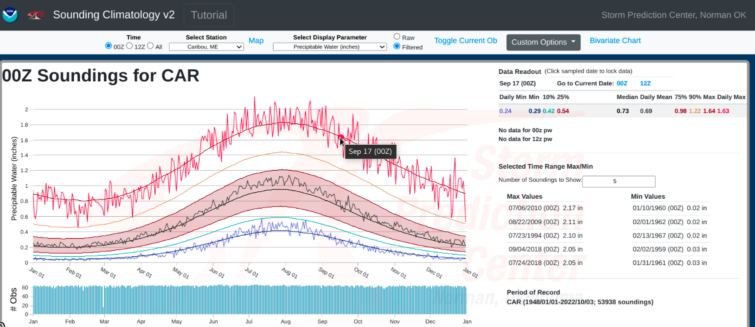
Plot of annual rawinsonde-derived Total Precipitable Water climatology for Caribou, Maine — highlighting values for 0000 UTC on 17 September [click to enlarge]