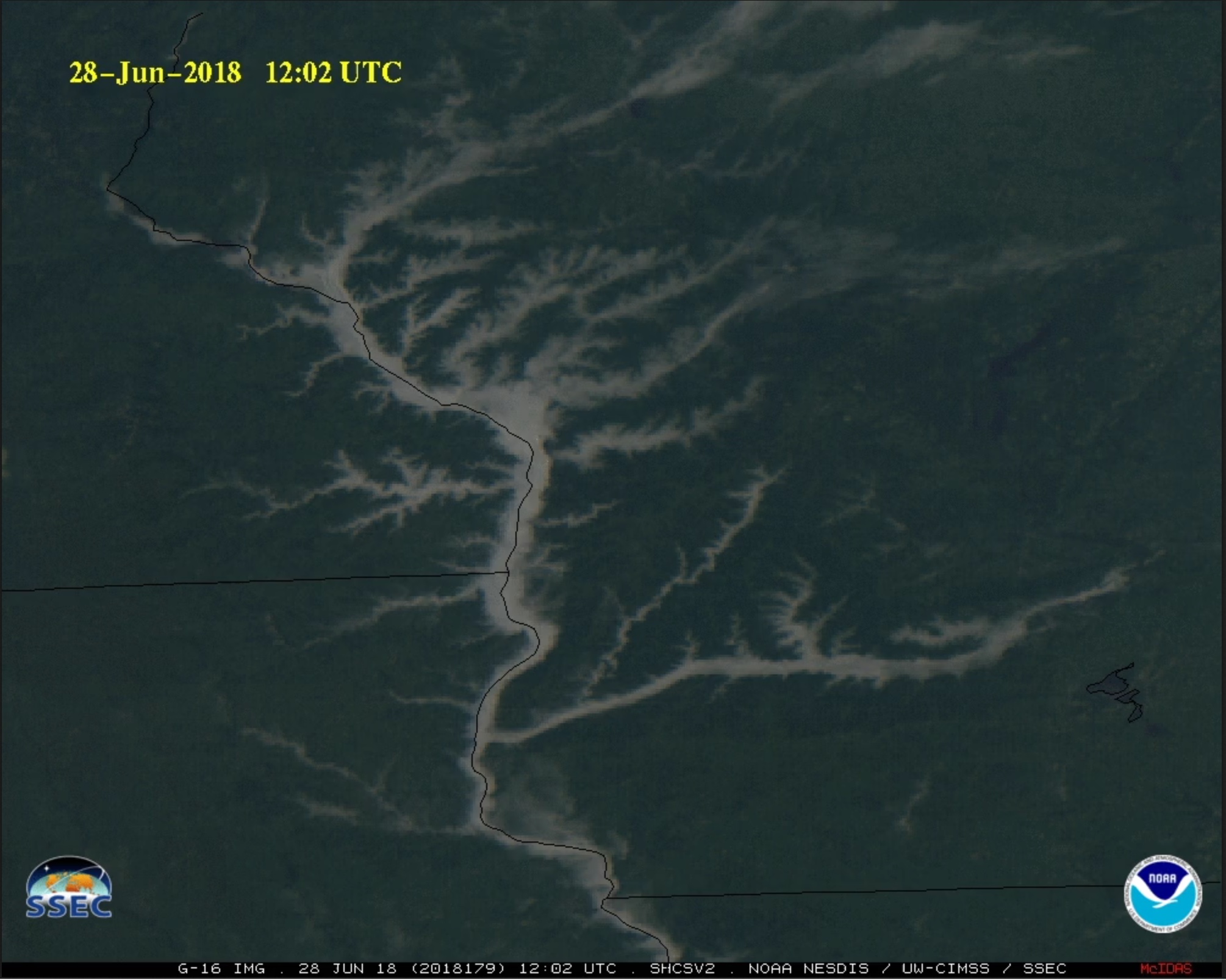
Derecho from the Midwest to the Mid-South
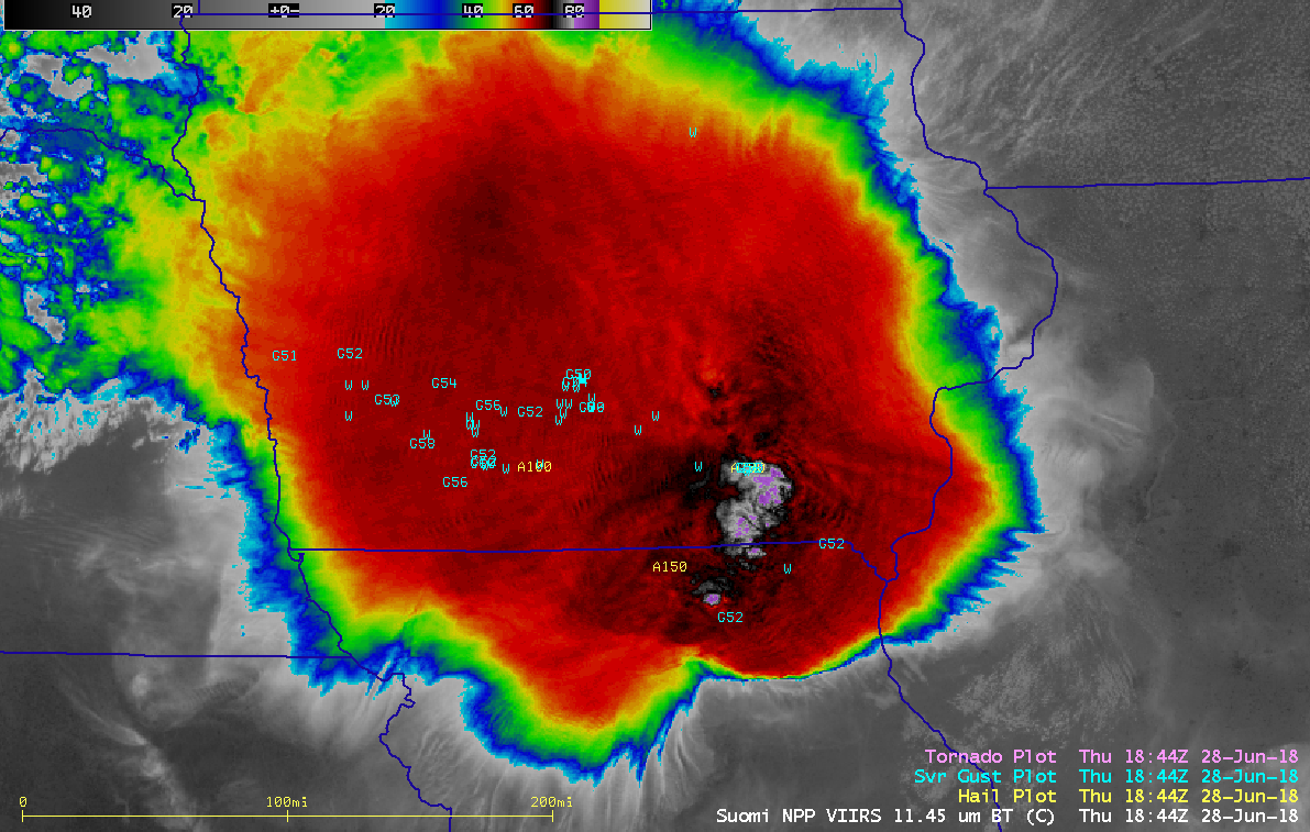
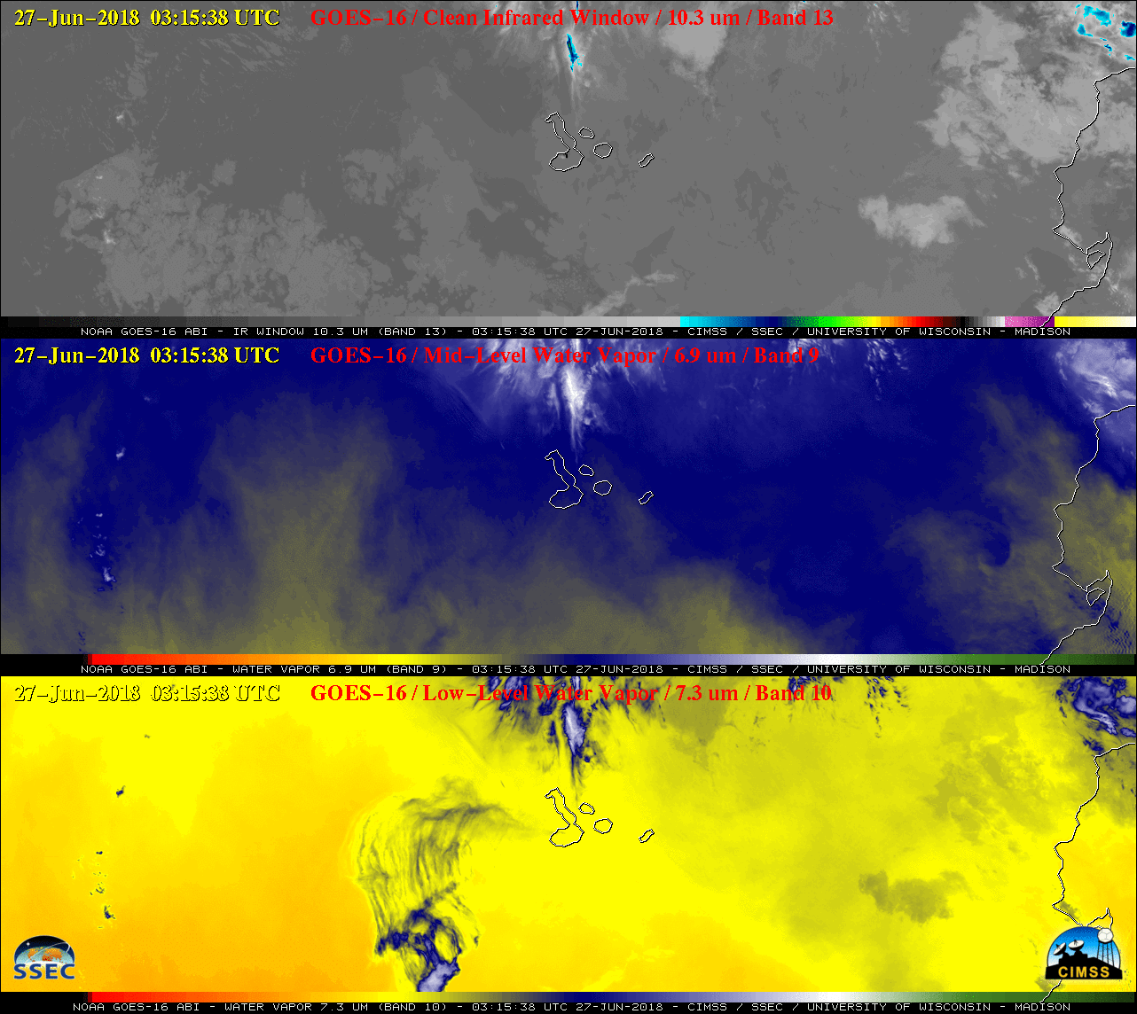
GOES-16 (GOES-East) “Red” Visible (0.64 µm) images (above) showed a large Mesoscale Convective System (MCS) which produced a long-lived path of large hail and damaging winds from eastern Nebraska to western Tennessee on 28 June 2018. The length and duration of damaging wind events (SPC storm reports) qualified this event as a derecho.The corresponding GOES-16... Read More