Eruption of the Sierra Negra volcano in the Galapagos
Onset of the #SierraNegra #eruption (#Galapagos) in the afternoon of June 26 captured by GOES & other satellites. The previous two Sierra Negra eruptions (1979 & 2005) both emitted a lot of SO2.
Source: @NOAA/@UWCIMSS volcanic cloud monitoring system; https://t.co/OZWmWBOVs9 pic.twitter.com/Gg3Yqw6pp3
— Simon Carn (@simoncarn) June 27, 2018
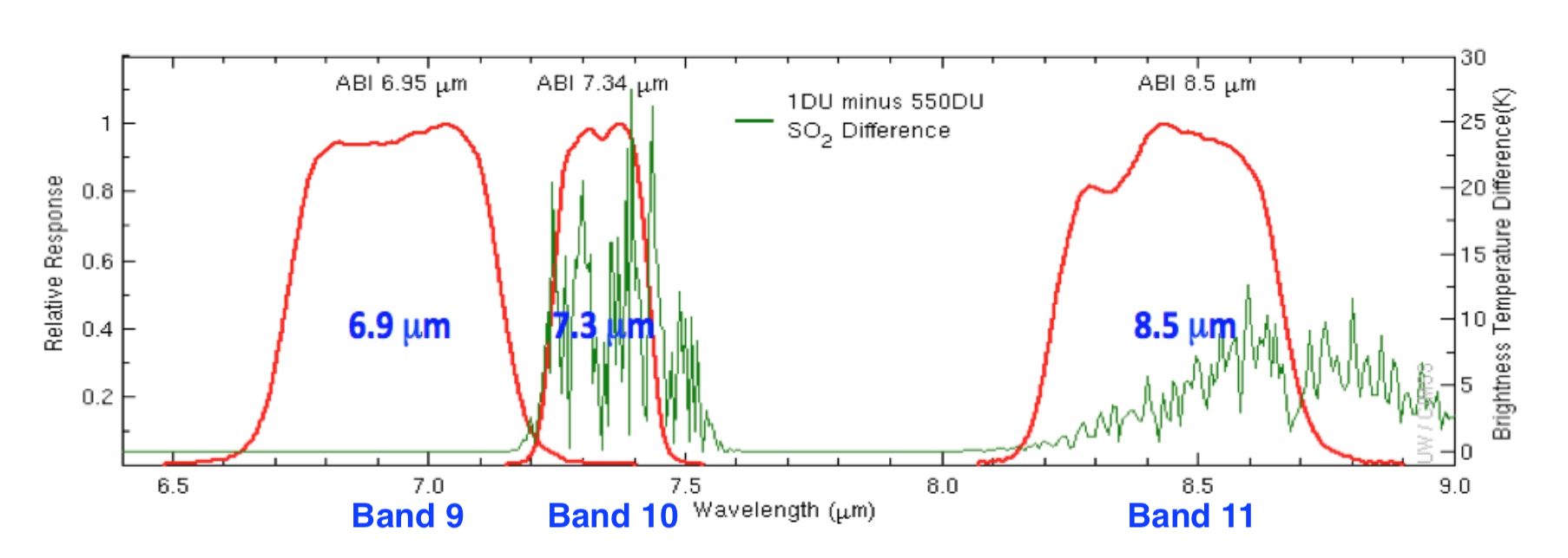
GOES-16 (GOES-East) “Clean” Infrared Window (10.3 µm), Mid-level Water Vapor (6.9 µm) and Low-level Water Vapor (7.3 µm) images beginning late in the day on 26 June 2018 (below) showed that a signature of the volcanic plume was evident in the 7.3 µm imagery for several hours after it was no longer seen in the 10.3 µm or 6.9 µm imagery — this is due to the fact that the 7.3 µm spectral band is also sensitive to SO2 absorption (and this volcanic eruption produced large amounts of SO2).

GOES-16 “Clean” Infrared Window (10.3 µm, top), Mid-level Water Vapor (6.9 µm, middle) and Low-level Water Vapor (7.3 µm, bottom) images [click to play animation | MP4]
Gigantic volcanic sulfur dioxide plume from the #SierraNegra volcano on the #GalapagosIslands over the tropical eastern Pacific as seen by the #TROPOMI satellite instrument, 28 June 2018. Source ESA/BIRA/DLR/KNMI, preliminary TROPOMI SO2 data. pic.twitter.com/iRGQfRXv39
— Jos (@weerrecords) July 2, 2018