Pyrocumulonimbus cloud from the Spring Fire in southern Colorado
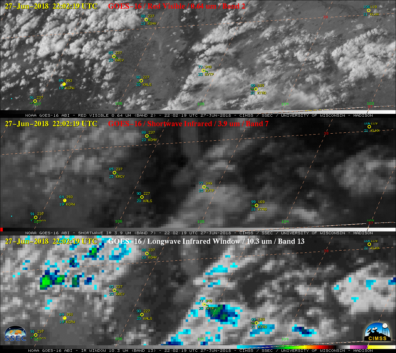
GOES-16 “Red” Visible (0.64 µm, top), Shortwave Infrared (3.9 µm, middle) and “Clean” Infrared Window (10.3 µm, bottom) images, with hourly plots of surface reports [click to play animation | MP4]
===== 29 June Update =====
![NOAA-20 VIIRS Day/Night Band (0.7 µm), Shortwave Infrared (3.75 µm and 4.05 µm) and Near-Infrared (1.61 µm and 2.25 µm) images [click to enlarge]](https://cimss.ssec.wisc.edu/satellite-blog/wp-content/uploads/sites/5/2018/06/180629_0852utc_noaa20_DayNightBand_ShortwaveInfrared_NearInfrared_Spring_Fire_CO_anim.gif)
NOAA-20 VIIRS Day/Night Band (0.7 µm), Shortwave Infrared (3.75 µm and 4.05 µm) and Near-Infrared (1.61 µm and 2.25 µm) images [click to enlarge]