This website works best with a newer web browser such as Chrome, Firefox, Safari or Microsoft Edge. Internet Explorer is not supported by this website.

Stories by Scott Bachmeier

30-second imagery of severe thunderstorms across the Upper Midwest

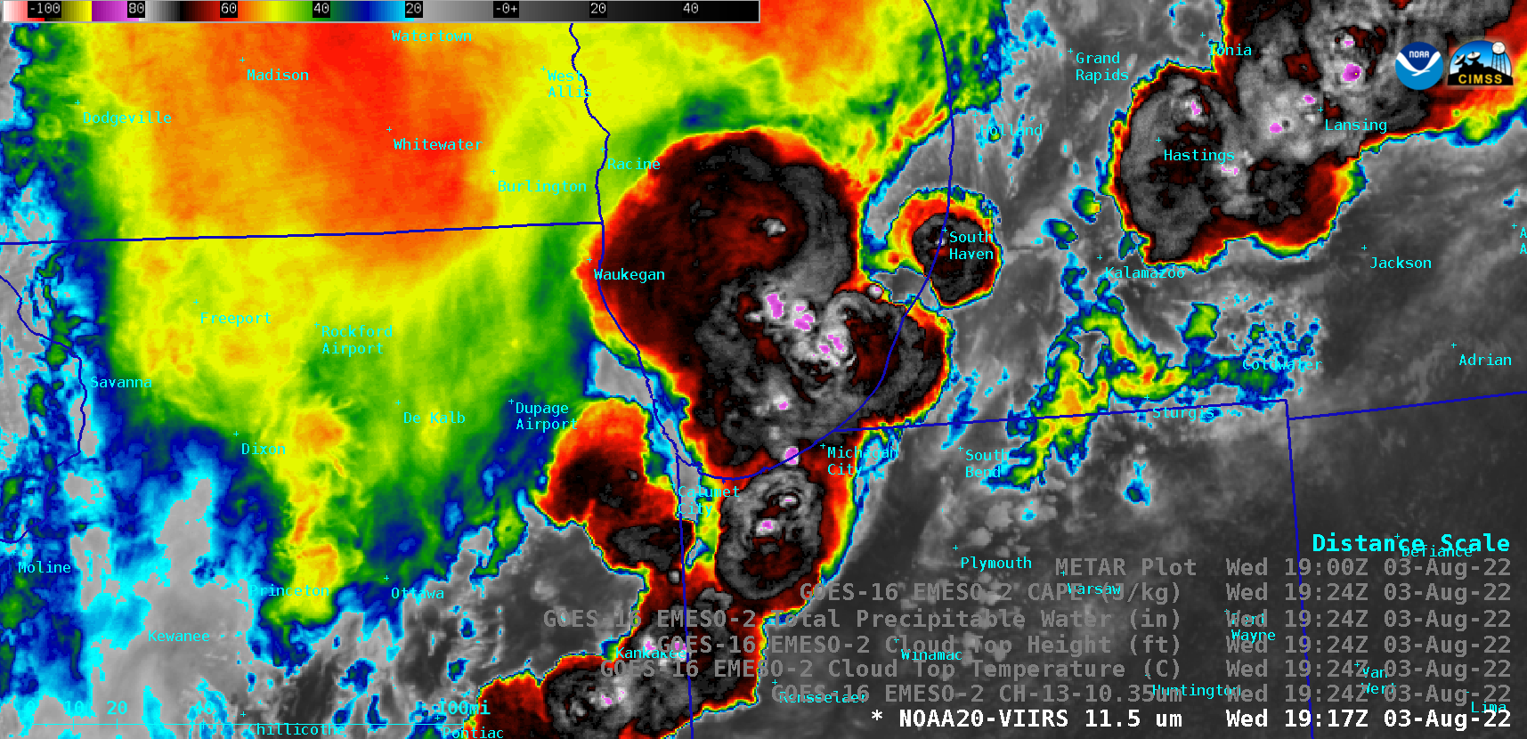
Overlapping 1-minute GOES-16 (GOES-East) Mesoscale Domain Sectors provided 30-second “Red” Visible (0.64 µm) images (above), which included time-matched plots of SPC Storm Reports — showing clusters of thunderstorms that moved eastward across parts of Illinois, Indiana and Lower Michigan on 03 August 2022.The corresponding 30-second GOES-16 “Clean” Infrared Window (10.35 µm) images (below) indicated that the coldest... Read More

McKinney Fire in California produces multiple pyrocumulonimbus clouds

1-minute Mesoscale Domain Sector GOES-17 (GOES-West) “Red” Visible (0.64 µm), Fire Temperature RGB, “Clean” Infrared Window (10.35 µm) and Cloud Top Temperature derived product images (above) showed that the rapidly-growing McKinney Fire in far northern California produced multiple (5 or 6) pulses of pyrocumulonimbus (pyroCb) clouds late in the day on 30 July 2022. The coldest pyroCb cloud-top 10.35... Read More