30-second imagery of severe thunderstorms across the Upper Midwest

GOE S-16 “Red” Visible (0.64 µm) images, with time-matched SPC Storm Reports plotted in red [click to play animated GIF | MP4]
The corresponding 30-second GOES-16 “Clean” Infrared Window (10.35 µm) images (below) indicated that the coldest overshooting tops exhibited infrared brightness temperatures around -80ºC (violet pixels within areas of brighter white enhancement). In addition, an animation of 30-second GOES-16 Visible/Infrared Sandwich RGB images is available here.
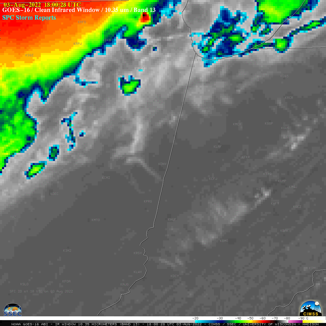
GOES-16 “Clean” Infrared Window (10.35 µm) images, with time-matched SPC Storm Reports plotted in cyan [click to play animated GIF | MP4]

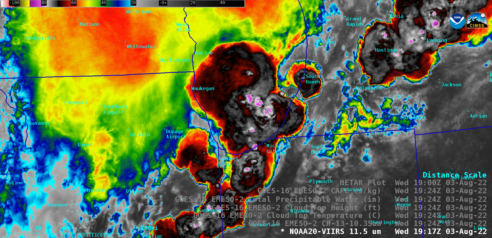
NOAA-20 Infrared Window (11.45 µm) and GOES-16 “Clean” Infrared Window (10.35 µm) images valid at 1924 UTC [click to enlarge]
NOAA-20 Infrared Window (11.45 µm) and GOES-16 Cloud Top Temperature derived product images valid at 1924 UTC [click to enlarge]