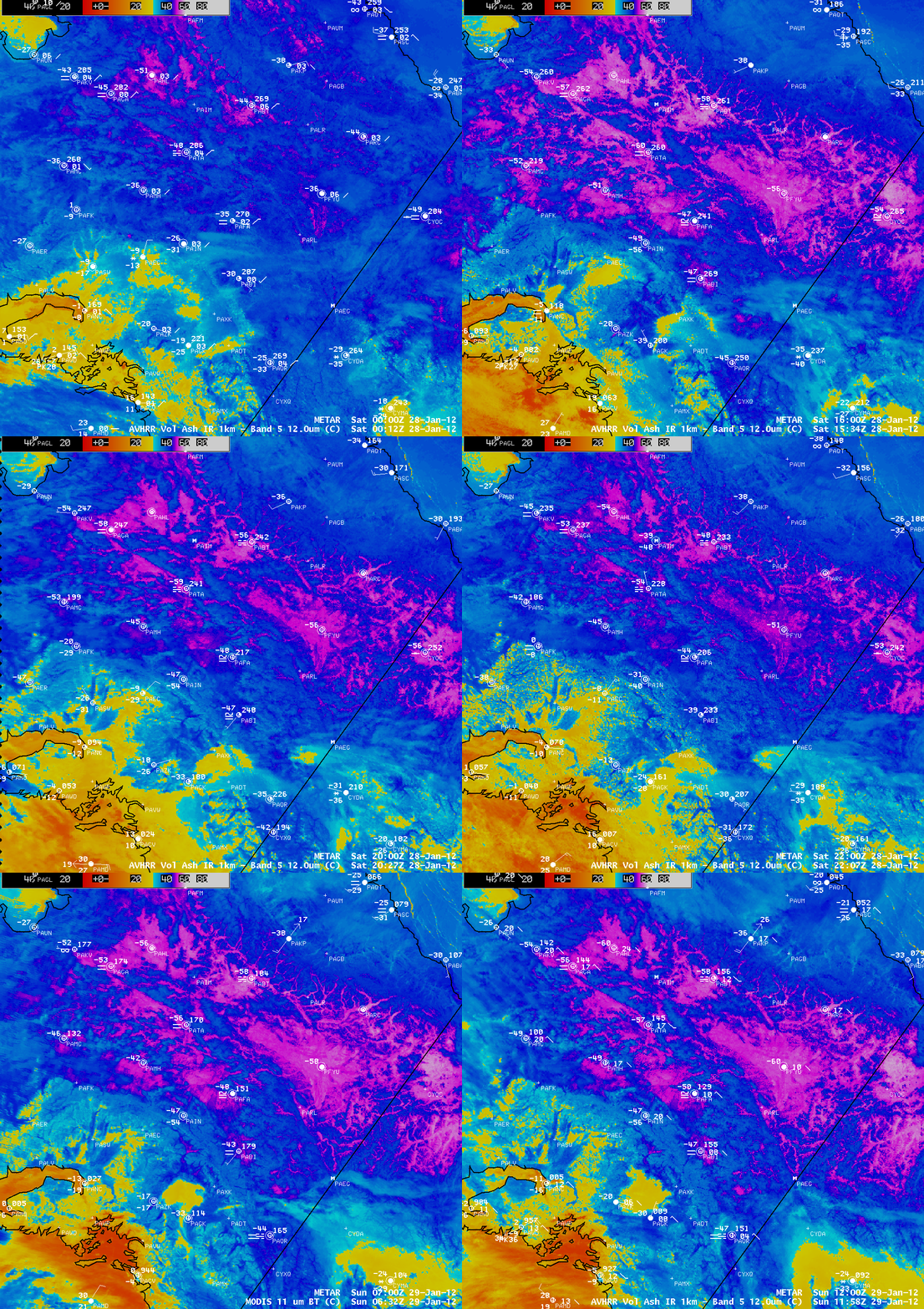
Record cold continues across interior Alaska
Record cold continued across the interior of Alaska, with Fairbanks reaching a minimum temperature of -50º F on 28 January 2012 and -51º F on 29 January 2012. These were the first -50º F temperatures at Fairbanks since 2006 (NWS Fairbanks public information statements). The coldest temperature reported was -65º F at Galena and by a coopertive observer at Fort Yukon (Fairbanks region temperature and precipitation data).
A sequence of AWIPS images of 1-km resolution POES AVHRR 12.0 µm IR and MODIS 11.0 µm IR data (above) revealed the expansion of surface IR brightness temperatures of -50º C or colder (violet to white color enhancement) during the early morning hours on 28 and 29 January. The coldest surface air temperatures at the times of the IR images included -50º F at Fairbanks (station identifier PAFA) and -60º F at Fort Yukon (station identifier PFYU) and Tanana (station identifier PATA). The signature of cold air drainage into lower elevation terrain (such as the relatively narrow river valleys along the south side of the Brooks Range, and also the broad Yukon Flats) could be seen on the 1-km resolution IR images.
The pattern of cold air drainage into lower elevations could be seen in even greater detail using McIDAS images of 375-meter resolution Suomi NPP VIIRS 10.450 µm IR data at 12:06 UTC on 28 January, over northwestern Alaska and the Yukon Territory of Canada (above), and also just to the southwest over the eastern interior of Alaska (below). These 2 VIIRS images use a different color enhancement, where the coldest surface IR brightness temperatures are darker blue.
Unfortunately, there was no surface air temperature report for Arctic Village (station identifier PARC) at this time, but the coldest surface IR brightness temperatures within some of the deeper valleys near that site was -58.4º C (-73.1º F).
To the south, a broad area of very cold (dark blue) surface IR brightness temperatures was seen across the Yukon Flats, with a minimum value of -58.3º C (-72.9º F). The hourly surface air temperature at the Fort Yukon (PFYU) reporting station close to the time of the satellite image was -56º F, while the surface IR brightness temperature at that location was -54º F. Although there is not always a direct 1:1 correspondence between satellite-sensed IR surface temperature values and the actual air temperature measured within an instrument shelter at a height of 5 feet above ground level, the IR satellite imagery can be used to located areas that might have the coldest surface air temperatures.


