The first 0ºF (-18ºC) temperature of the season in Alaska
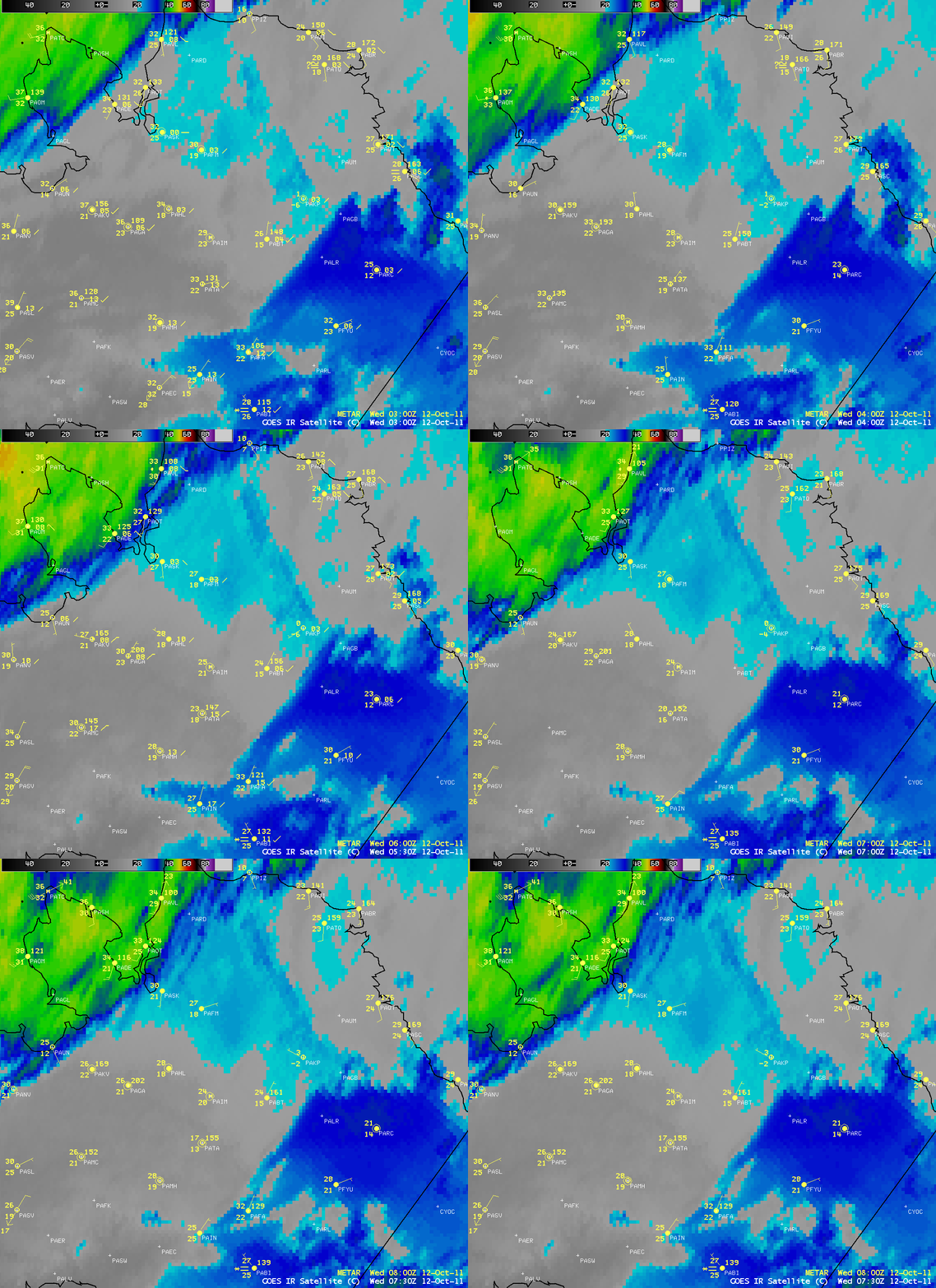
The first “official” 0ºF (-18ºC) temperature of the 2011/2012 winter season in Alaska was recorded at Anaktuvuk Pass on 12 October 2011. AWIPS images of “4-km resolution” GOES-11 10.7 µm IR data (above) indicated that portions of the Brooks Range in northern Alaska were beginning to exhibit IR brightness temperatures of -20ºC and colder (cyan to blue color enhancement), with Anuktuvuk Pass (station identifier PAKP) situated between a quasi-stationary deck of colder (darker blue) clouds to the east and another area of multi-layered clouds approaching from the west. Due to the very large viewing angle from the geostationary GOES-11 satellite positioned over the equator, the effective resolution of the IR pixels over northern Alaska was actually on the order of 10-15 km.
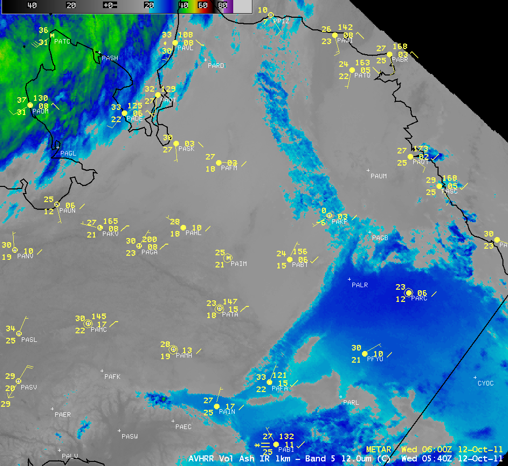
A more detailed view was available using a 1-km resolution POES AVHRR 12.0 µm IR image at 05:40 UTC (below), which did a better job of portraying the arc of colder (-20ºC to -28ºC, cyan to darker blue) high-elevation portions of the Brooks Range, as well as the boundaries of the cloud deck that was covering parts of northeastern Alaska. With calm winds and no clouds at Anaktuvuk Pass, strong radiational cooling allowed the temperature to get much colder than adjacent areas with a blanket of cloud cover.
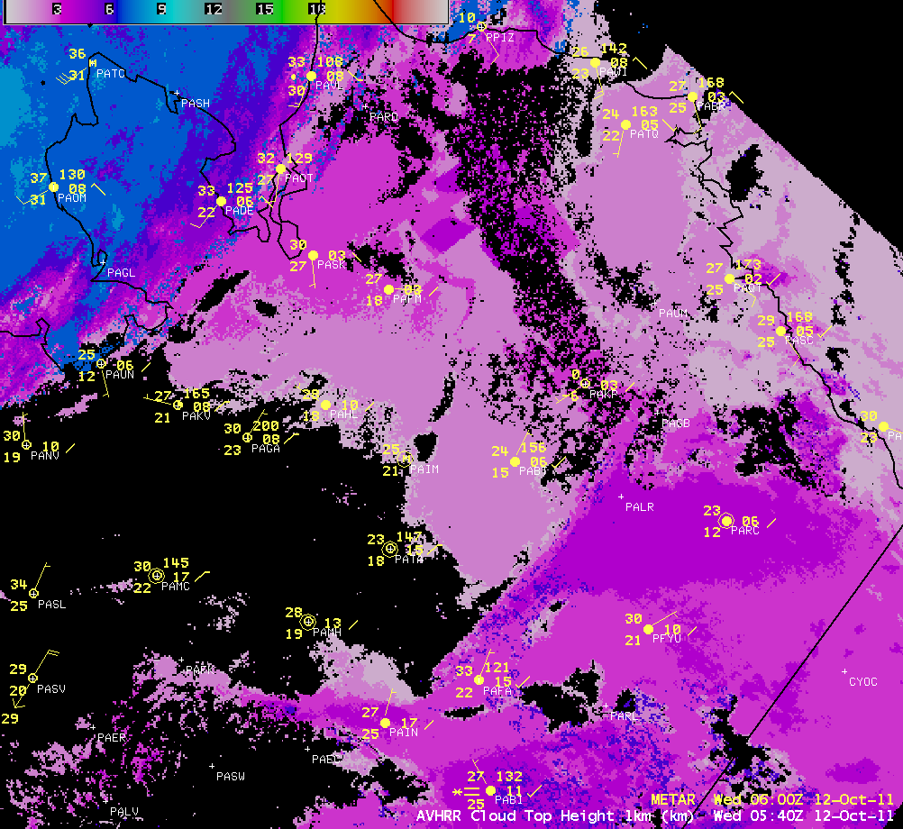
The corresponding 05:40 UTC POES AVHRR Cloud Top Height product (below) showed that the northeastern Alaska cloud deck extended to heights of 3-4 km (darker violet color enhancement).
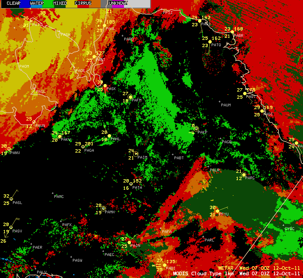
A MODIS Cloud Type product at 07:03 UTC (below) indicated that the cloud deck covering northeastern Alaska was primarily a “mixed phase” (supercooled water and ice, darker green color enhancement) feature.


