Smoke dissipation via downdrafts from a collapsing thunderstorm
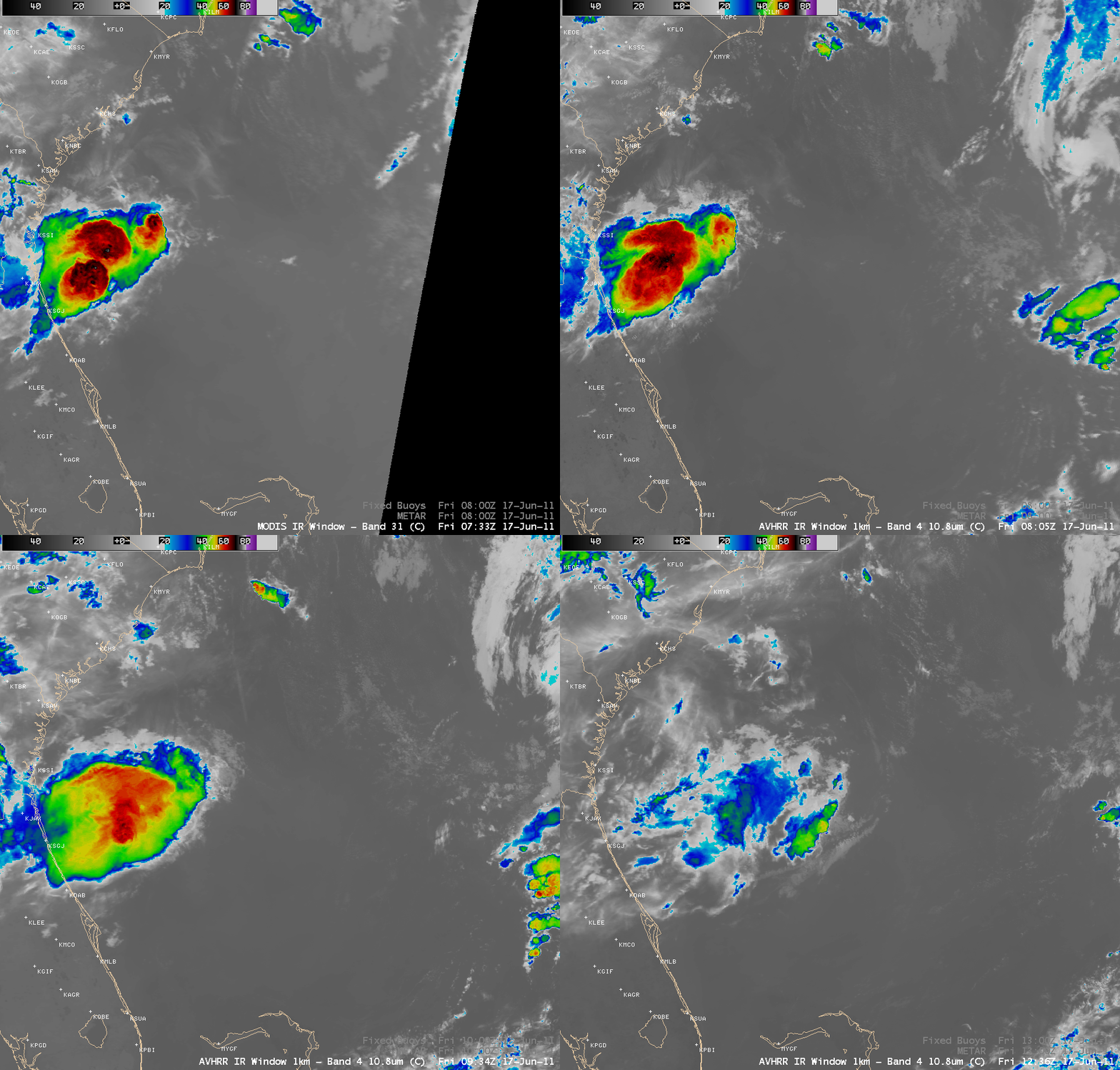
AWIPS images of POES AVHRR 10.8 µm IR data (above) showed a thunderstorm that was moving off the Georgia/Florida coast during the pre-dawn hours on 17 June 2011. Rapidly-warming cloud top IR brightness temperatures indicated that this thunderstorm was quickly dying.
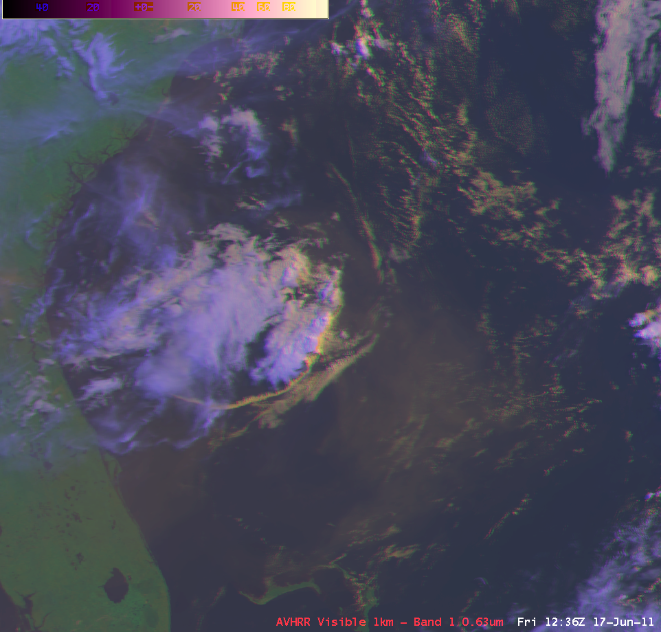
A POES AVHRR false color Red/Green/Blue (RGB) image at 12:36 UTC (below) depicted a well-defined outflow boundary resulting from the downdrafts of the collapsing thunderstorm — and to the east of the storm, the hazy signature of residual smoke from wildfires that had been burning across the region during previous days.
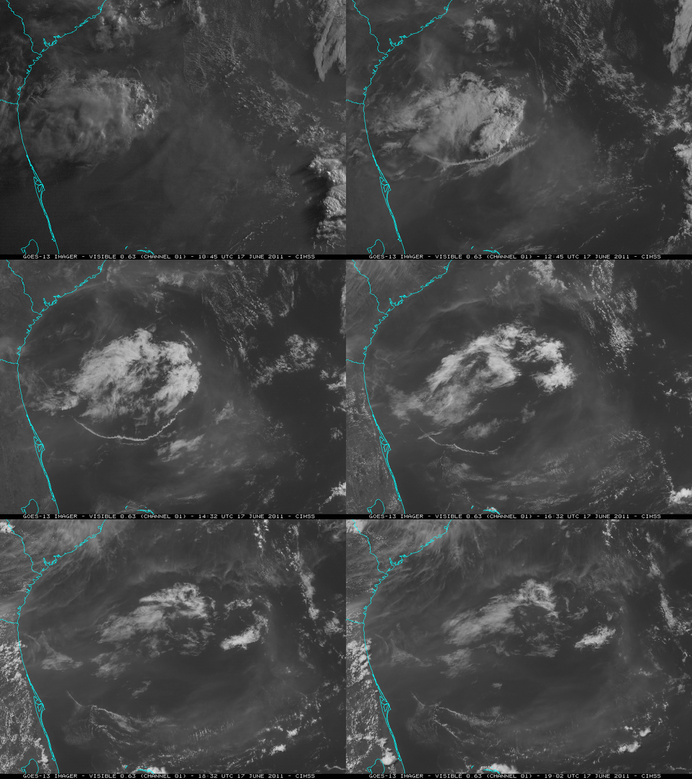
McIDAS images of GOES-13 0.63 µm visible channel data (below) showed that a great deal of the smoke east of the storm was apparently dissipated by cleaner downdraft air from the dying convection.
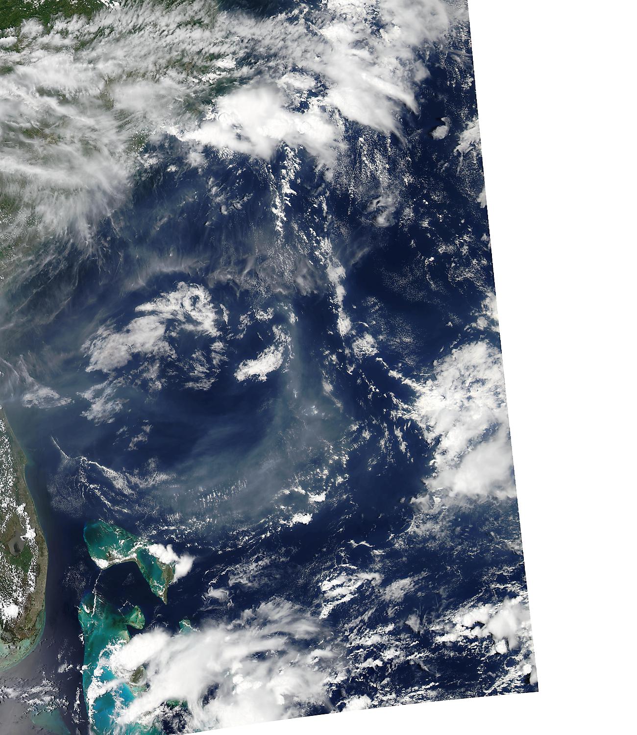
This clearing of the smoke was also apparent on a MODIS true color image from the SSEC MODIS Today site (below).
For additional images and information, see the US Air Quality “Smog Blog”.


