Convective outflow boundary and softball-size hail in southern Wisconsin
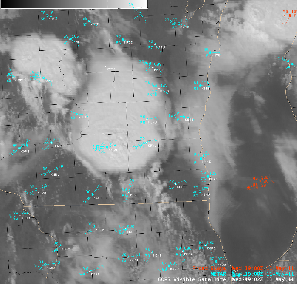
AWIPS images of 1-km resolution GOES-13 0.63 µm visible channel data (above; click image to play animation) showed a convective outflow boundary (originating from strong thunderstorms earlier in the day over northeastern Wisconsin) propagating southward across the eastern portion of the state on 11 May 2011. The leading edge of the outflow boundary moved farther to the south over the nearshore waters of Lake Michigan, where surface friction was less than that over land. Later in the day, clusters of severe thunderstorms were seen to develop over southcentral and southeastern Wisconsin, along an advancing warm frontal boundary.
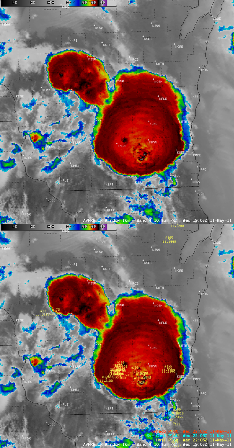
A 1-km resolution POES AVHRR 10.8 µm “IR window” image (below) at 19:08 UTC (2:08 pm local time) revealed a number of overshooting tops, which exhibited IR brightness temperature values as cold as -70 to -78º C (black to white color enhancement). Overlaid are the numerous SPC reports of hail that had occurred up through 22:06 UTC — hail was as large as 1.75 inches in diameter in Dane County (where observation station Madison KMSN is located), and as large as 4.25 inches (softball-size) just to the east in Jefferson county (where observation station Watertown KRYV is located). A subtle signature of outward-propagating concentric gravity waves could also seen on the IR image of this hail-producing storm, which was especially evident over the northern portion of the cold cloud shield.
CIMSS participation in GOES-R Proving Ground activities includes making a variety of POES AVHRR images and products available for National Weather Service forecasters to add to their AWIPS workstations. A “POES and AVHRR Satellite Products in AWIPS” VISIT training lesson is also available to help users understand the products and their applications to weather analysis and forecasting.
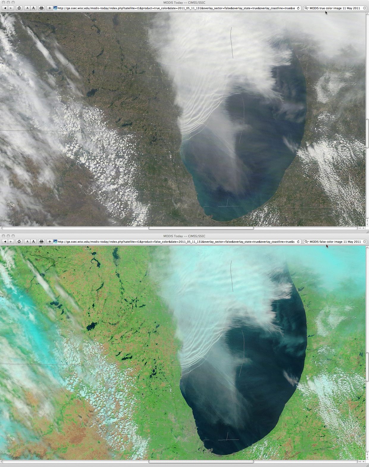
A closer look at the aforementioned leading edge of the outflow boundary over the nearshore waters of Lake Michigan is offered using 250-meter resolution MODS true color and false color Red/Green/Blue (RGB) images from the SSEC MODIS Today site (below). Multiple wave fronts can be seen associated with this density current as it moved southward near the Wisconsin/Illinois border region.


