Widespread fires continue in eastern Kansas; resultant smoke pall aloft over Missouri
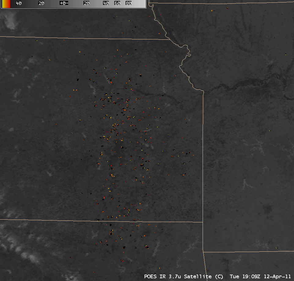
An AWIPS image of POES AVHRR 3.7 µm shortwave IR data (above) revealed a large number of fire “hot spots” (black to red to yellow pixels) across much of eastern Kansas on 12 April 2011. The majority of these were grassland fires.
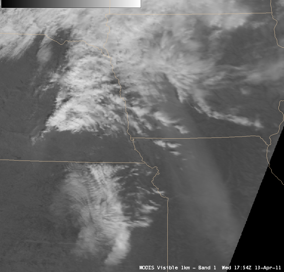
On the following day (13 April 2011), a well-defined area of dense smoke aloft could be seen stretching from Missouri into southwestwen Iowa on a MODIS 0.65 µm visible channel image (below).
====================================
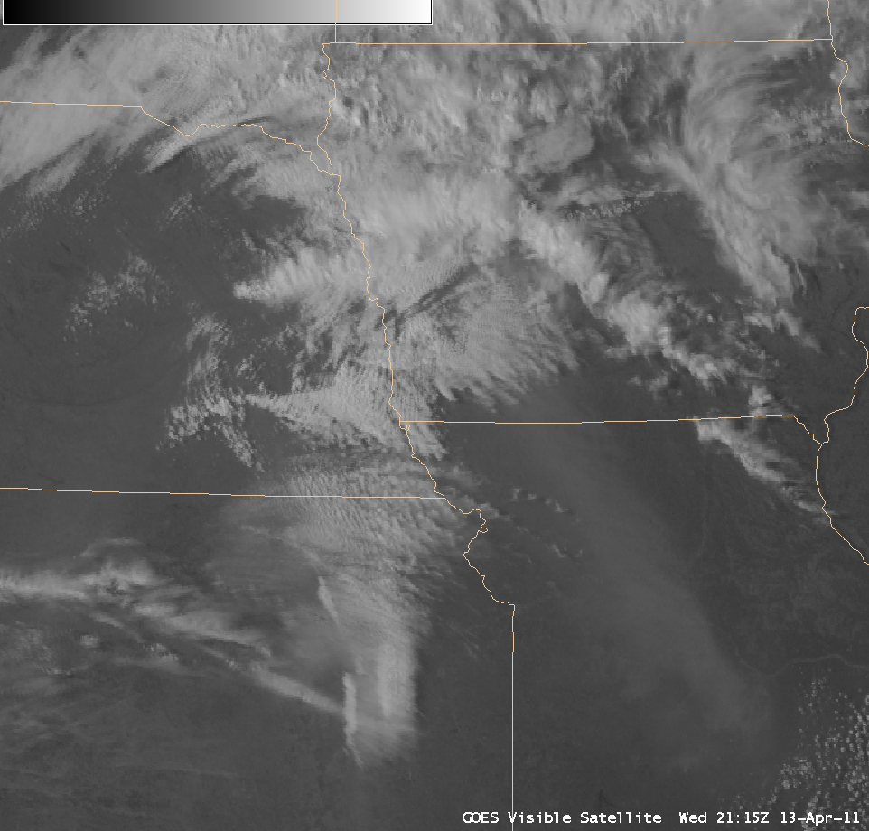
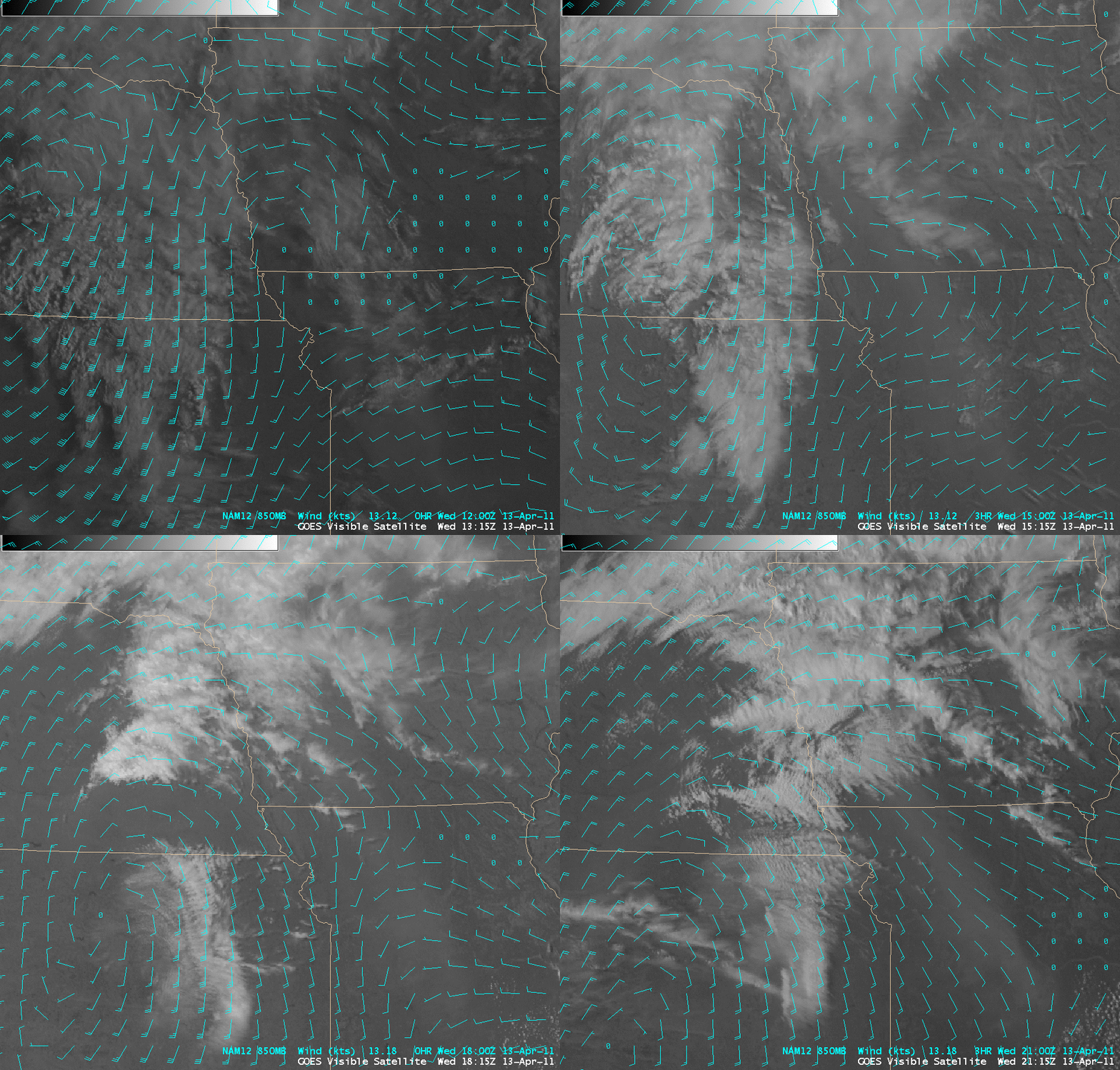
GOES-13 0.63 µm visible images (above; click image to play animation) showed that the dense smoke feature moved very little during the day. An overlay of NAM12 850 mb winds (below) indicated that light southwesterly winds in the morning transitioned to a more organized southeasterly flow as a low-level cyclonic circulation moved southward across Nebraska into Kansas.
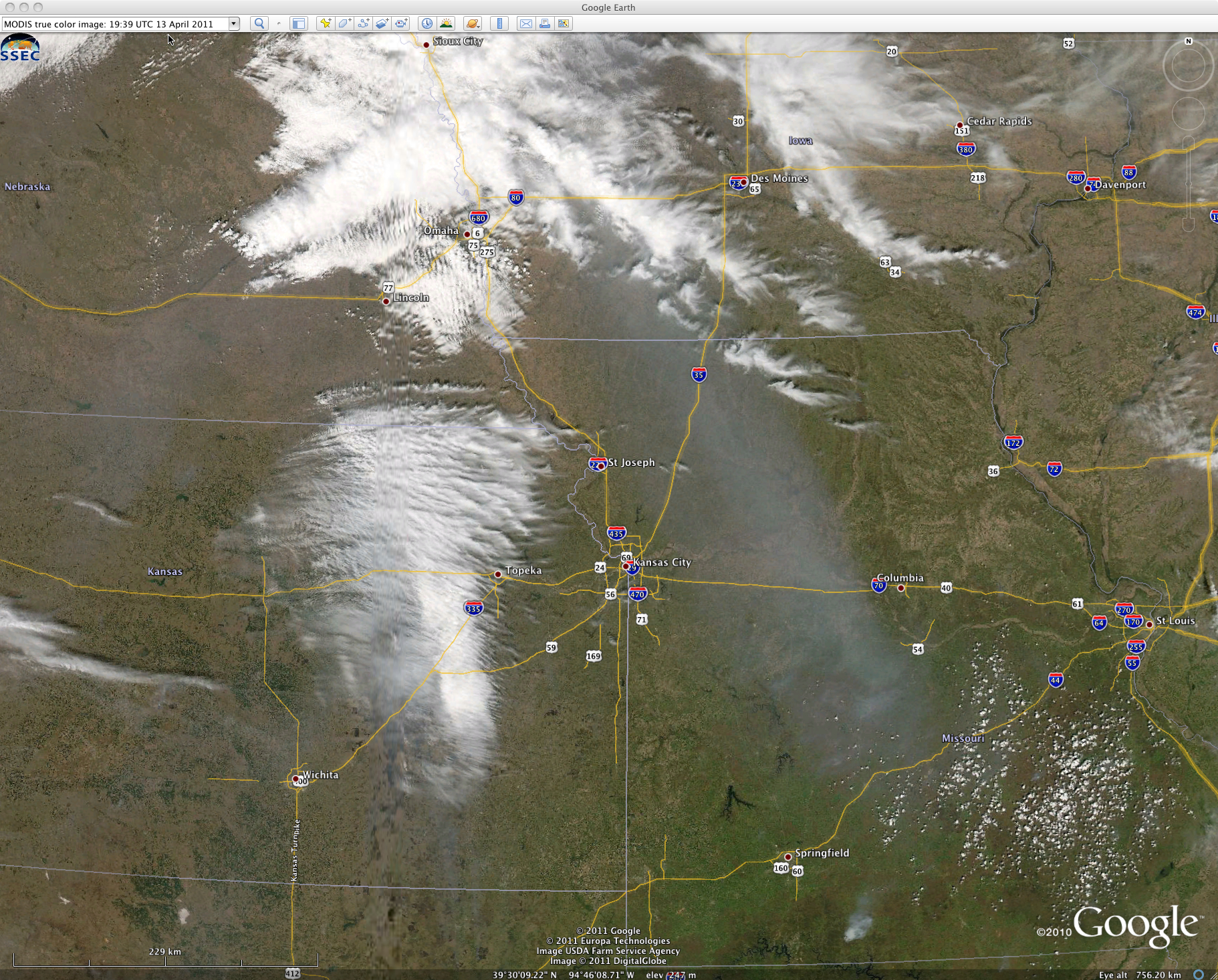
A MODIS true color Red/Green/Blue (RGB) image from the SSEC MODIS Today site (below; displayed using Google Earth) provided a better view of the smoke pall aloft as the northern end wrapped around the low-level cyclonic circulation.
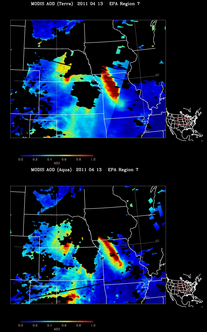
MODIS Aerosol Optical Depth (AOD) products from the IDEA site (below) showed very high ADO values (orange to red color enhancement) associated with this smoke feature.


