First lake-effect snow flurries of the season in the Upper Peninsula of Michigan
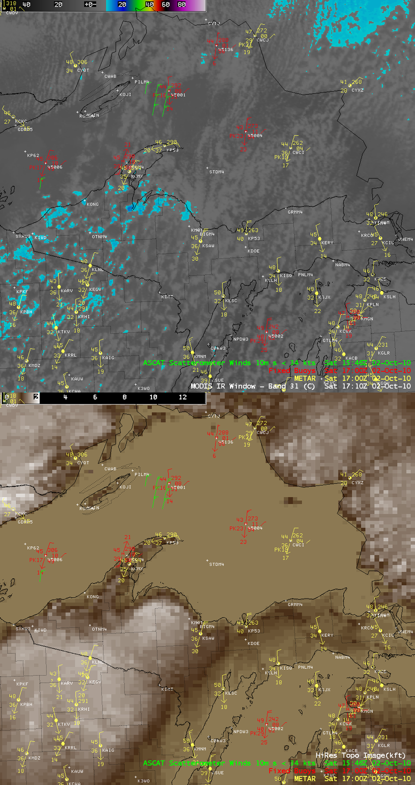
The first lake-effect snow flurries of the season were observed in the Upper Peninsula of Michigan at Gwinn, Sawyer Airport (station identifier KSAW) on 02 October 2010. An AWIPS image of MODIS 11.0 µm IR channel data (above) showed a few disorganized cloud bands over Lake Superior, with the coldest cloud top IR brightness temperature values of -13.5º C over the KSAW area.
Looking at the buoy data and the ASCAT winds over Lake Superior (below), the wind speeds over the water were not particularly strong — but the winds at KSAW gusted as high as 36 mph during the day. The could be attributed in part to terrain interaction, as the surface winds encountered a rather abrupt change in topography immediately inland across the Upper Peninsula of Miichigan (where the elevations quickly rise to 1000-1800 feet).
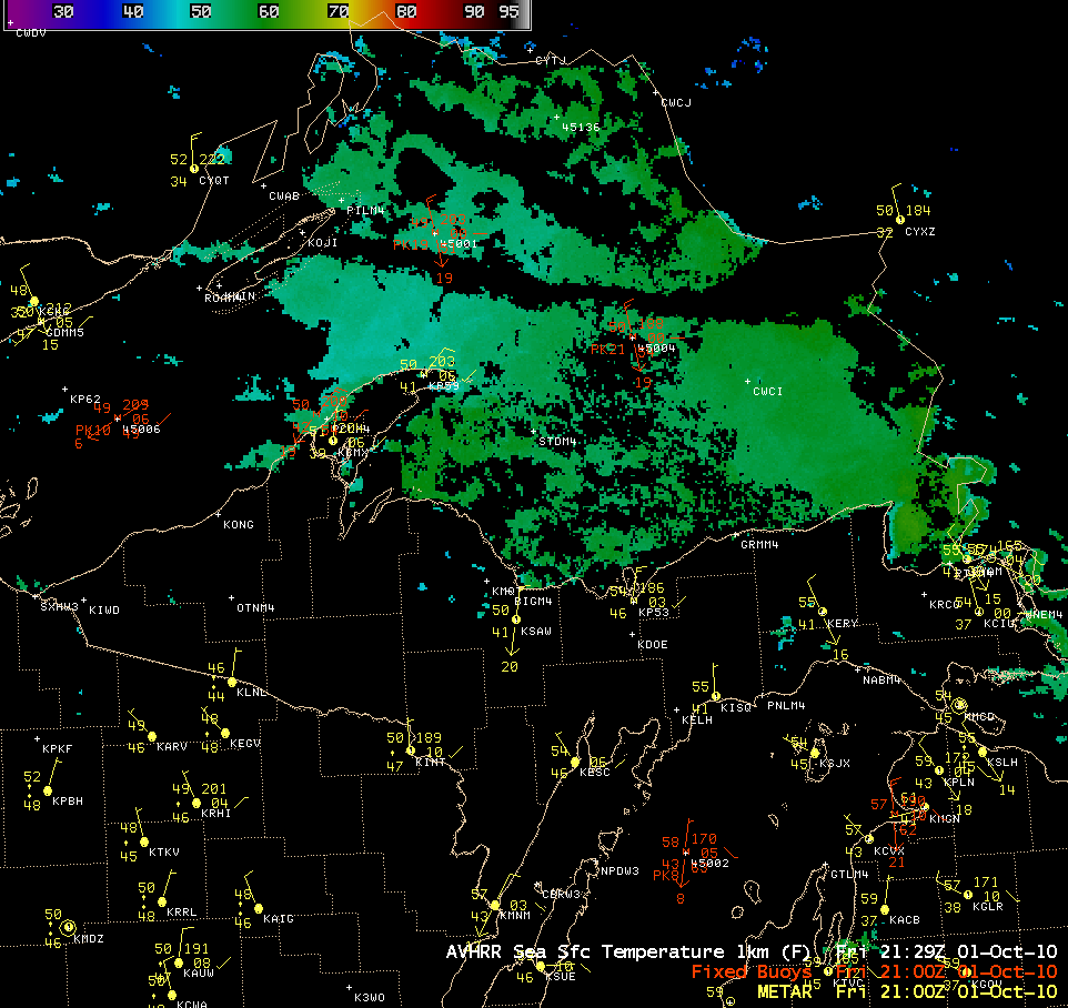
The AVHRR Sea Surface Temperature (SST) product from late in the day on 01 October (below) indicated that SST values across much of the central and eastern part of Lake Superior were in the middle to upper 50s F (around 12 to 15º C). With 850 hPa air temperatures of 0º C to -5º C, the “Delta-T” values were not of sufficient magnitude for the formation of well-defined lake-effect snow bands.


