“Anvil plumes” associated with severe convection in NE and SD

GOES-13 10.7 µm IR images
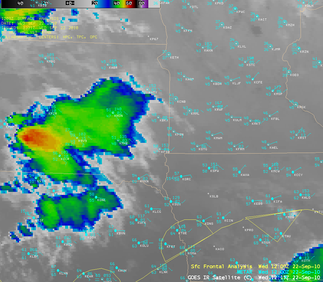
Clusters of severe thunderstorms developed across parts of northeastern Nebraska and southeastern South Dakota ahead of a warm frontal boundary that was advancing northward across the region on 22 September 2010. These severe thunderstorms produced a number of reports of large hail and damaging winds. AWIPS images of GOES-13 10.7 µm IR data (above) showed that cloud top IR brightness temperatures were as cold as around -70º C (dark black enhancement) at times.
The corresponding GOES-13 3.9 µm shortwave IR images (below) revealed that a few interesting “darker plumes” developed on the cloud tops of some of the southernmost storms — this darker appearance was a signature of smaller ice crystal particles that were being ejected above the anvil top by some of the stronger thunderstorm updrafts. These smaller ice crystals were better reflectors of incident solar radiation, making them show up as warmer (darker) features on the shortwave IR images.

GOES-13 3.9 µm shortwave IR images
These darker anvil top plumes were also very evident at 16:33 UTC on 1-km resolution MODIS 3.7 µm shortwave IR imagery (below).

MODIS 3.7 µm shortwave IR image
A closer view using 1-km resolution POES AVHRR 10.8 µm IR imagery at 18:56 UTC (below) displayed a well-defined “enhanced-v” signature in southeastern South Dakota (with the coldest cloud top IR brightness temperature value of -82º C, violet color enhancement) — and a large number of hail reports associated with this storm as it tracked through the area, including a report of 3.5 inch diameter hail near Vermillion, South Dakota.
")
POES AVHRR 10.8 µm IR image (with hail reports)