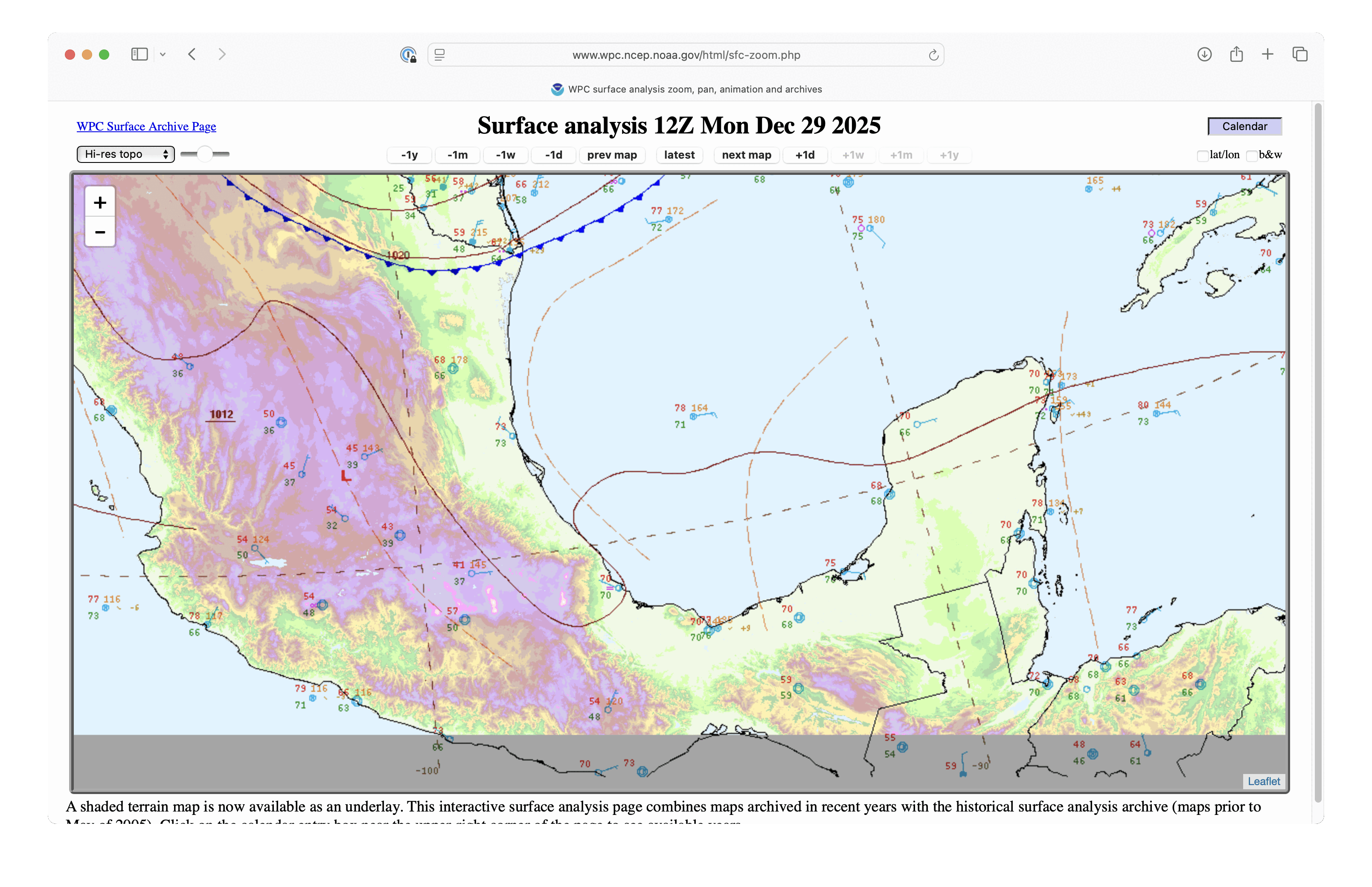
Tehuano gap wind event

10-minute GOES-19 Near-Infrared images, from 1300-2330 UTC on 30 December [click to play MP4 animation]
A topography image (below) also showed Metop-B ASCAT winds emerging from the southern coast of Mexico, after the gap winds had accelerated through Chivela Pass; wind speeds were as high as 45 kts. The Tropical Analysis and Forecast Branch had issued a polygon where Storm Force winds were likely over the Gulf or Tehuantepec (1800 UTC surface analysis).

Topography image, with Metop-B ASCAT wind barbs (having speeds of 34-47 kts) valid at 1513 UTC plotted in cyan [click to enlarge]

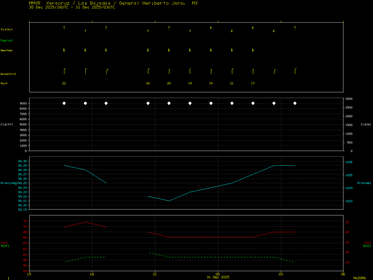
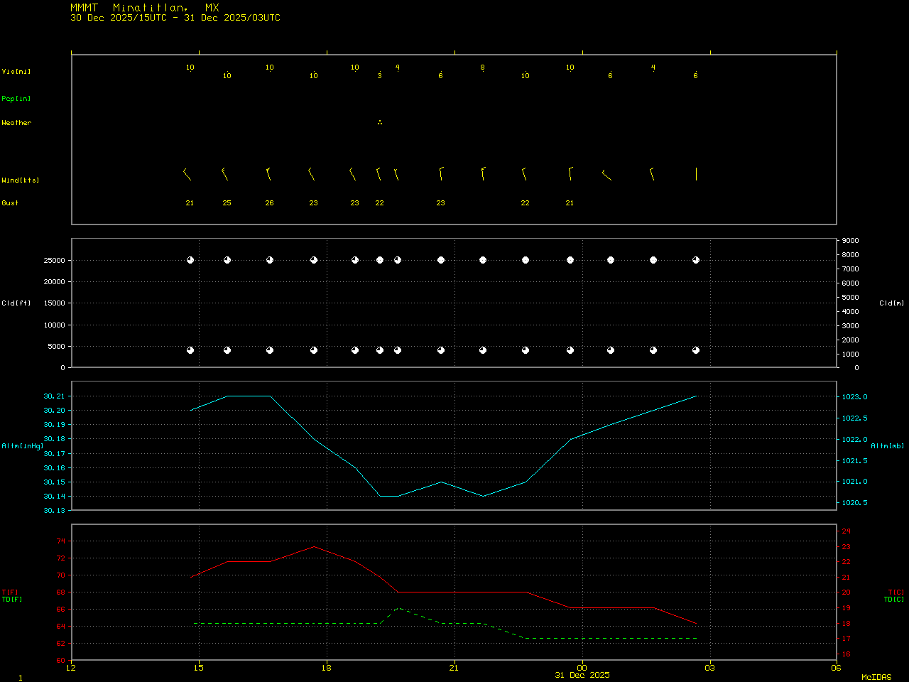
Sequence of Metop-B/C ASCAT and OSCAT-3 wind barbs, from 0242-1758 UTC on 30 December
True Color RGB images from GOES-18 (GOES-West) and GOES-19 from the CSPP GeoSphere site (below) displayed the hazy plume of blowing dust as it fanned out across the Gulf of Tehuantepec and the Pacific Ocean.
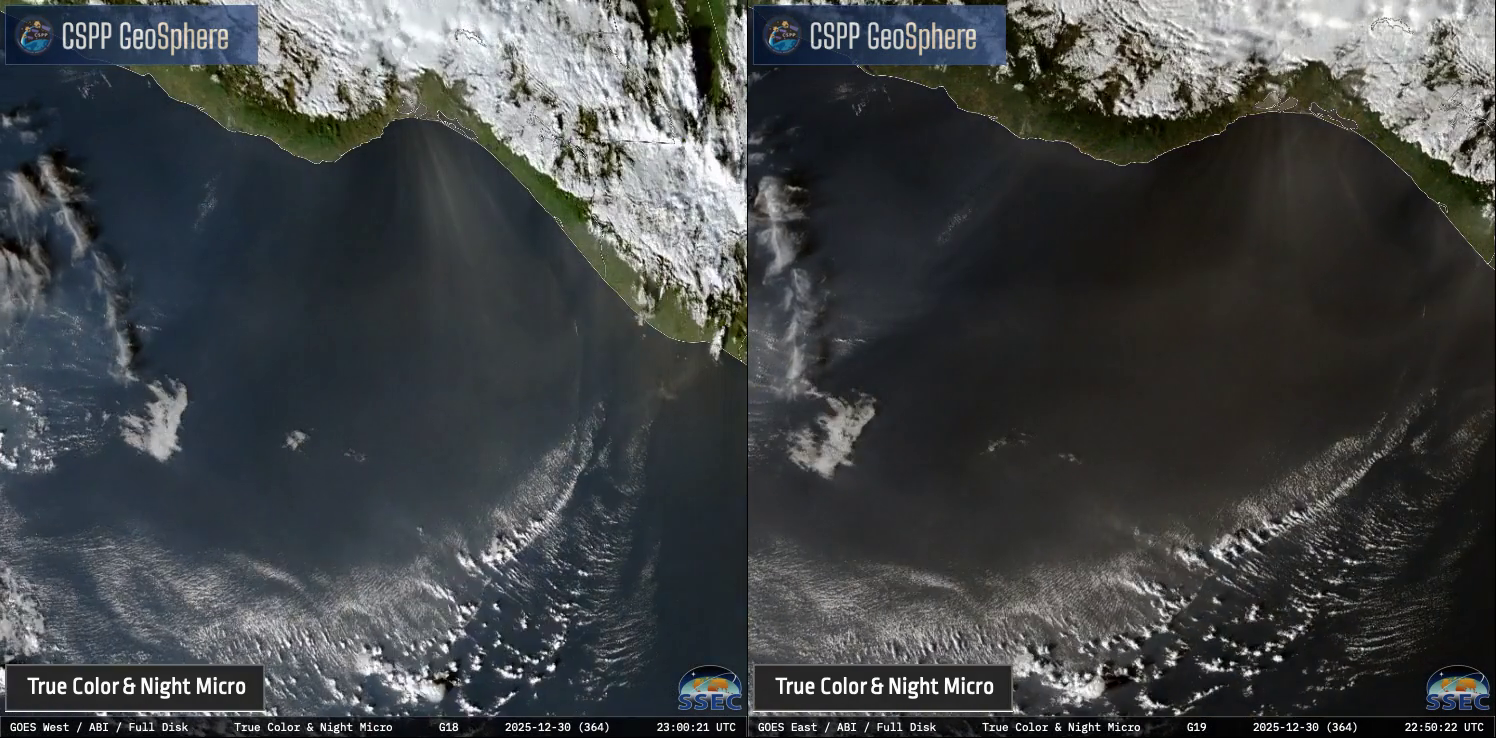
10-minute True Color RGB images from GOES-18 (left) and GOES-19 (right), from 1330-2330 UTC on 30 December [click to play MP4 animation]