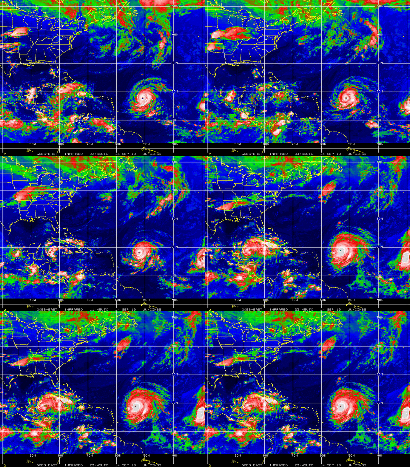
3 tropical cyclones in the Atlantic Basin: Igor, Julia, and Karl
GOES-13 10.7 µm IR images (above) showed 3 tropical cyclones in the Atlantic Basin on 14 September 2010: from left to right, Tropical Storm Karl, Hurricane Igor, and Hurricane Julia. Real-time visible and IR images covering the Tropical Atlantic are available from NOAA/NESDIS/OSDPD/SSD.
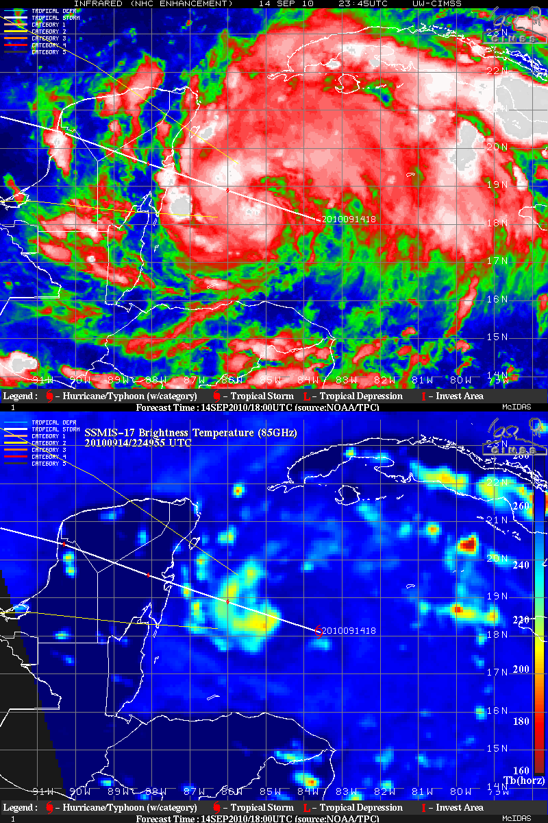
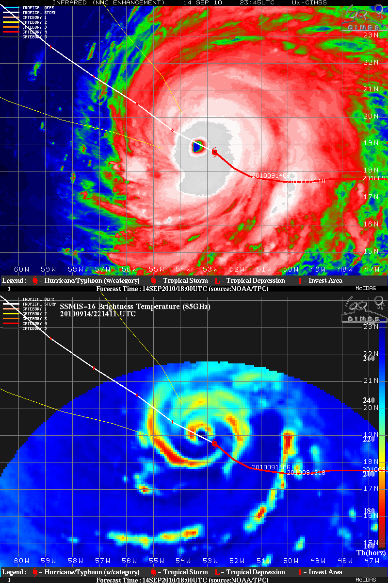
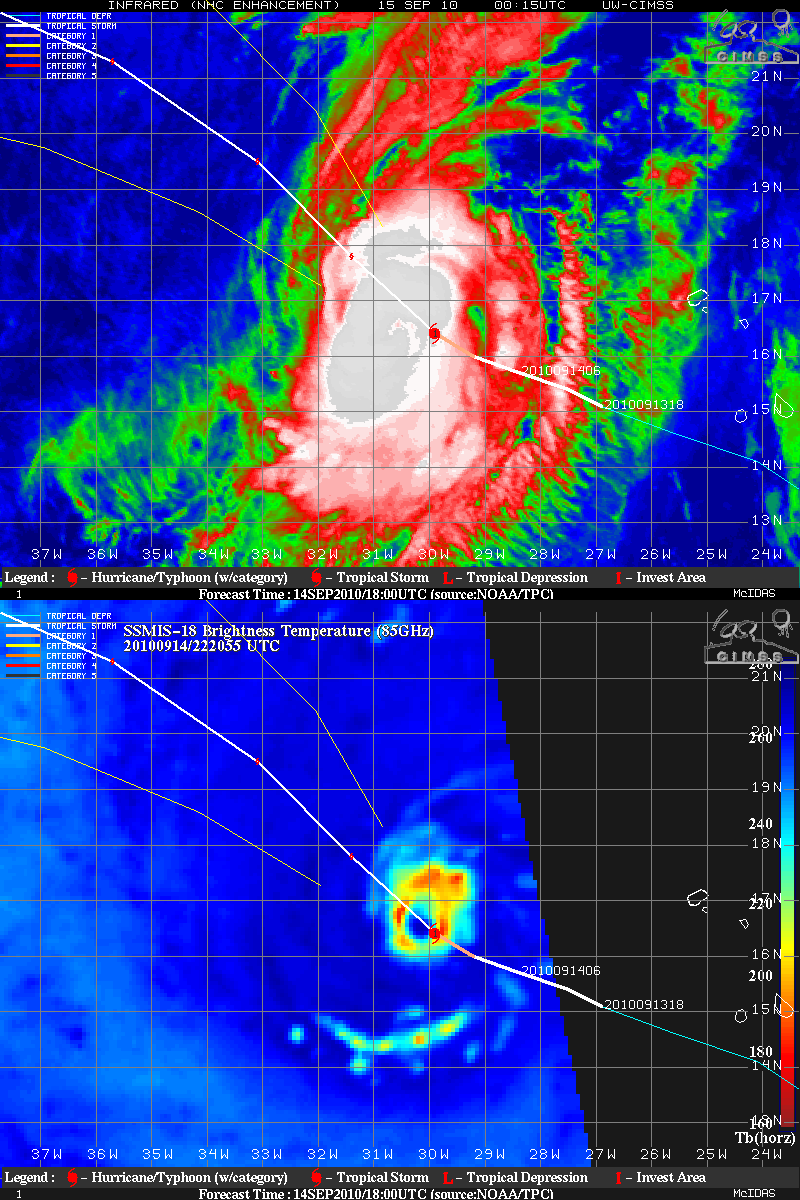
A comparison of geostationary-orbiting satellite IR images and polar-orbiting microwave images (from the CIMSS Tropical Cyclones site) for each of the 3 tropical cyclones are shown below. Note that there is a 1-2 hour difference between the IR images and the microwave images — however, these comparisons show the utility of the microwave images for showing tropical cyclone structures that are often masked by the cold convective cloud shield.
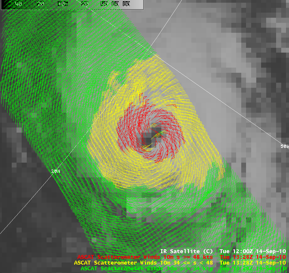
An AWIPS image of EUMETSAT METOP Advanced Scatterometer (ASCAT) winds (below) indicated surface winds as high as 63 knots near the center of Hurricane Igor at 13:28 UTC; however, ASCAT winds are known to have a low speed bias (which increases as winds get to higher speeds).
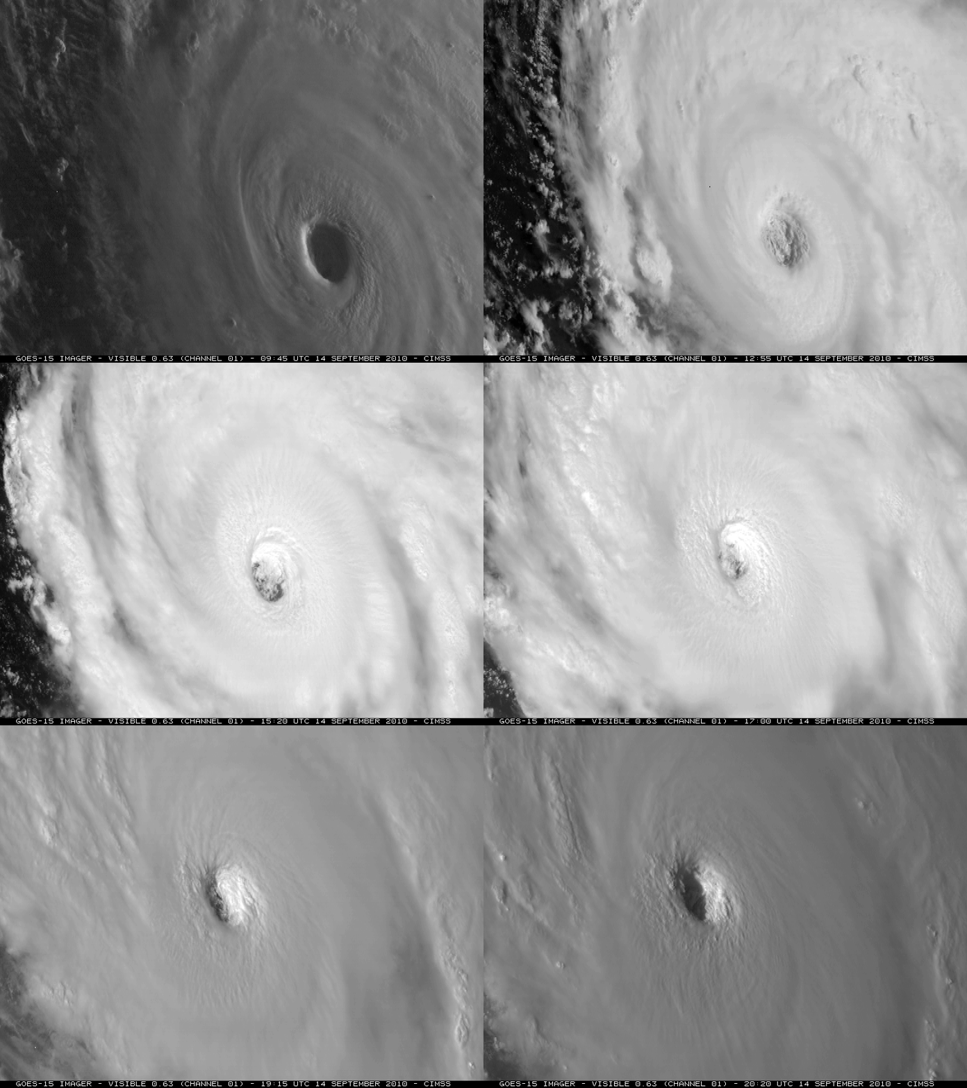
As part of the GOES-15 Post Launch Science Test, the satellite was placed into Rapid Scan Operations (RSO) mode, providing images as frequently as every 5 minutes during the day. The evolution of the eye of Hurricane Igor is seen on GOES-15 0.63 µm visible channel images (below; also available as a QuickTime movie) — note the occasional presence of small mesovortices within the eye region.


