Tropical Storm Melissa forms in the Caribbean Sea

1-minute GOES-19 Infrared and Visible images with plots of GLM Flash Points, from 1401-2230 UTC on 21 October [click to play MP4 animation]

GOES-19 Infrared images, with an overlay of contours and streamlines of deep-layer wind shear at 0200 UTC on 22 October
Melissa was moving across very warm waters, where high values of Sea Surface Temperature and Ocean Heat Content were present (below).

Sea Surface Temperature on 21 October, with a plot of Melissa’s track ending at 1800 UTC

Ocean Heat Content on 21 October, with a plot of Melissa’s track ending at 1800 UTC
Surface scatterometer data from OCEANSAT and ASCAT (below) indicated that the strongest winds existed east of the storm center.
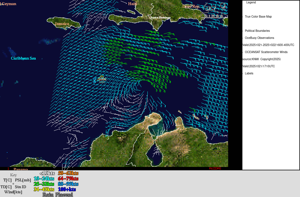
OCEANSAT scatterometer winds at 1710 UTC on 21 October

GOES-19 Infrared image at 0121 UTC on 22 October, with a cursor sample of 30-knot ASCAT winds [click to enlarge]

GOES-19 Infrared image at 0121 UTC on 22 October, with a cursor sample of 30-knot ASCAT winds [click to enlarge]
===== 22 October Update =====

1-minute GOES-19 Infrared images with plots of GLM Flash Points, from 1801 UTC on 21 October to 1800 UTC on 22 October [click to play MP4 animation]
Cloud-top infrared brightness temperatures of convective overshooting tops closer to the center of Melissa have been as cold as -96.57ºC below).

GOES-19 Infrared image with GLM Flash Points at 1347 UTC, with a cursor sample of the coldest cloud-top infrared brightness temperature at that time [click to enlarge]