Hurricane Kiko rapidly intensifies to a Category 4 storm in the East Pacific Ocean

1-minute GOES-18 Visible and Infrared images with plots of 1-minute GOES-18 GLM Flash Points, from 1733 UTC on 03 September to 0200 UTC on 04 September [click to play MP4 animation]
Kiko was moving through an environment characterized by low values of deep-layer wind shear (below), and moving over relatively warm water — two factors that were favorable for tropical cyclone intensification.
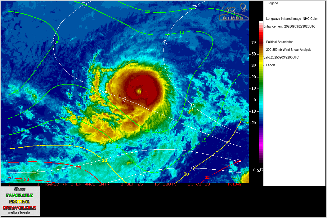
GOES-18 Infrared images with an overlay of contours and streamlines of Deep-Layer Wind Shear at 2200 UTC on 03 September
An AMSU-B Microwave image at 1815 UTC (below) displayed a closed eyewall around the time that Kiko reached Category 4 intensity.

AMSU-B Microwave (183 GHz) image at 1815 UTC
A RCM-2 Synthetic Aperture Radar (SAR) image (source) at 0301 UTC on 04 September (below) depicted a maximum wind speed of 118.35 kts within the eyewall of Kiko.

RCM-2 SAR wind speed image at 0301 UTC on 04 September [click to enlarge]

1-minute GOES-18 CIMSS True Color RGB images, from 1800 UTC on 03 September to 0259 UTC on 04 September (courtesy Mat Gunshor, CIMSS) [click to play animated GIF | MP4]

Hourly MIMIC Total Precipitable Water images, from 0000 UTC on 03 September to 2300 UTC on 04 September