GOES Low Cloud Base product
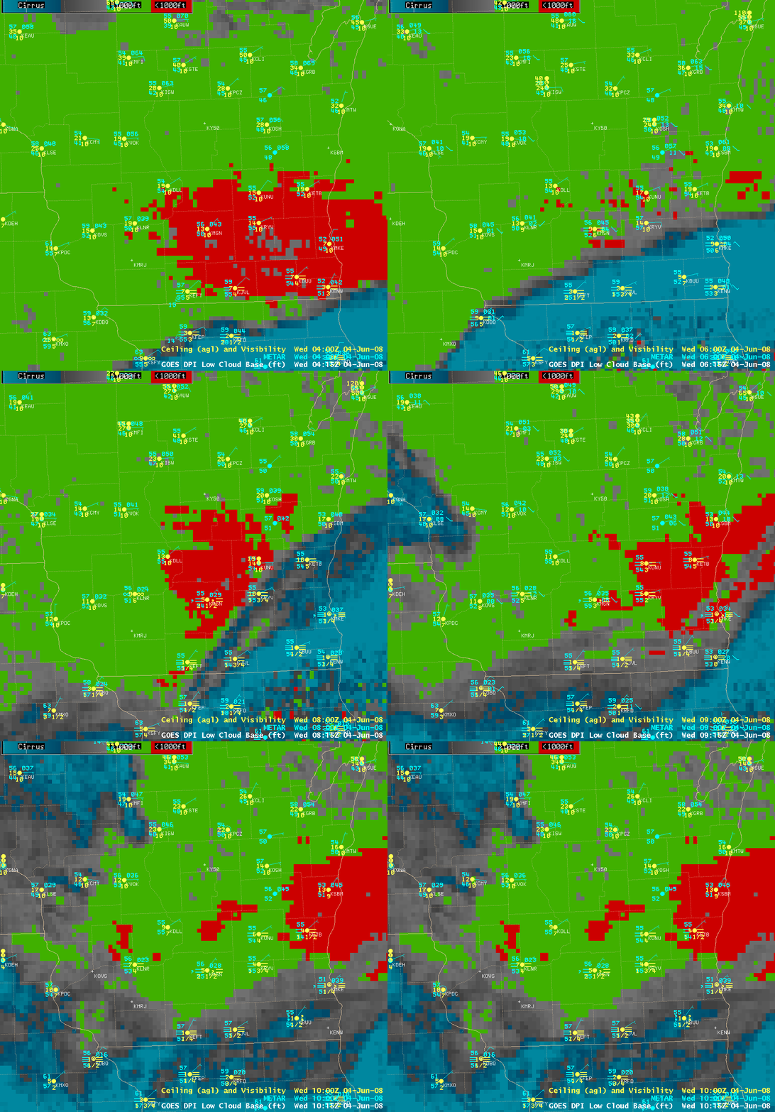
A cold northeasterly flow in tandem with widespread stratus clouds and fog (with some areas of drizzle) to the north of a stationary frontal boundary kept daytime temperatures unusually cool across parts of the Upper Midwest and Great Lakes states on 03 June 2008 — the daytime maximum temperatures of 63º F at Madison, 59º F at Green Bay, and 56º F at Milwaukee were 12, 15, and 17 degrees below normal, respectively. Hourly AWIPS images of GOES derived product imagery (DPI) of the Low Cloud Base product (above) indicated the presence of a large area of cloud bases less than 1000 feet above ground level (aviation Instrument Flight Rules criteria, red enhancement) over parts of southern Wisconsin during the early evening hours, with cloud bases greater than 1000 feet but less than 3000 feet (aviation Marginal Visual Flight Rules criteria, green enhancement) covering much of the remainder of the state. The surface visibility briefly dropped to zero due to dense fog at Kenosha (KENW) in far southeastern Wisconsin. A patch of high cirrus clouds (gray to cyan enhancement) was also seen moving from northern Illinois into far southeastern Wisconsin during that time period (04 to 10 UTC, or 11pm to 5am local time), which was partially obscuring the low cloud features.
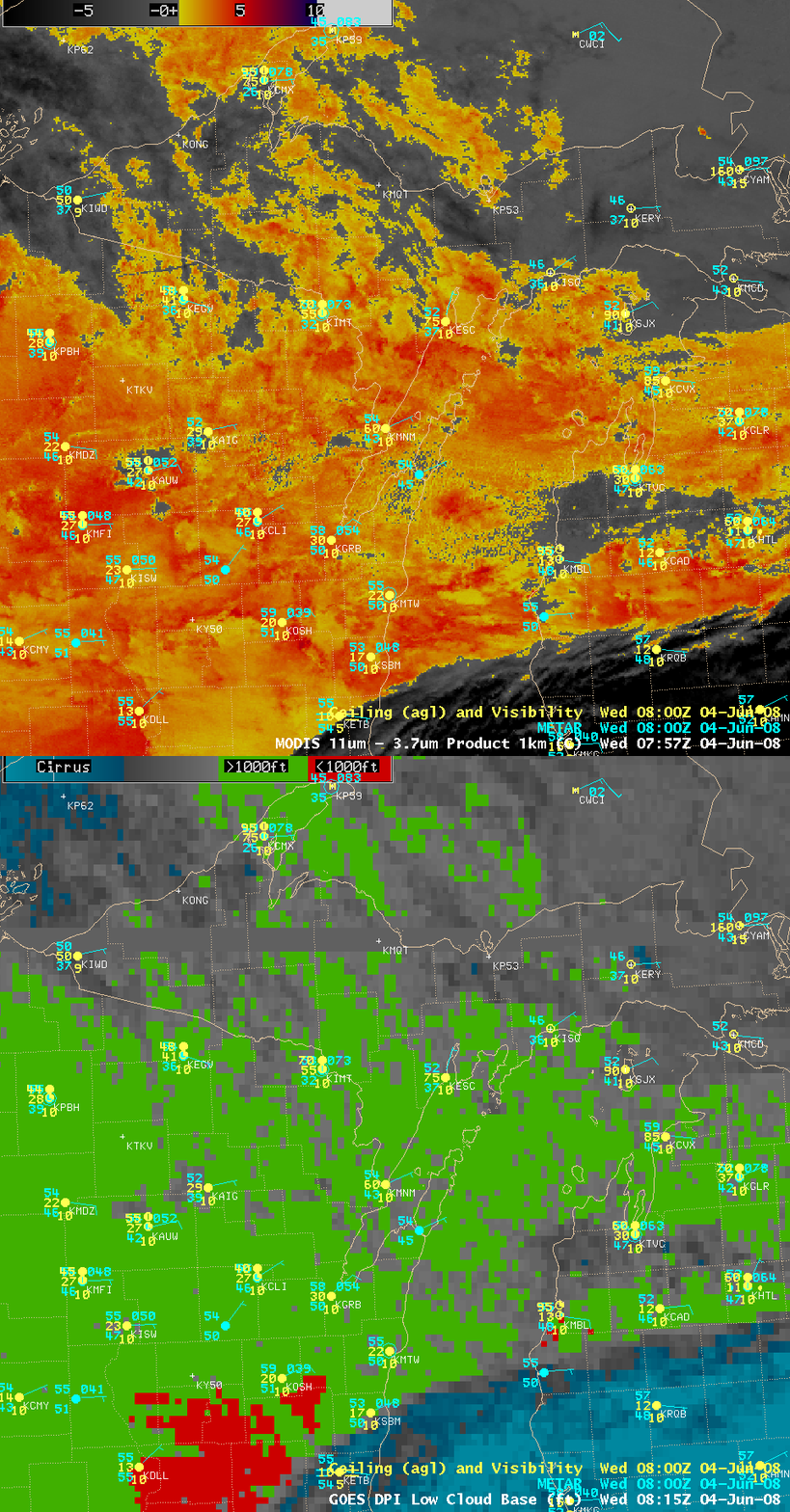
A comparison of the 4-km resolution GOES Low Cloud Base product with the 1-km resolution MODIS fog/stratus product around 08 UTC (below) demonstrated the advantage of better spatial resolution for locating the northern edge of the stratus cloud and fog across far northern Wisconsin, the Upper Peninsula of Michigan, and northern Lower Michigan. The spatial resolution of the IR channels on the Advanced Baseline Imager (ABI) instrument aboard the GOES-R satellite (planned to be launched in 2014) will be 2 km, which will provide improved detection of mesoscale features compared to the 4 km IR products now available from the current generation of GOES imagers.
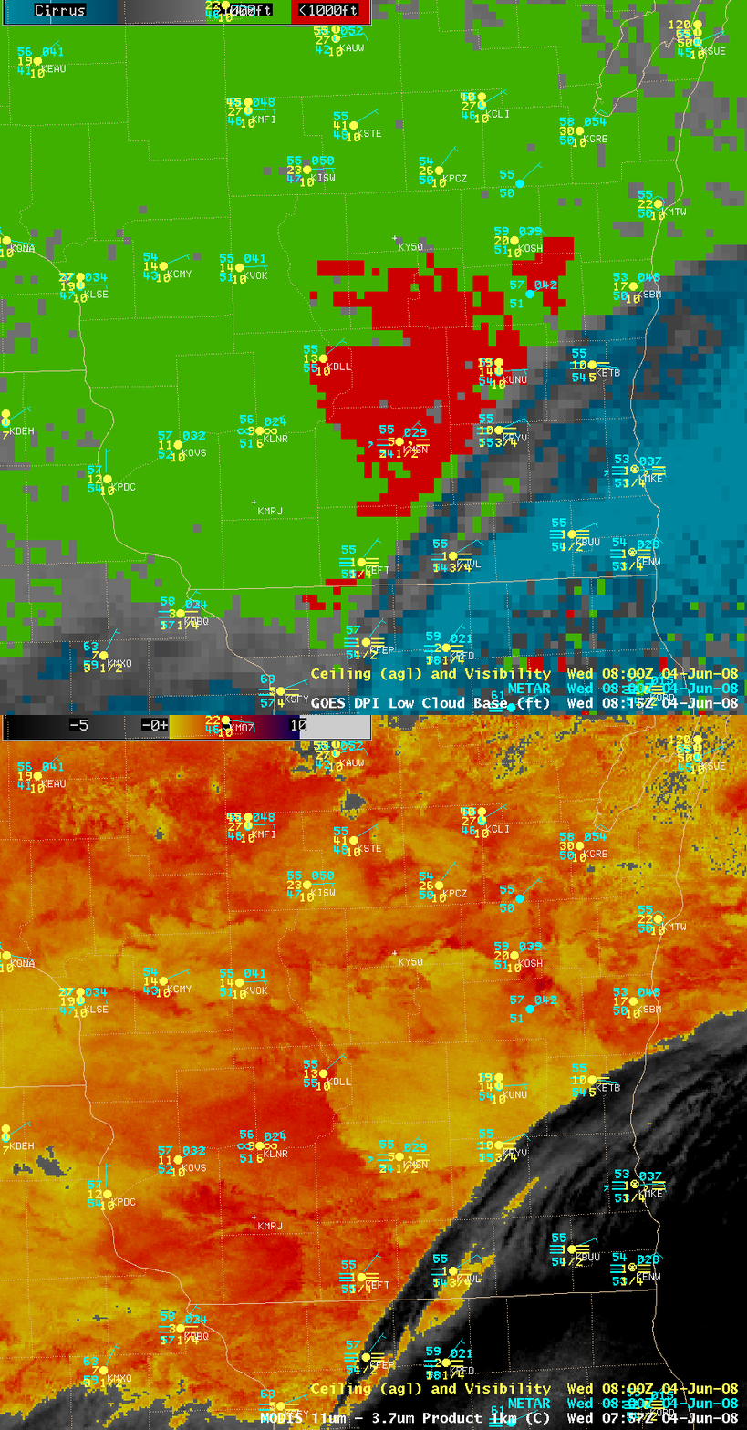
Over far southeastern Wisconsin (below), note that the northern edge of the cirrus cloud shield (gray to cyan on the GOES Low Cloud Base product, and dark gray to black on the MODIS fog/stratus product) appeared to be located slightly farther to the north/northwest on the GOES image (compared to the corresponding MODIS image) — this is due to “parallax error” resulting from the large viewing angle of the geostationary satellite, which is positioned over the Equator.


