American Samoa’s Wettest Year Gets Wetter
2025 has proven to be an atypically wet year for American Samoa. The cumulative precipitation chart backs that up: going back to 1 January, the total rainfall at Pago Pago has been the highest on record up to this date, and total rainfall is 70% higher than a normal year.
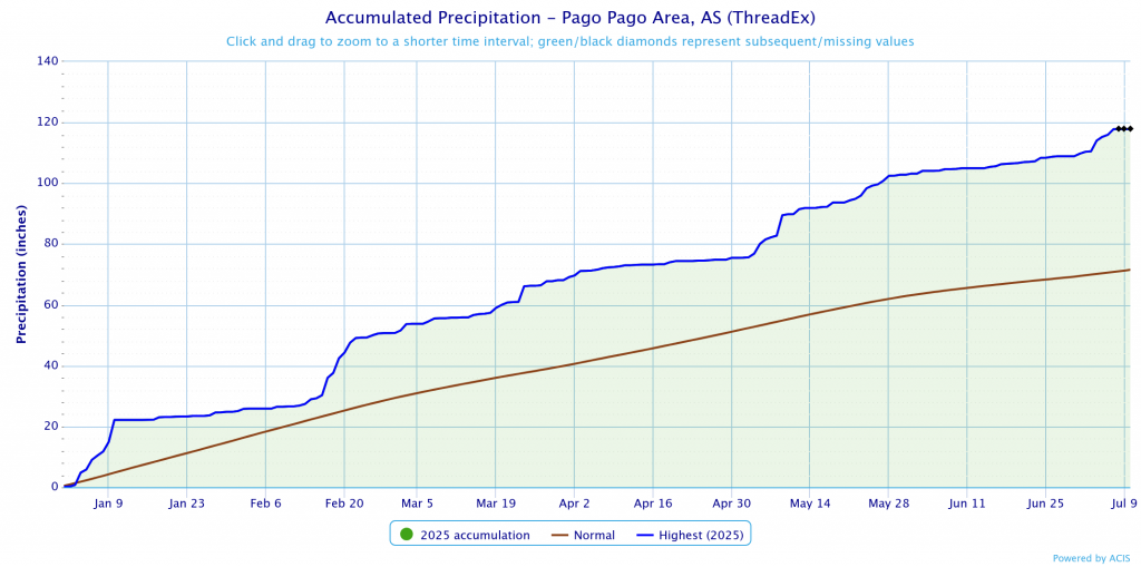
July has been no exception to this trend. With nearly 9 inches of rain as of 8 July, the Pago Pago airport has already exceeded the normal value for the entire month. These trends are going to continue for quite some time, however. The CIMSS MIMIC product quantifies the total precipitable water present in the atmosphere, and it indicates an atmospheric river stretching from New Guinea to the Samoan archipelago and beyond into the southeastern Pacific.
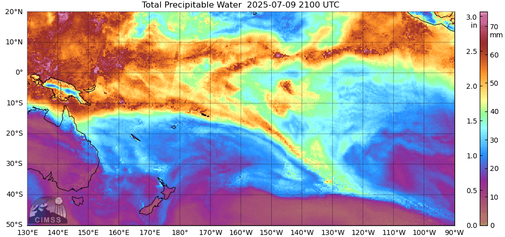
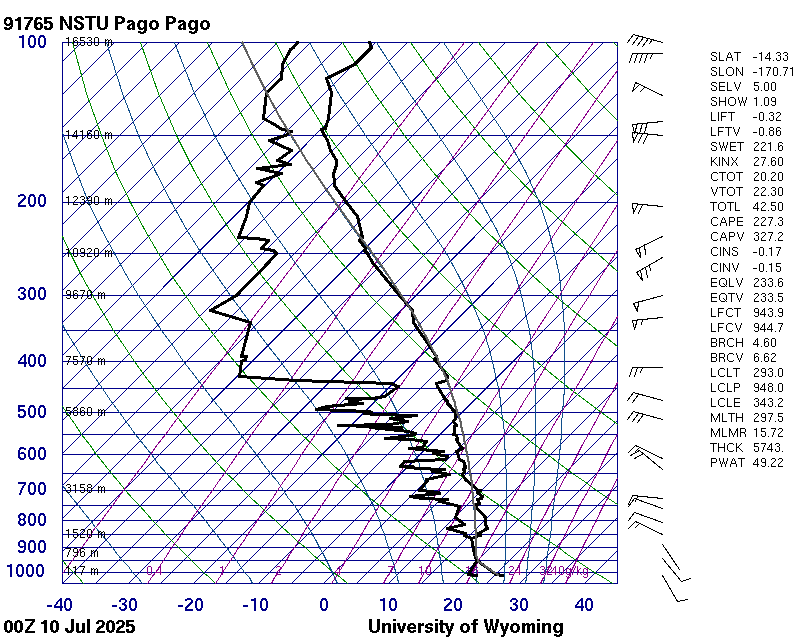
MIMIC indicates TPW values of approximately 2 inches, which is confirmed by the radiosonde launches from Pago Pago. The calculated precipitable water is 49.22 mm, which is a little over 1.9 inches. While this is slightly reduced compared to earlier in the week (values as high as 2.2 inches were observed), this can still result in a substantial amount of rain. Given the significant amounts of rain that have already occurred, the ground is saturated and flash flooding is a concern. The lowest levels of the atmospheric profile are quite saturated, in fact, helping to bolster the idea of substantial rain.
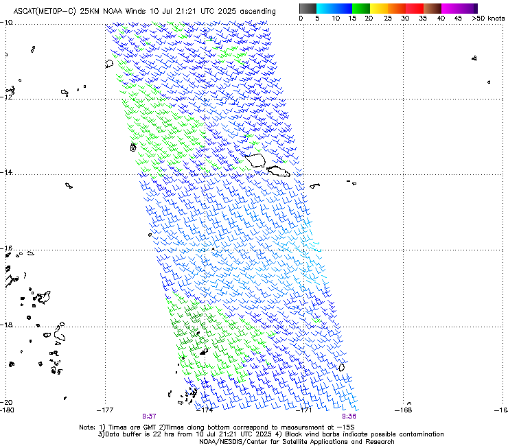
Given the continued flow of moisture from the equatorial western Pacific as seen from MIMIC, the chances for rain in American Samoa remain significant as long as appropriate lifting mechanisms are present. The right amount of low-level convergence, for example, can be enough to force enough upward motion to initiate convective rain. Unfortunately, the most recent ASCAT overpasses just missed American Samoa, makinng it a challenge to directly observe low-level convergence over the islands.