Active Monsoon trough over the western Pacific
Total Precipitable Water (TPW) fields across the western Pacific (source), show a band of abundant moisture between 10o and 20o N latitude. In addition, the remnants of Sepat are moving to the north and east of Japan, and a tropical depression is making landfall over China to the north of Hainan Island. Do you expect tropical cyclogenesis from the rotation apparent in the MIMIC TPW fields centered near 138oE and 15oN?
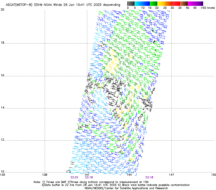
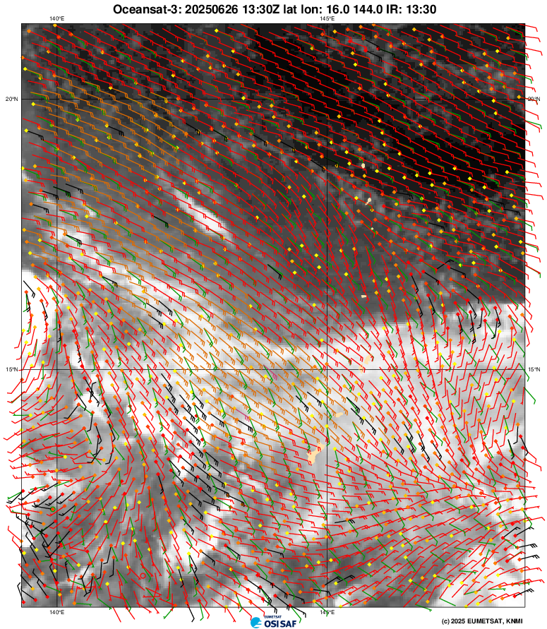
Scatterometry data from MetopB and OSCAT, below (from here, and here, respectively) shows a circulation moving to the west, from about 141oE to 139oE in 12 hours.
NOAA-21 overflew Guam around 0345 UTC on 26 June, and the direct broadcast antenna at the NWS forecast office there acquired data used to create the images (created with CSPP software) below. ATMS rain rate data shows concentrated convection under a region of active convection to the west of Guam; parallel lines of convection are east and north of Guam.
Himawari-9 imagery (more-or-less centered on Guam), below, shows a region of convection associated with the circulation detected by scatterometry. (There are many other interesting features in this animation too!)
Mid-level water vapor imagery shows now distinct regions of mid-level dry air that could act to impede development of this system.

The Joint Typhoon Weather Center (JTWC) show this system as an invest (#97W). Imagery from this site shows the system in a narrow region of low shear.
Refer to the webpages of the Joint Typhoon Warning Center and JMA for more information on this system.