Pyrocumulonimbus clouds spawned by a wildfire in British Columbia
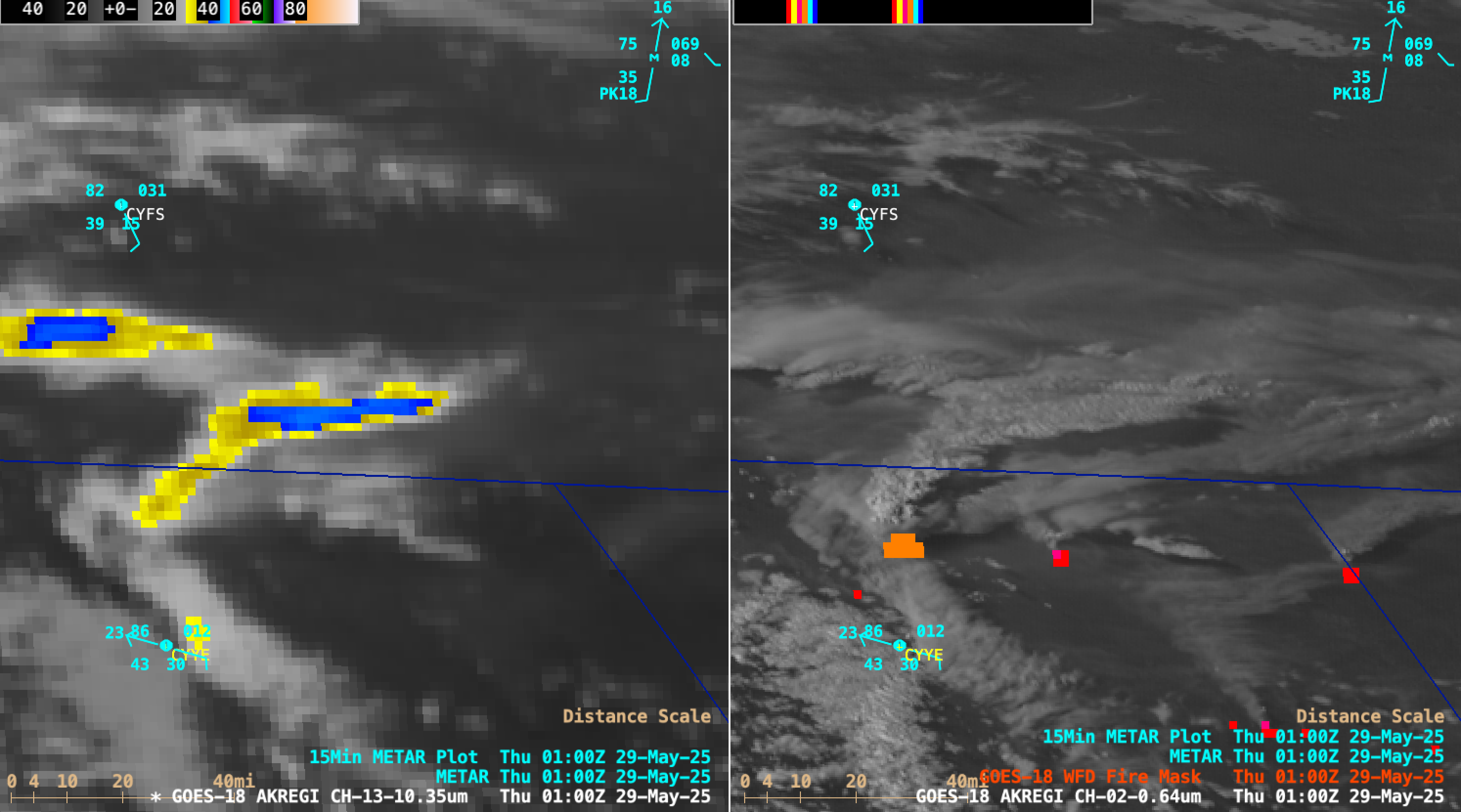
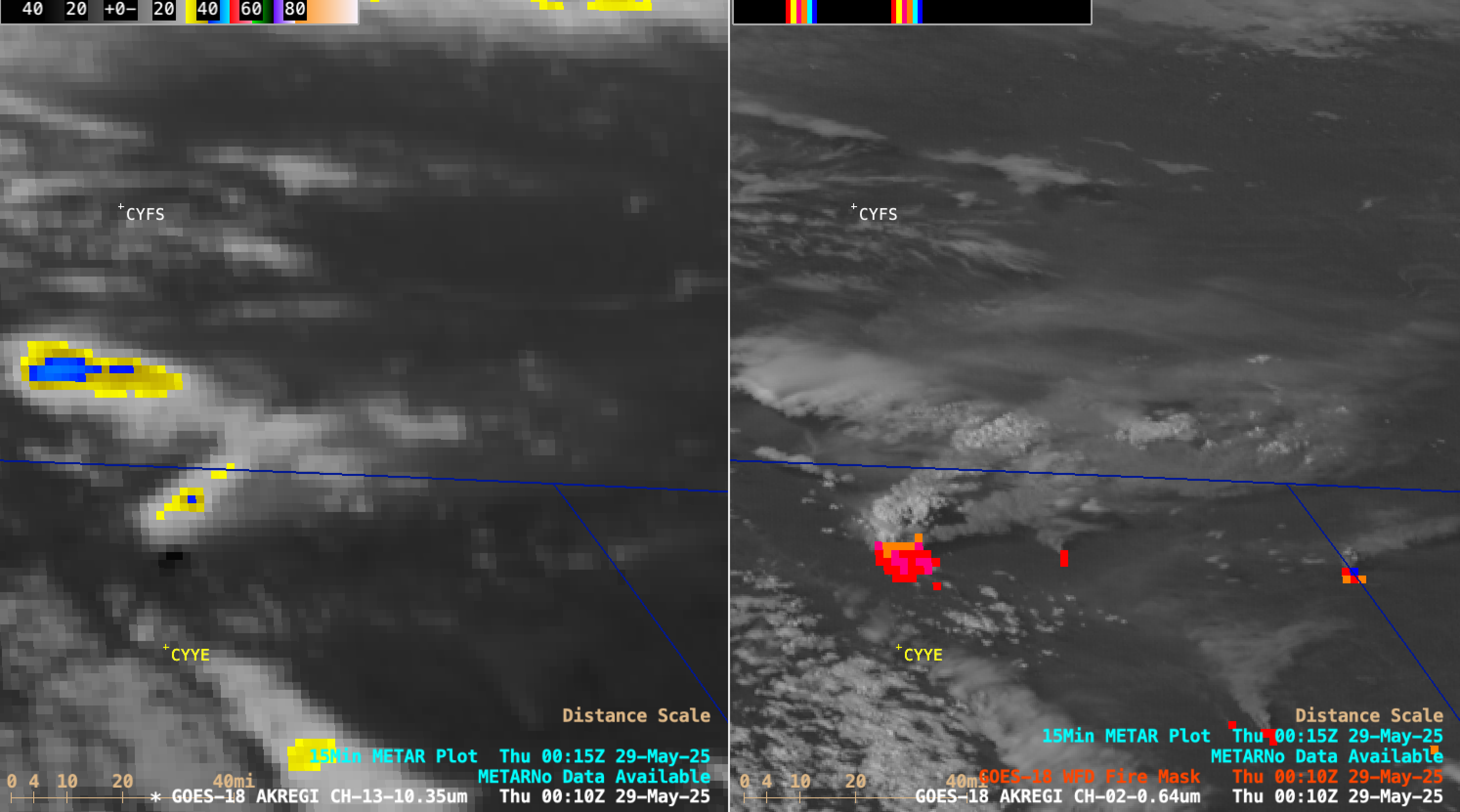
10-minute GOES-18 Clean Infrared Window (10.3 µm, left) images and Red Visible (0.64 µm) images + Fire Mask derived product (right), from 2000 UTC on 28 May to 0500 UTC on 29 May [click to play MP4 animation]
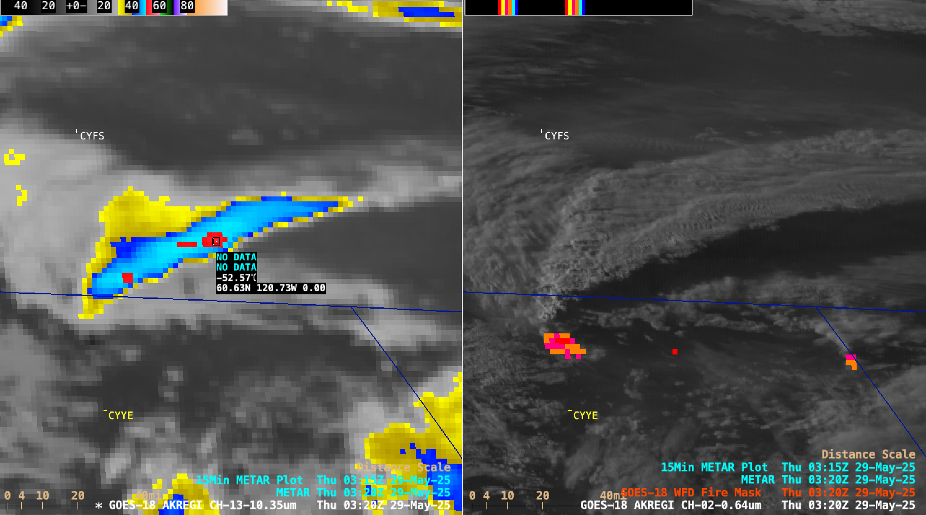
GOES-18 Clean Infrared Window (10.3 µm, left) image and Red Visible (0.64 µm) image + Fire Mask derived product (right), with a cursor sample of the coldest cloud-top infrared brightness temperature at 0320 UTC on 29 May [click to enlarge]
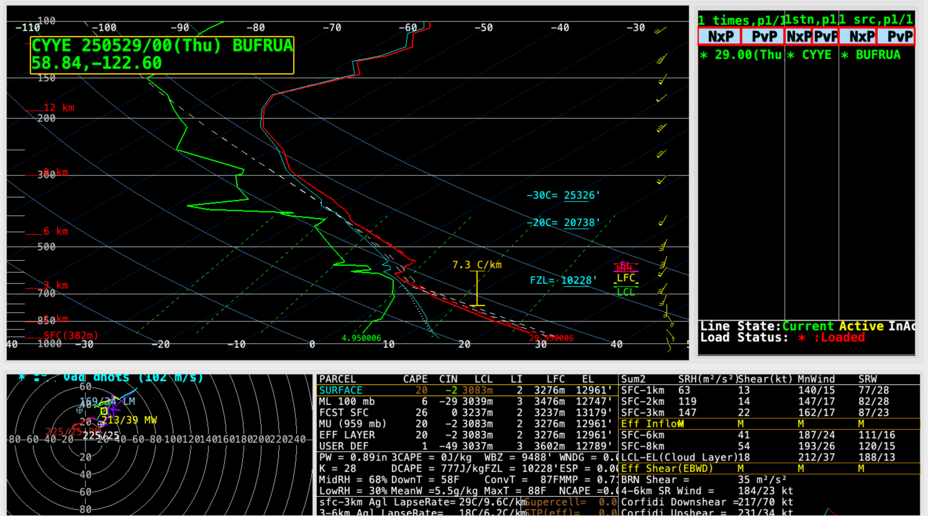
Plot of rawinsonde data from Fort Nelson, British Columbia at 0000 UTC on 29 May [click to enlarge]

Cursor sample of GOES-18 Shortwave Infrared (3.9 µm) brightness temperature (left panel) at 2210 UTC on 28 May [click to enlarge]
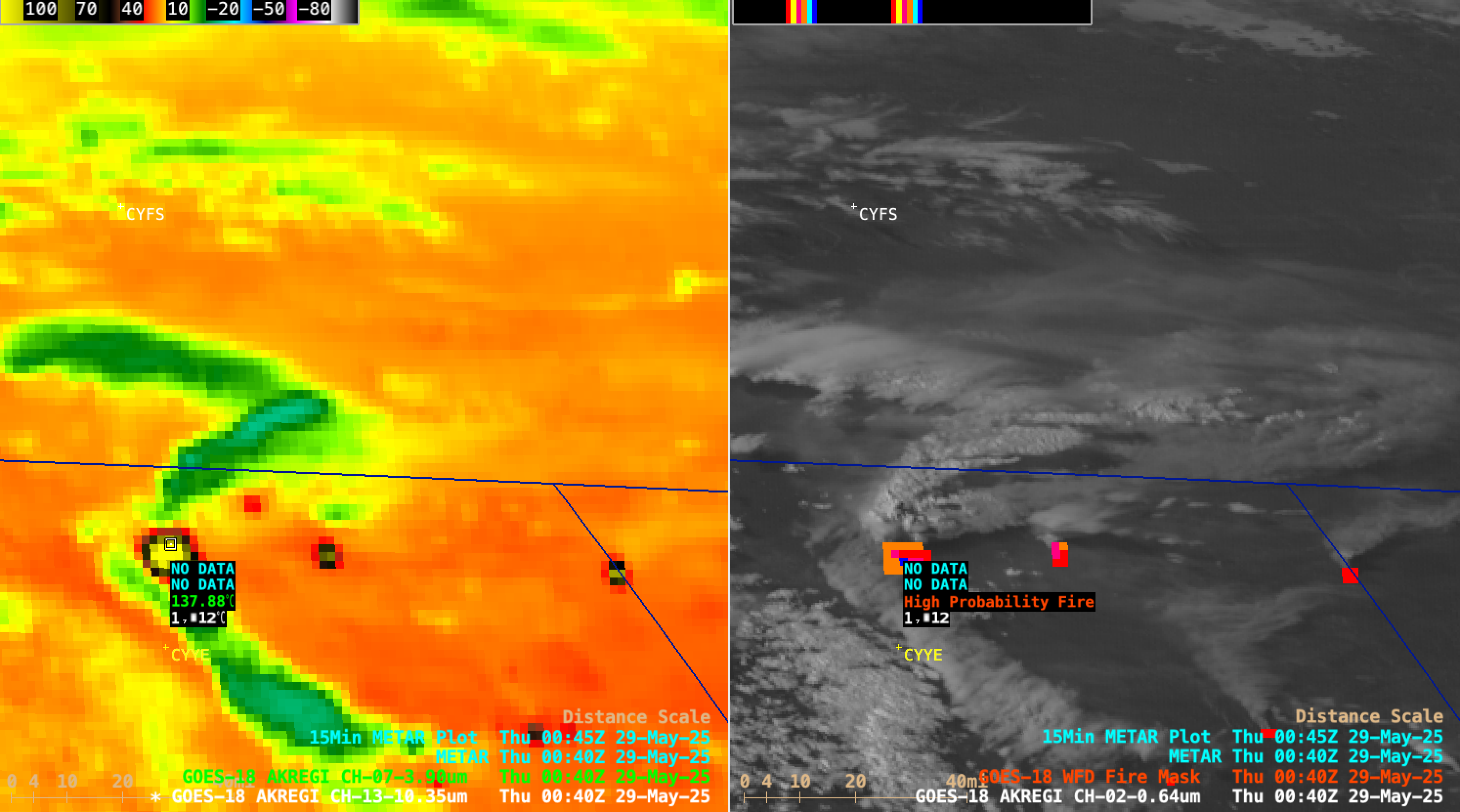
Cursor sample of GOES-18 Shortwave Infrared (3.9 µm) brightness temperature (left panel) at 0040 UTC on 29 May [click to enlarge]
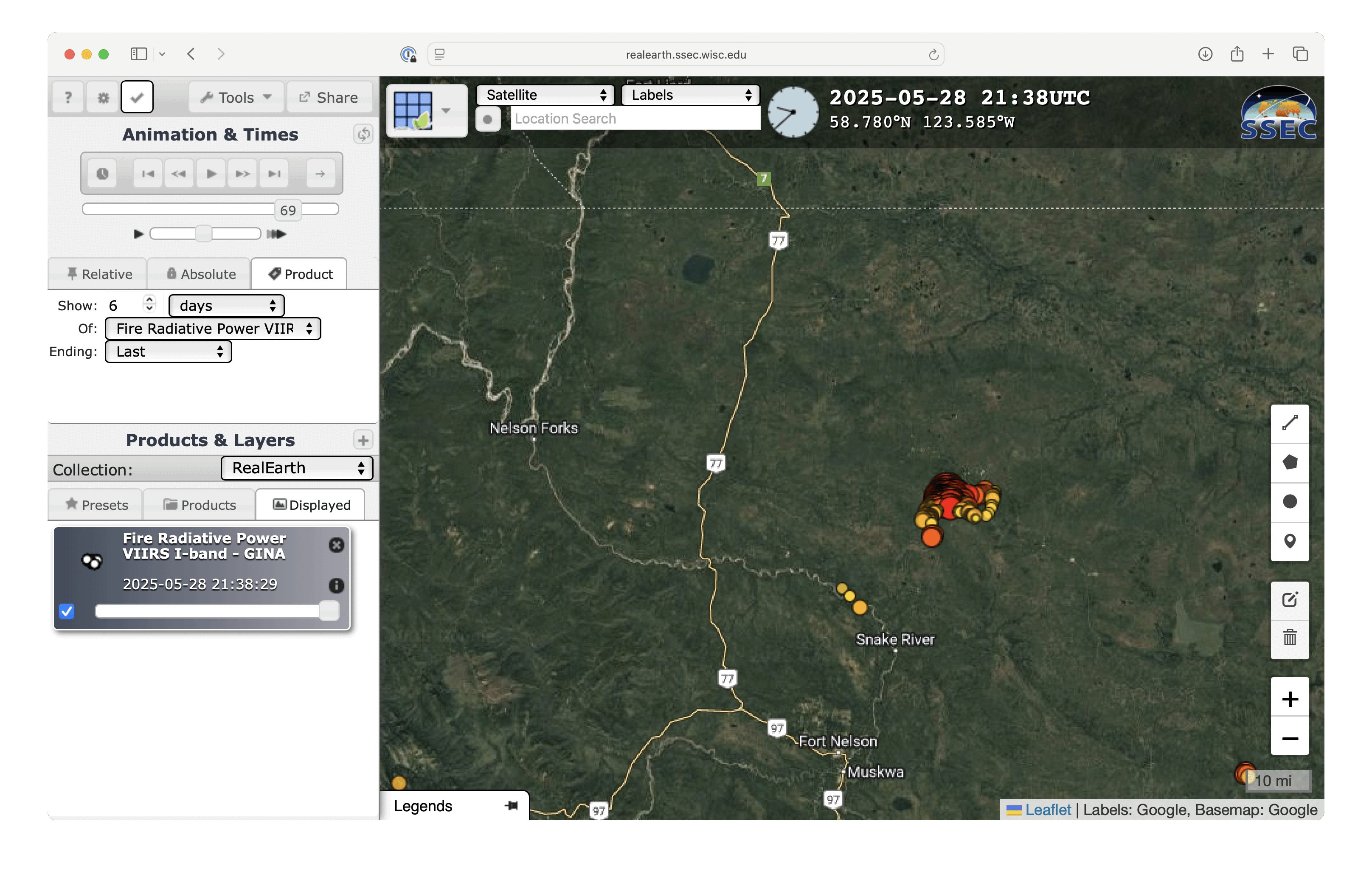
VIIRS Fire Radiative Power at 2138 UTC on 28 May and 1039 UTC on 29 May [click to enlarge]
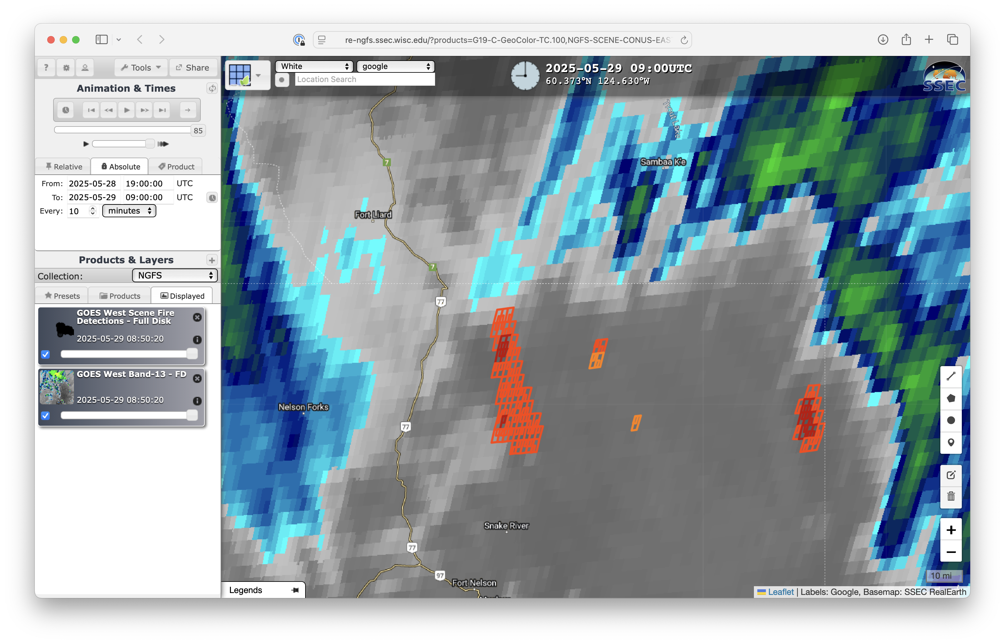
10-minute GOES-18 Infrared Window images with an overlay of NGFS Fire Detection polygons, from 1900 UTC on 28 May to 0900 UTC on 29 May [click to play MP4 animation]
===== 29 May Update =====
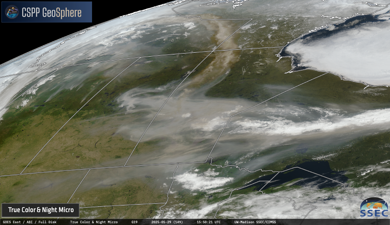
10-minute GOES-19 True Color RGB images, from 1100 UTC on 29 May to 0050 UTC on 30 May [click to play MP4 animation]