Tornadoes in southeastern Virginia
Severe convection along an advancing cold frontal boundary was responsible for several tornadoes and reports of damaging winds across southeastern Virginia on 28 April 2008 (SPC storm reports | Wakefield, Virginia NWS forecast office storm report). AWIPS images of the GOES-12 10.7 µm IR channel data (above) showed that cloud top brightness temperatures began to cool into the -55 to -65º C range (orange to red enhancement) after about 18:15 UTC (2:15 PM local time), but no classic severe storm signatures such an “enhanced-v” were noted. The strongest tornado moved through the Suffolk, Virginia area during the 20:05 – 20:15 UTC (4:05 – 4:15 PM local time) period, producing EF-3 damage (about 140 homes were either destroyed or damaged) and injuring over 200 people.
A comparison of 4-km resolution GOES-12 IR and 1-km resolution NOAA-18 IR images (below) revealed an area of cold cloud top brightness temperatures between Petersburg (KPTB) and Emporia (KEMV) in southeastern Virginia around 18:40-18:45 UTC (2:40-2:45 PM local time), close to the time that a tornado (denoted by “TOR” on the images) produced EF-1 damage near Lawrenceville, Virginia. Cloud top brightness temperatures were several degrees colder on the NOAA-18 IR image (-61º C, vs. -56º C on the GOES-12 IR image), but still rather unremarkable compared to the -70 to -80º C values that are often seen associated with severe convection in the Plains states. As discussed in the Jon Davies Severe Weather Notes blog, the atmosphere over southeastern Virginia on that day exhibited relatively weak instability (which was confined to low levels), which likely limited the resulting thunderstorm updraft intensities — stronger updrafts would probably have produced significantly colder satellite IR temperatures associated with the overshooting tops.
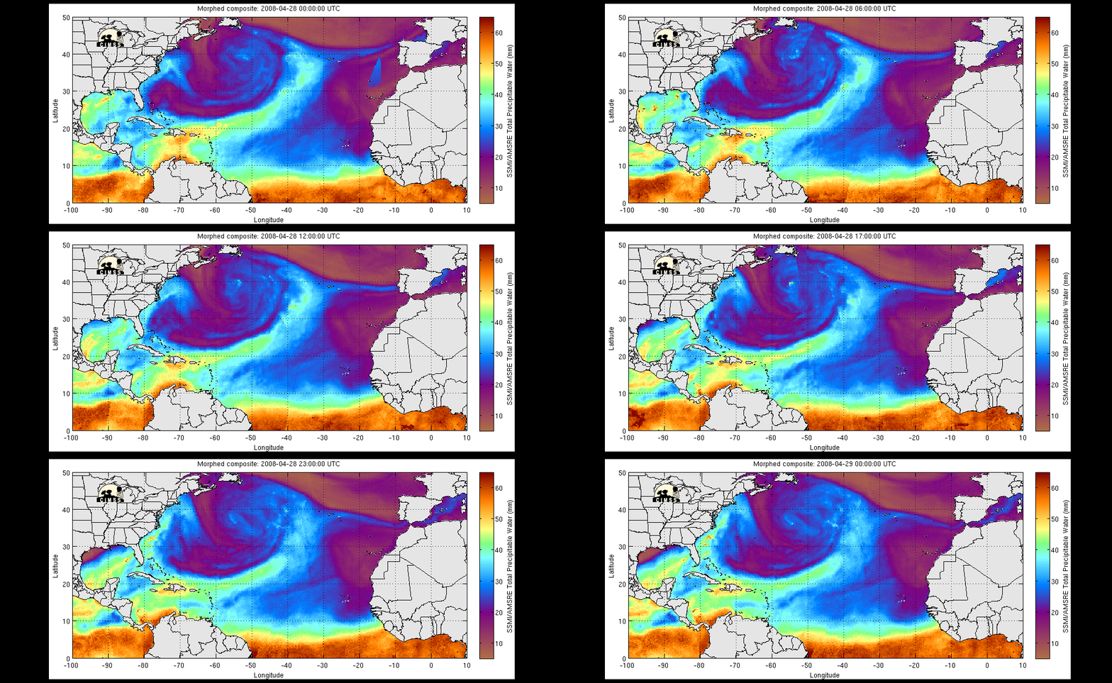
Hourly images of the MIMIC Total Precipitable Water (TPW) product from 28 April (below) showed that a plume of relatively high TPW (35-45 mm or 1.4-1.8 inches, light blue to green to yellow enhancement) originating over the Gulf of Mexico was streaming northeastward along the Eastern Seaboard during the day, helping to provide the necessary moisture for convective development along and ahead of the cold front that was moving eastward through the mid-Atlantic states.
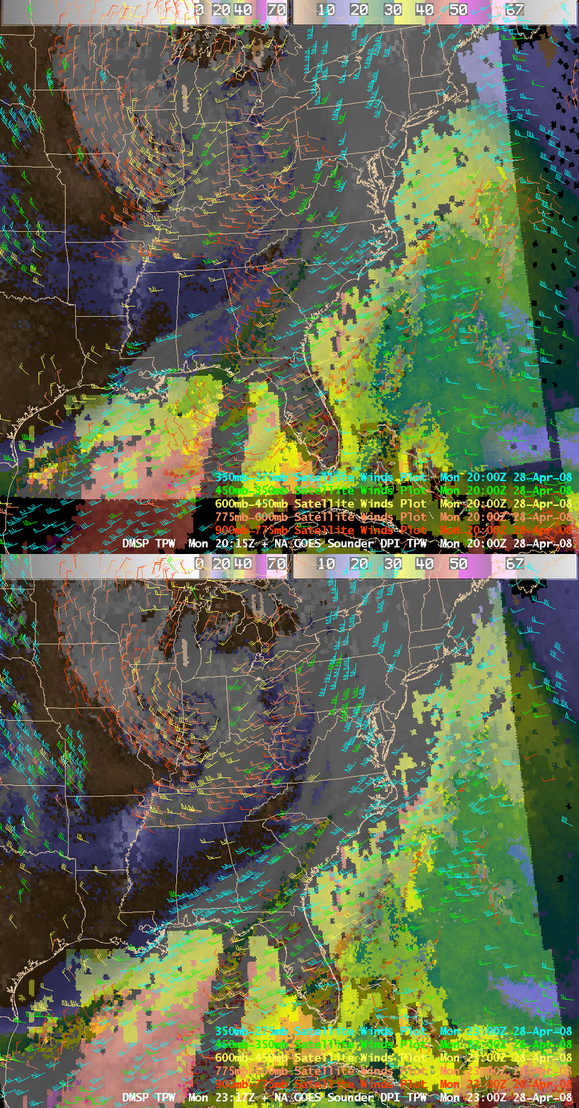
AWIPS image combinations of the DMSP TPW + GOES-12 sounder TPW (below) also show the TPW plume, and include an overlay of the GOES-derived atmospheric motion vectors. These satellite winds showed that a large trough was centered over the southern Great Lakes and Ohio River Valley; in addition, a diffluent flow pattern within the upper troposphere (the 450-275 mb layers, green and cyan wind vectors) was evident over eastern Virginia. This diffluence aloft likely contributed to the creation of an environment that supported large-scale ascent favorable for severe thunderstorm development over that particular region during the afternoon hours on 28 April.


