Fires in Kansas/Oklahoma, and continued river flooding in the Ohio Valley
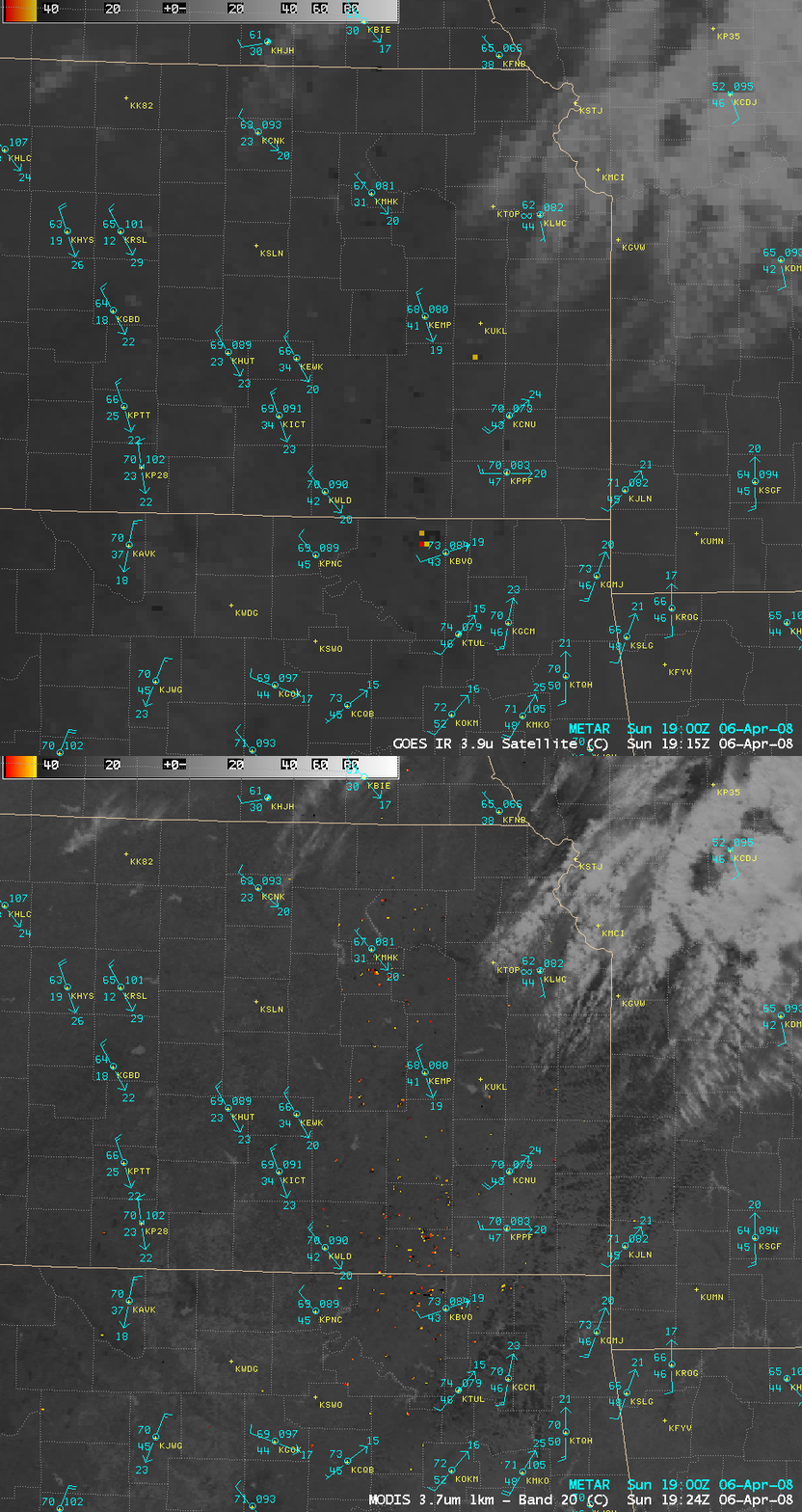
A comparison of AWIPS images of the GOES-12 3.9µm and the MODIS 3.7µm “shortwave IR” channels (above) revealed that numerous small fires were burning across parts of eastern Kansas and northeastern Oklahoma during the afternoon of 06 April 2008. Note how the 1-km resolution MODIS imagery did a better job of detecting more of the smaller fire “hot spots” (yellow to red pixels) than the corresponding 4-km resolution GOES-12 imagery, and many more hot fires (with brightness temperature values of 50ºC or greater) were seen on the MODIS imagery.
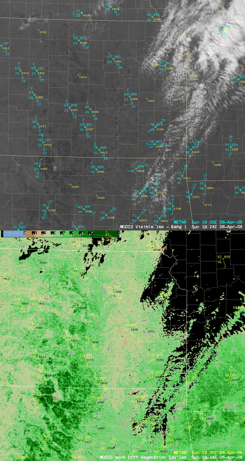
These small fires were the result of agricultural burning to prepare fields for a new round of planting. AWIPS images of the MODIS visible and Normalized Difference Vegetation Index (NDVI) product (below) indicated that much of eastern Kansas and northeastern Oklahoma (where these fires were burning to clear cropland) exhibited much lower NDVI values of 0.2 to 0.3 (pale yellow to beige colors), while higher NDVI values of 0.5 to 0.7 (darker green colors) were seen in surrounding areas (where mature crops or dense trees and other vegetation dominated the landscape).
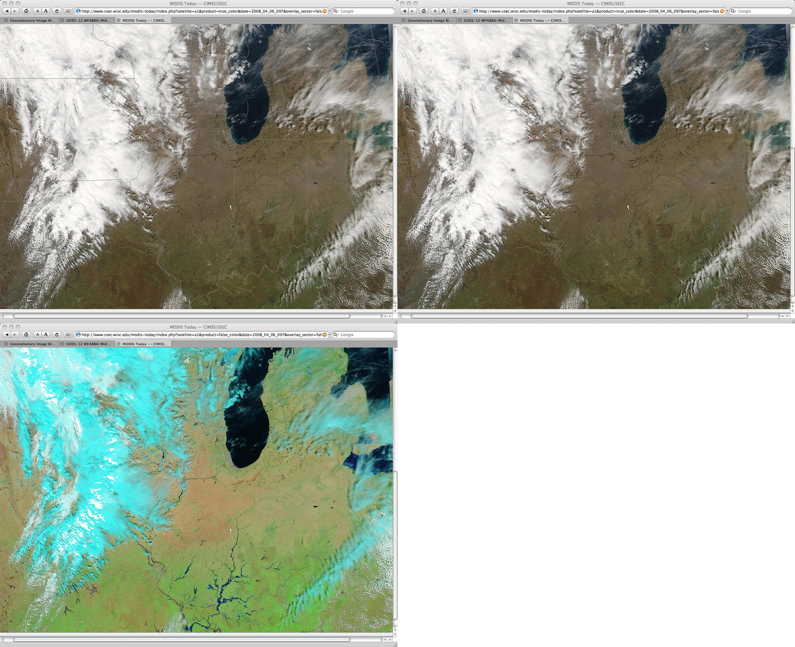
Farther to the east, the impacts of the ongoing episode of extensive river flooding in the Ohio River Valley region were quite apparent by examining MODIS false color imagery from the SSEC MODIS Today site (below) — water appears dark blue in the false color imagery, allowing swollen rivers and flooded areas to be easily identified. According to the NWS Advanced Hydrologic Prediction Service site, parts of Missouri, Illinois, Indiana, and Kentucky had received 10-20 inches of precipitation in the 30 day period ending on 06 April, which was 200-400% above normal.


