Blowing dust across parts of Mexico, New Mexico and Texas — as viewed by 4 GOES

From left to right: GOES-18, GOES-17, GOES-19 and GOES-16 Dust RGB images, from 1900 UTC on 11th February to 0300 UTC on 12th February [click to play animated GIF]
10-minute Full Disk scan Dust RGB images from GOES-18 (GOES-West), GOES-17, GOES-19 (Preliminary/Non-operational) and GOES-16 (GOES-East) created using Geo2Grid (above) showed vivid signatures of blowing dust (brighter shades of magenta) that originated over parts of northern Mexico and southwestern New Mexico — and was subsequently transported northeastward across southern New Mexico and southwestern Texas on 11th February 2025.
The respective satellite locations over the Equator are: GOES-18 (137.0 W longitude), GOES-17 (104.7 W longitude), GOES-19 (89.5 W longitude) and GOES-16 (75.2 W longitude). However, GOES-17 has been temporarily brought out of storage and is drifting slowly from 12th-15th February 2025, approximately 0.3 degrees of longitude in total. All ABI imagery during this “Longitude Test” will be resampled to the nominal 105 W location. GOES-17 products will be analyzed for any potential impacts that this shift in longitude might cause. The overall goal of the Longitude Test is to determine what product impacts (if any) there might be when GOES-16 (currently operational as GOES-East) is moved to 75.5 W in March, ahead of GOES-19’s arrival (GOES-19 is then scheduled to become operational as GOES-East on 4th April). Tangentially, this also tests our ability to track a GOES-R series satellite as it moves (and still receive data).
5-minute CONUS Sector GOES-16 daytime True Color and Nighttime Microphysics RGB images from the CSPP GeoSphere site (below) highlighted the hazy tan-colored appearance of the blowing dust during the hours leading up to sunset, followed by the brighter shades of magenta dust signature at night (the Nighttime Microphysics RGB makes use of the 10.3-12.3 µm “Split Window Difference“, which is effective for dust detection).

GOES-16 daytime True Color RGB and Nighttime Microphysics RGB images, from 1901 UTC on 11th February to 0236 UTC on 12th February [click to play MP4 animation]
A GOES-16 Visible image (below) included plots of the strong winds that were creating the blowing dust — which at that time was restricting the surface visibility to 1/2 mile at El Paso, Texas (KELP).
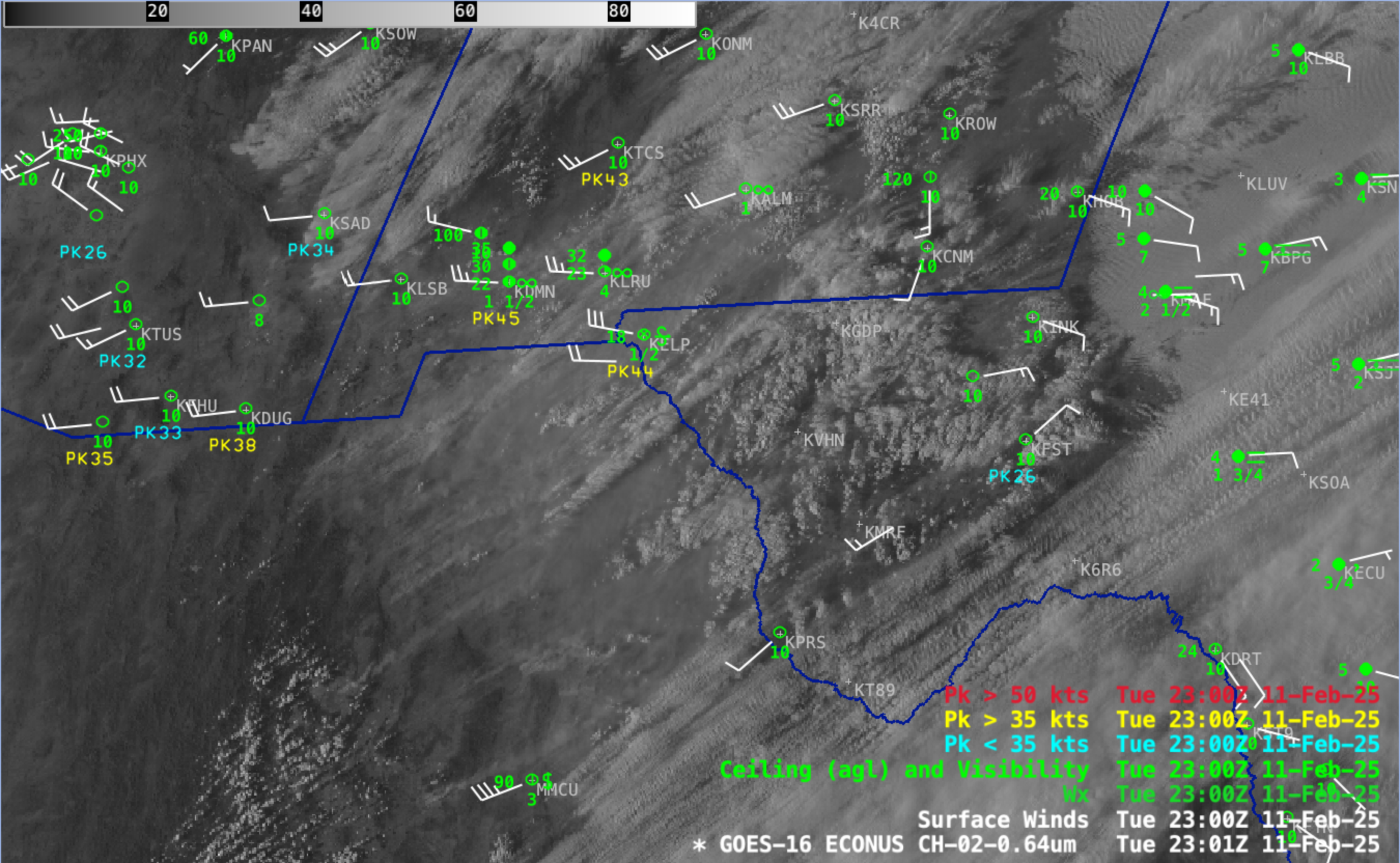
GOES-16 Red Visible (0.64 µm) image with plots of Surface Wind barbs (white), Peak Wind gusts (cyan/yellow) and Ceiling/Visibility/Weather (green) at 2301 UTC on 11th February [click to enlarge]