“Return flow” of moisture from the Gulf of Mexico
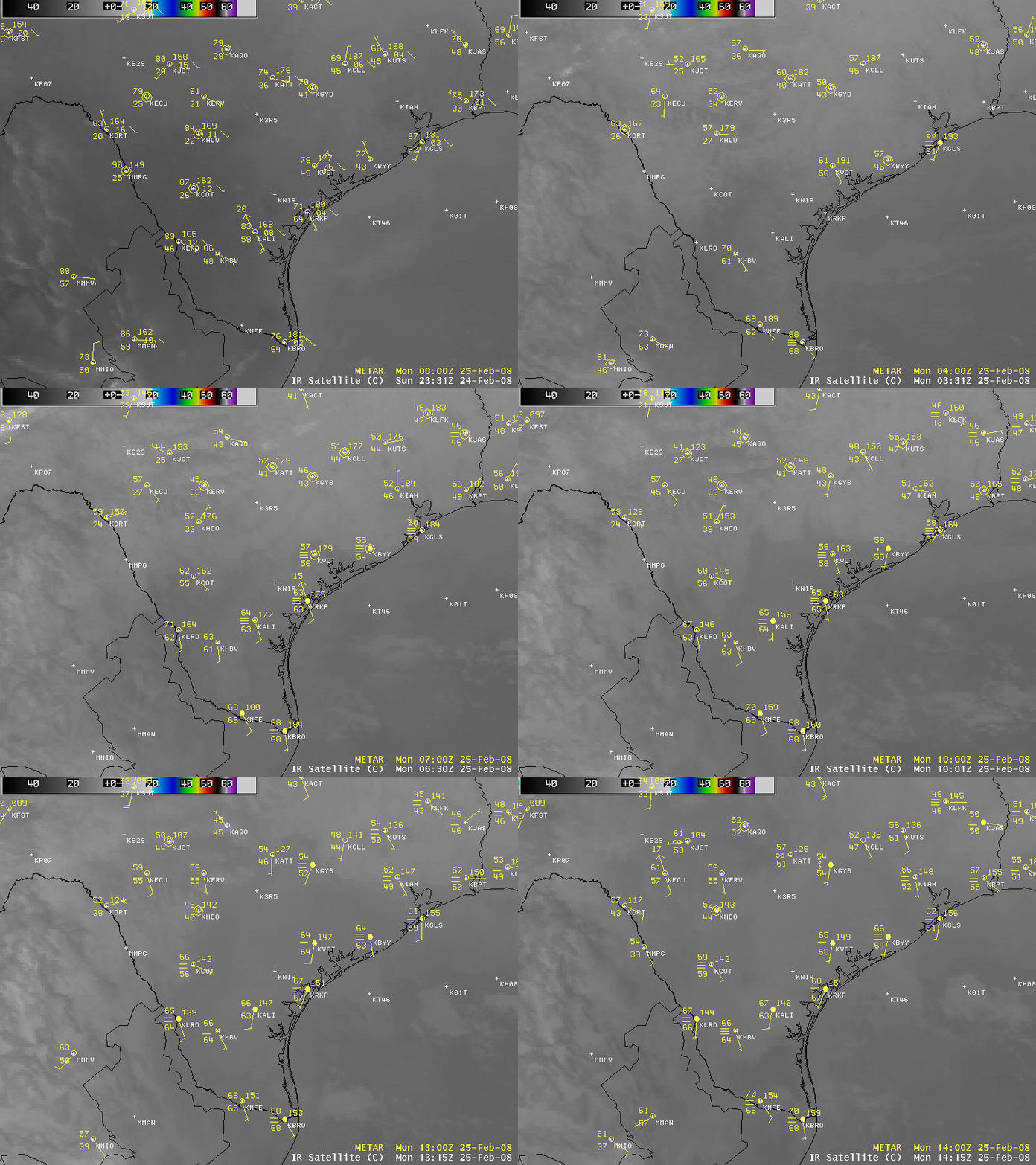
With a dome of high pressure centered over the southeastern US early in the day on 25 February 2008, the Gulf Coast of Texas began to experience a southeasterly onshore flow during the pre-dawn hours. AWIPS images of the GOES-12 10.7µm IR channel (above) revealed a subtle signature of slightly warmer cloud top temperatures (darker gray enhancements) associated with the “return flow” of fog and stratus as moisture over the Gulf of Mexico began to move inland across Texas.
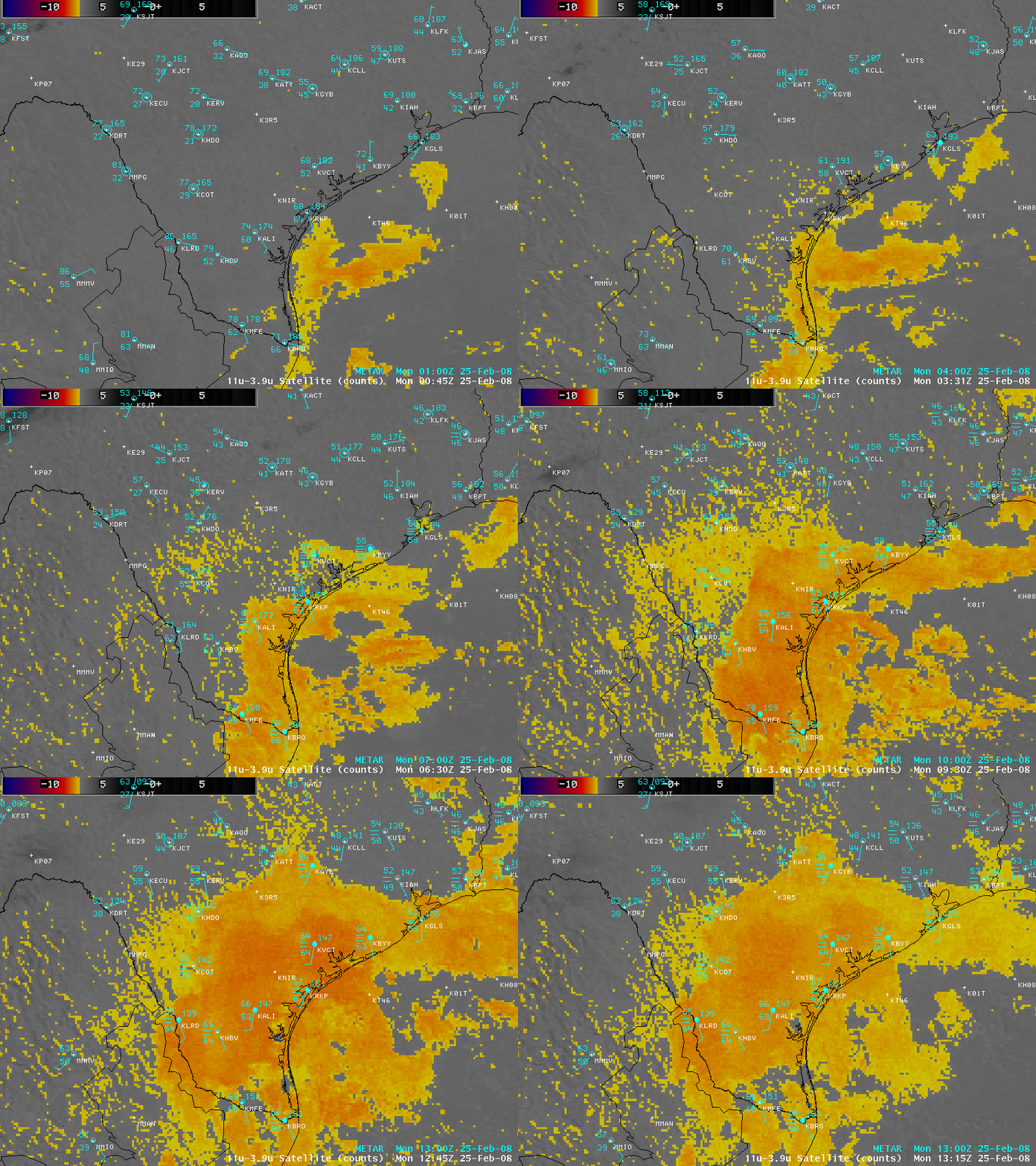
The GOES-12 fog/stratus product (above) was better able to detect the inland progression of the leading edge of the fog/stratus features (darker yellow to orange enhancements), as well as the development of separate areas of radiation fog further inland (lighter yellow enhancement).
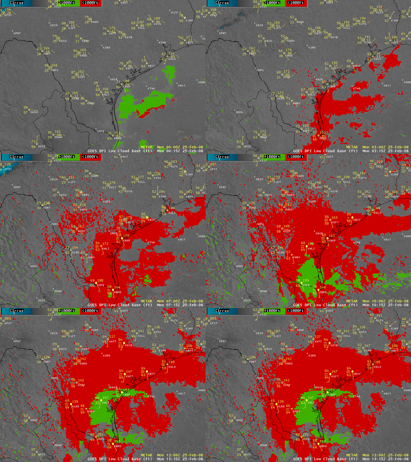
A new satellite product that has recently been added to AWIPS (beginning with Operational Build 8.2) is the GOES Low Cloud Base product (above), which provides an indicator of whether the base (or bottom) of a cloud/fog feature meets the aviation criteria of Instrument Flight Rules (IFR) with bases less than 1000 feet above ground level (red enhancement), or Marginal Visual Flight Rules (MVFR) with bases greater than 1000 feet but less than 3000 feet above ground level (green enhancement), or cirrus cloud (blue enhancement). Note that the GOES Low Cloud Base product is only valid during night-time hours; this is also true of the GOES fog/stratus product (due to the fact the the 3.9µm shortwave IR channel used for those satellite products is very sensitive to reflected solar radiation during daylight hours).
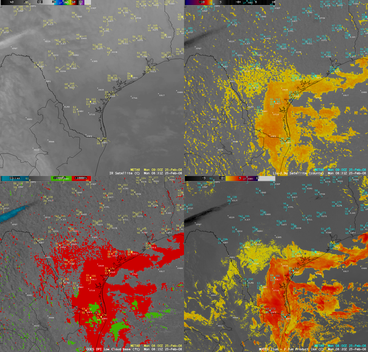
A comparison of the 4-km resolution GOES-12 IR image, fog/stratus product, and low cloud base product with the 1-km resolution MODIS fog/stratus product (above) shows the advantage of better spatial resolution for detecting the leading edge of the inland-moving fog/stratus features, and also for estimating what portions of the areas of fog/stratus might be vertically deeper (denoted by the darker orange to red enhancements). The spatial resolution of the IR channels on the Advanced Baseline Imager (ABI) instrument aboard the GOES-R satellite (planned to be launched in 2014) will be 2 km, which will provide improved detection of mesoscale features compared to the 4 km IR channels and products now available from the current generation of GOES imagers. And what about the Sounder instrument aboard GOES-R and beyond? We refer you to the VISIT Meteorological Interpretation Blog for a discussion of that particular topic…


