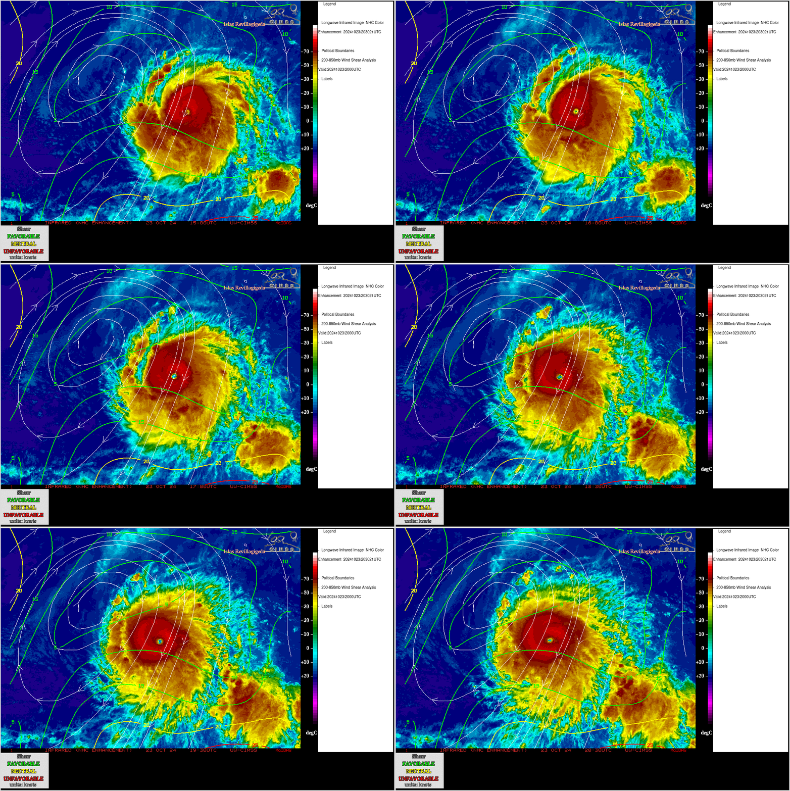
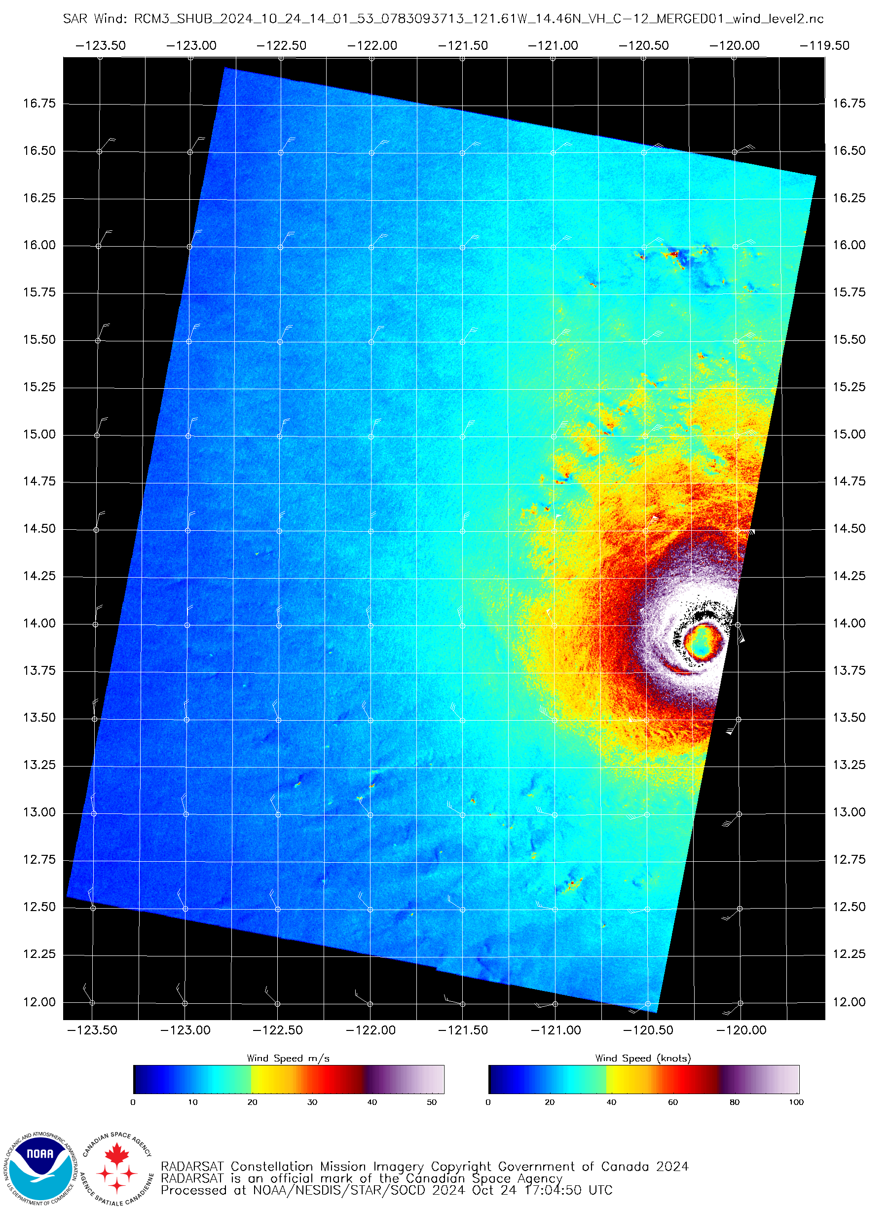
Hurricane Kristy reaches Category 5 intensity
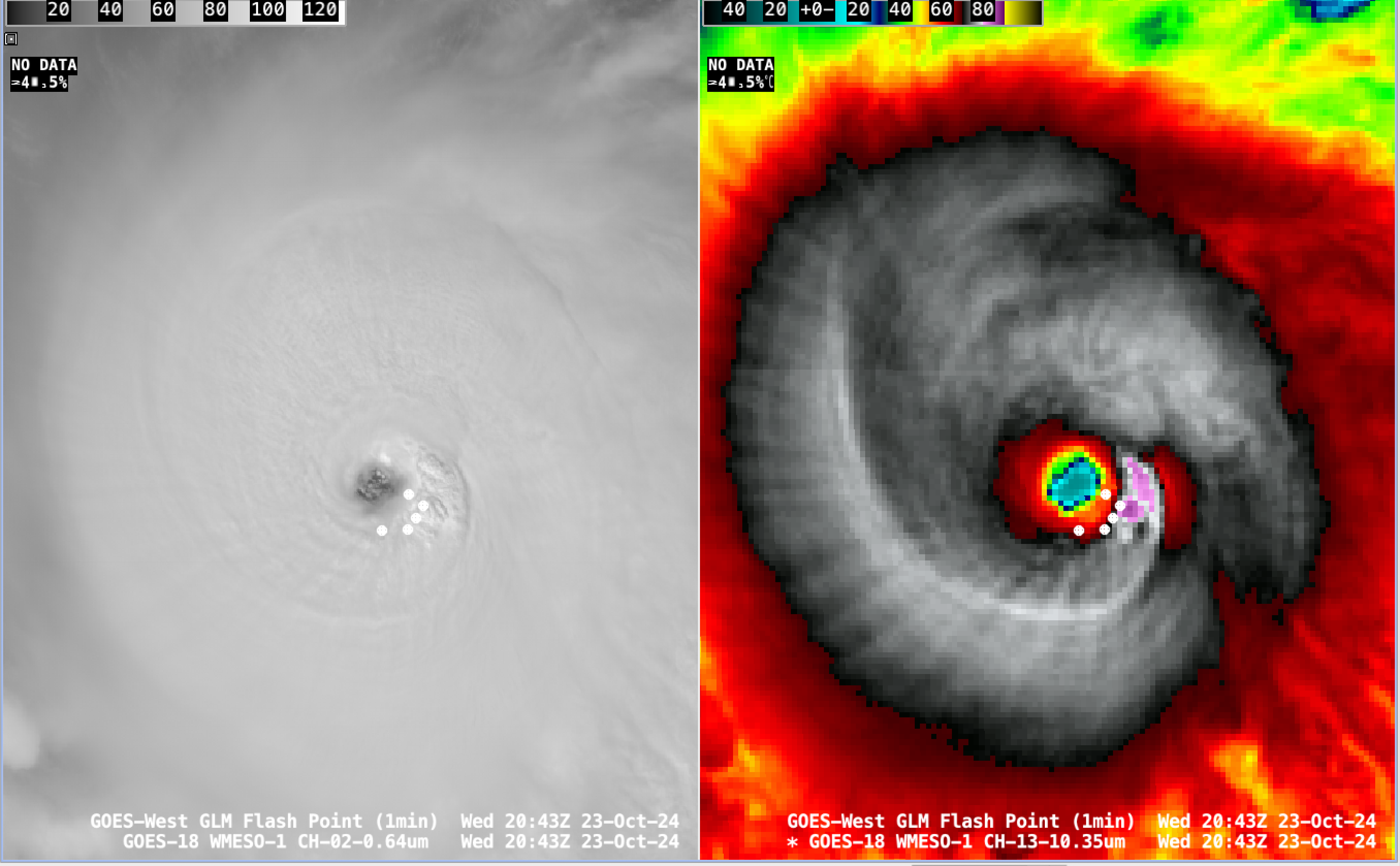
1-minute GOES-18 Red Visible (0.64 µm, left) and Clean Infrared Window (10.3 µm, right) images with an overlay of GLM Flash Points, from 1331-1600 UTC on 23 October [click to play MP4 animation]
A closer view of GOES-18 Visible images (below) revealed low-altitude mesovortices within the eye.
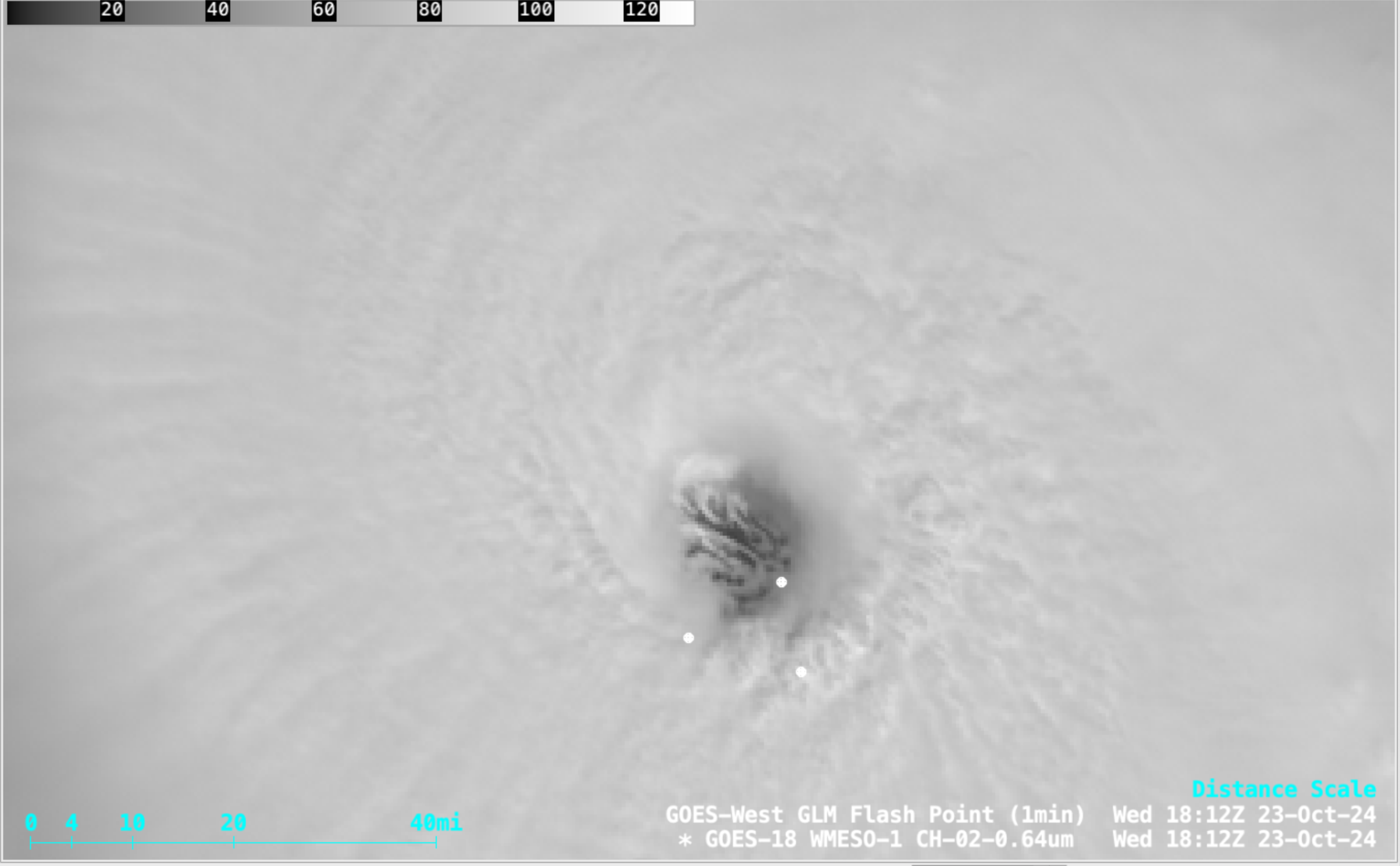
1-minute GOES-18 Red Visible (0.64 µm) images with an overlay of GLM Flash Points, from 1601-2100 UTC on 23 October [click to play MP4 animation]
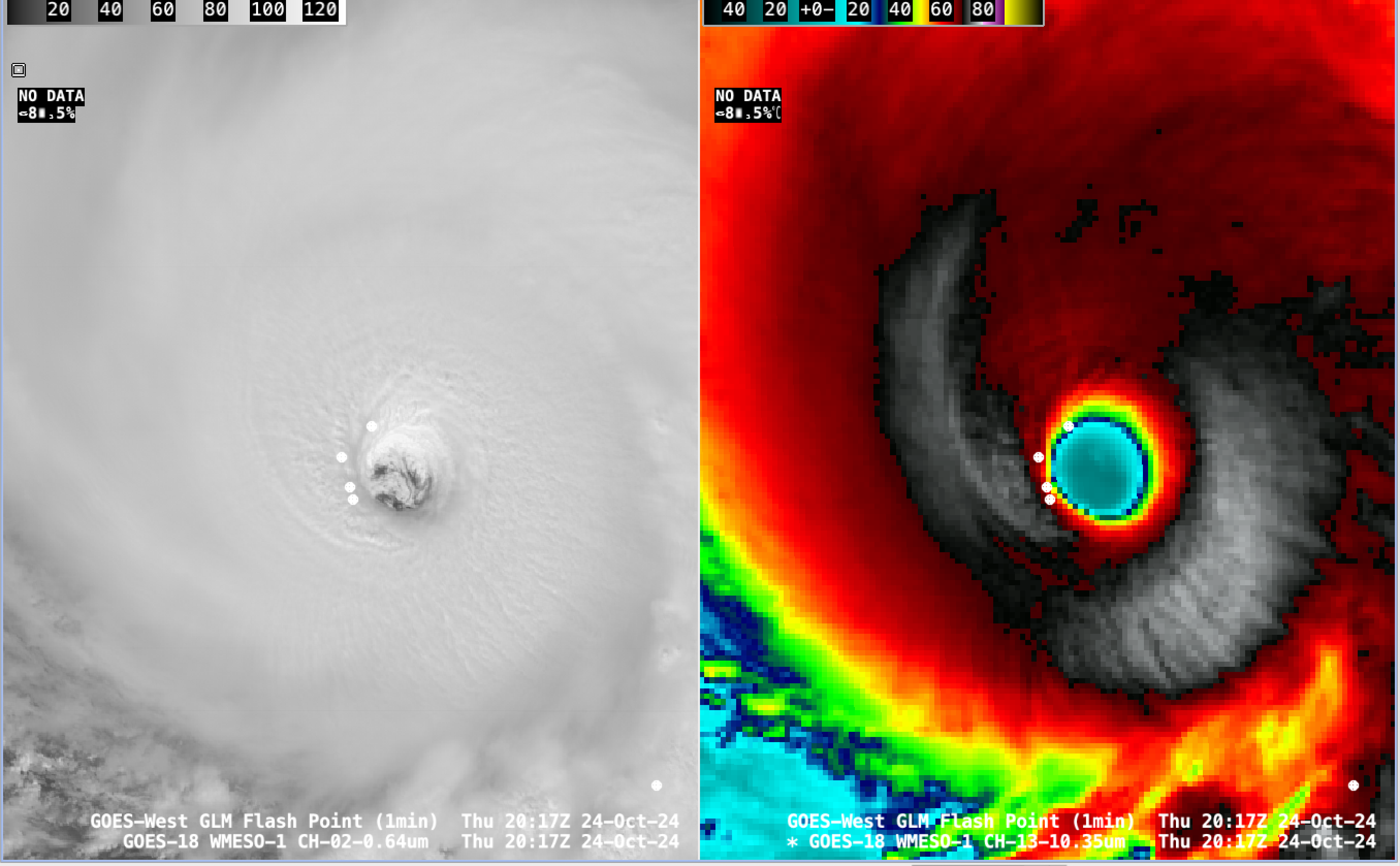
1-minute GOES-18 Red Visible (0.64 µm, left) and Clean Infrared Window (10.3 µm, right) images with an overlay of GLM Flash Points, from 1802-2300 UTC on 24 October [click to play MP4 animation]
In a closer view of GOES-18 Visible images (below), distinct low-altitude mesovortices were once again seen within the eye.
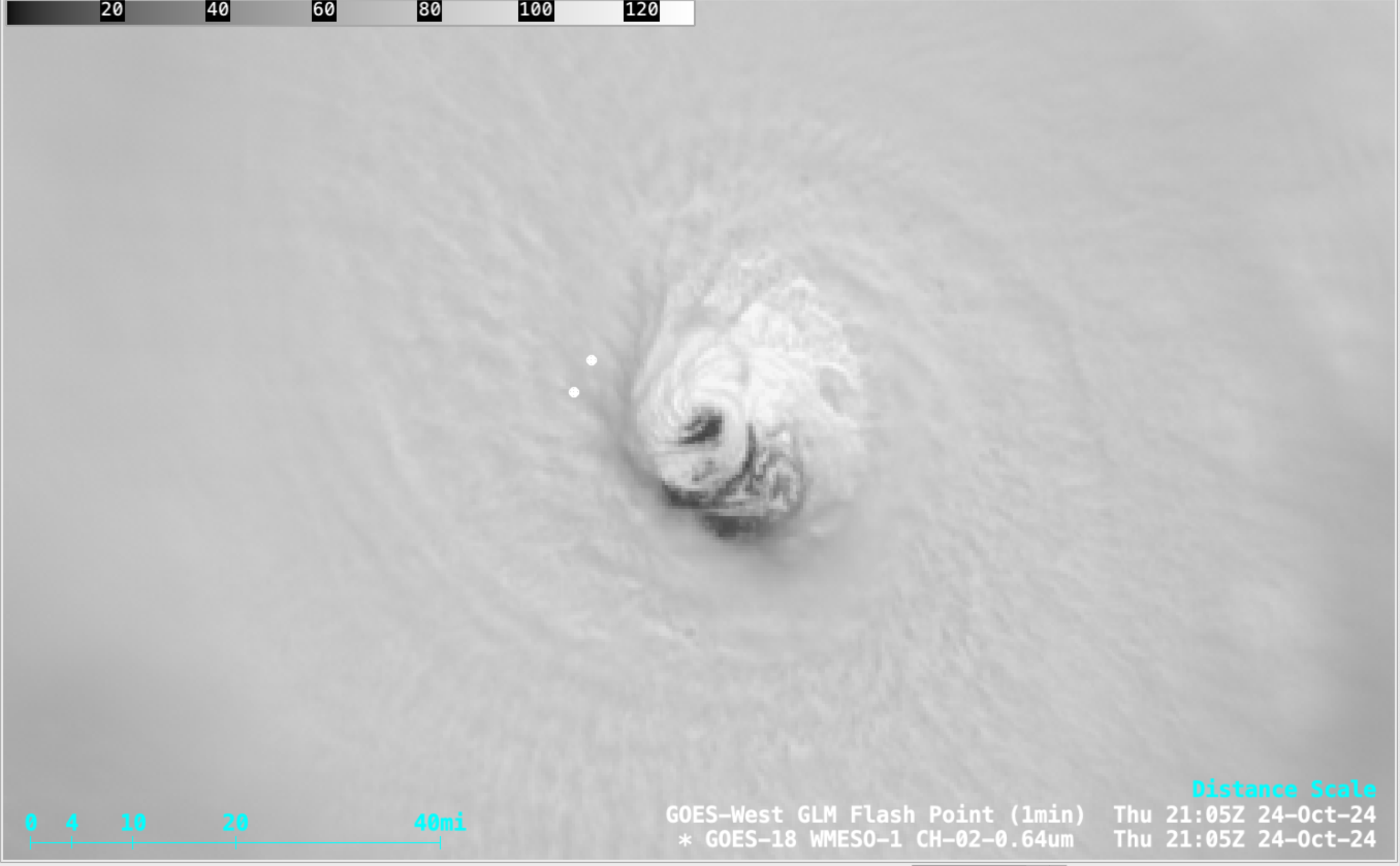
1-minute GOES-18 Red Visible (0.64 µm) images with an overlay of GLM Flash Points, from 1802-2300 UTC on 24 October [click to play MP4 animation]


