Smoke from Canadian fires over the Great Lakes region
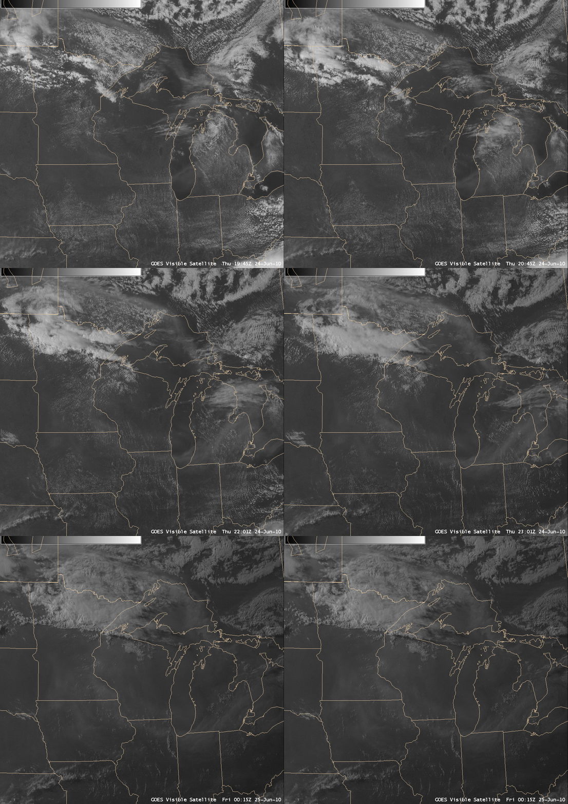
AWIPS images of GOES-13 0.63 µm visible channel data (above) showed widespread hazy conditions over much of the Great Lakes region during the afternoon and evening hours on 24 June 2010. The thick haze became more evident during the late afternoon and early evening hours, as a more favorable sun angle for “forward scattering” helped to highlight the airborne aerosols.
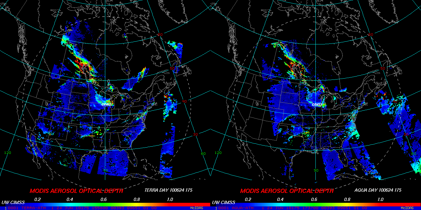
The MODIS Aerosol Optical Depth (AOD) product (below) indicated that AOD values over much of the Great Lakes region were in the 0.6 to 0.8 range, with a larger area of AOD values near 1.0 over south-central Canada. A large number of wildfires had been burning across the northern Prairie Provinces of Canada during the preceding days — so could this thick haze seen over the Great Lakes be due to smoke from Canadian fires?
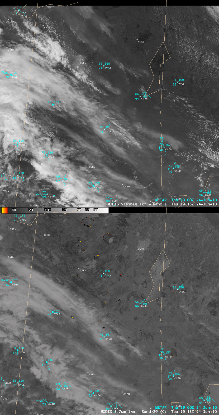
A comparison of 1-km resolution MODIS 0.65 µm visible and 3.7 µm shortwave IR images (below) depicted a number of smoke plumes and “hot spots” (orange to yellow color enhancement) from fires that were still burning on 24 June over northern Saskatchewan and Manitoba. However, on this day, surface winds were from the southeast, advecting the smoke plumes toward the northwest.
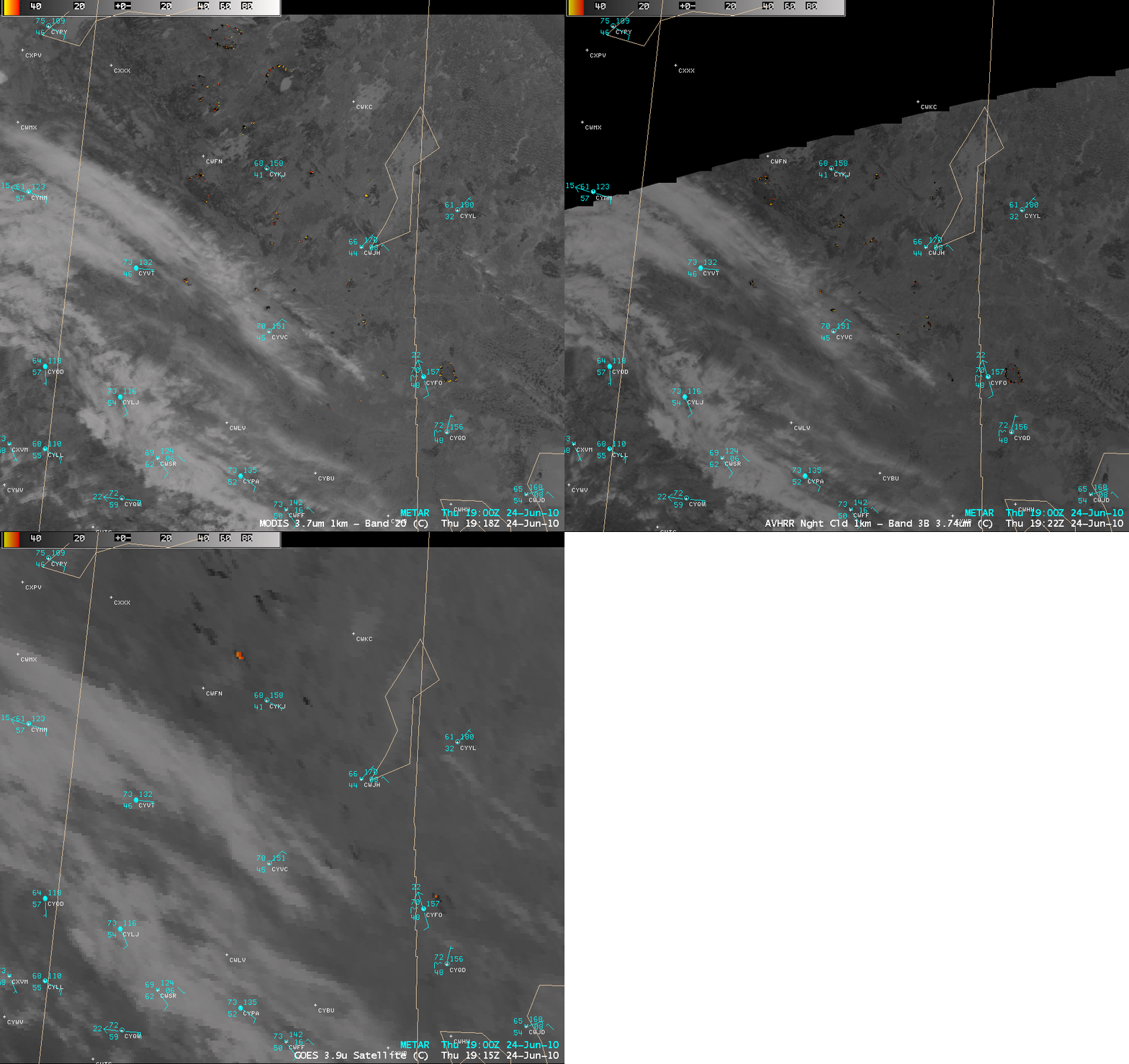
A comparison of the 1-km resolution MODIS and AVHRR 3.7 µm shortwave IR images with the corresponding 4-km resolution GOES-13 3.9 µm shortwave IR image (below) demonstrated the improvement in fire hot spot detection and geo-location using the 1-km resolution polar orbiting satellite data — note the mapping errors on the GOES-13 image due to the large viewing angle from the geostationary satellite.
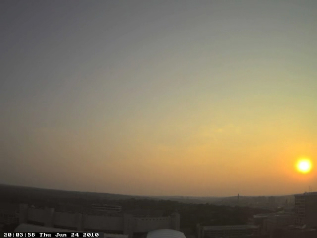
Over southern Wisconsin, the thick smoke contributed to colorful yellow to orange sunset, as seen using the AOSS rooftop camera at the University of Wisconsin – Madison (below; also available as a QuickTime animation).
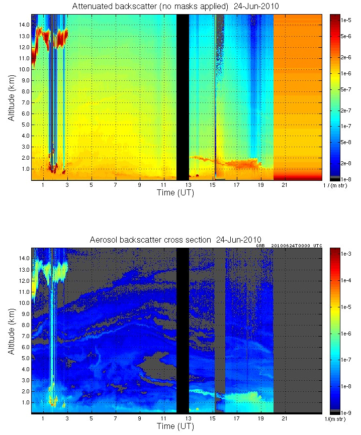
Lidar data from the UW-Madison SSEC Lidar Group (below) showed enhanced backscatter within the 1-2 km altitude layer during the daytime hours.
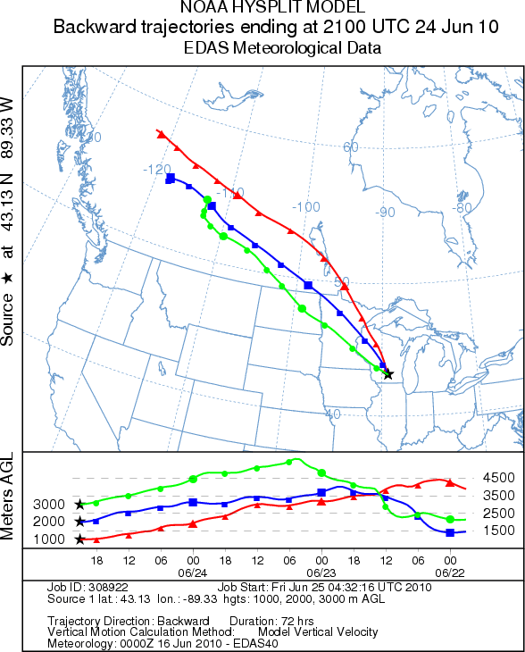
NOAA ARL HYSPLIT back trajectories (below) confirmed that air parcels arriving over Madison, Wisconsin on 24 June had likely passed over the parts of northern Saskatchewan 2-3 days earlier, where active fires had been burning for several days.


