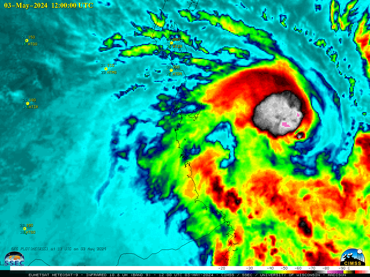
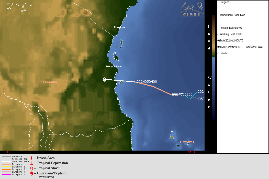
Cyclone Hidaya reaches Category 1 Hurricane intensity
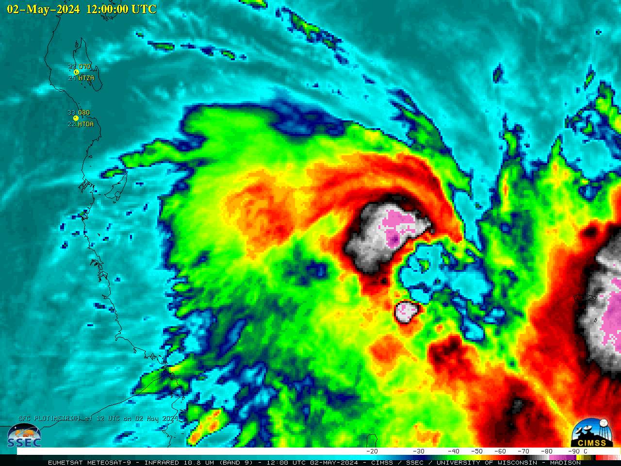
EUMETSAT Meteosat-9 Infrared Window (10.8 µm) images, from 1200 UTC on 02 May to 1200 UTC on 03 May [click to play animated GIF | MP4]
A DMSP-18 SSMIS Microwave (85 GHz) image at 0024 UTC on 03 May, from the CIMSS Tropical Cyclones site (below) revealed a well-defined eye and surrounding eyewall structure.
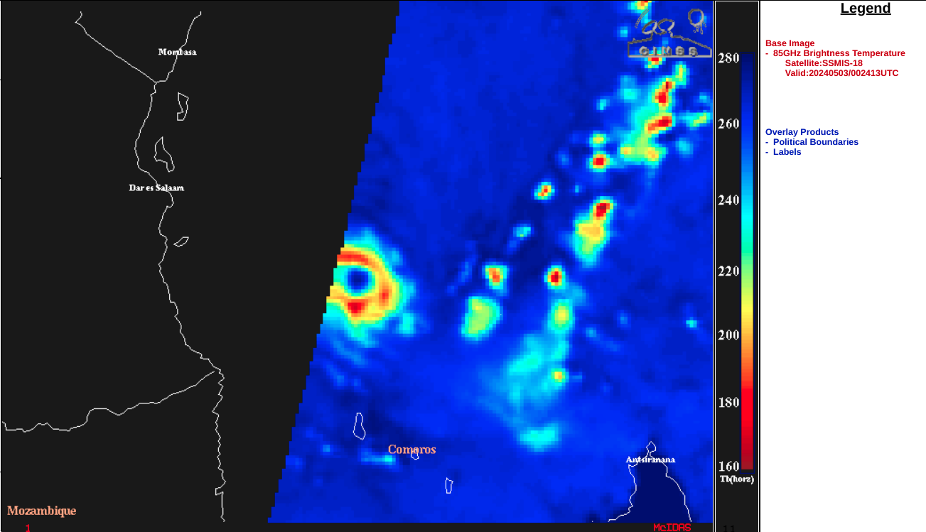
DMSP-18 SSMIS Microwave (85 GHz) image at 0024 UTC on 03 May [click to enlarge]
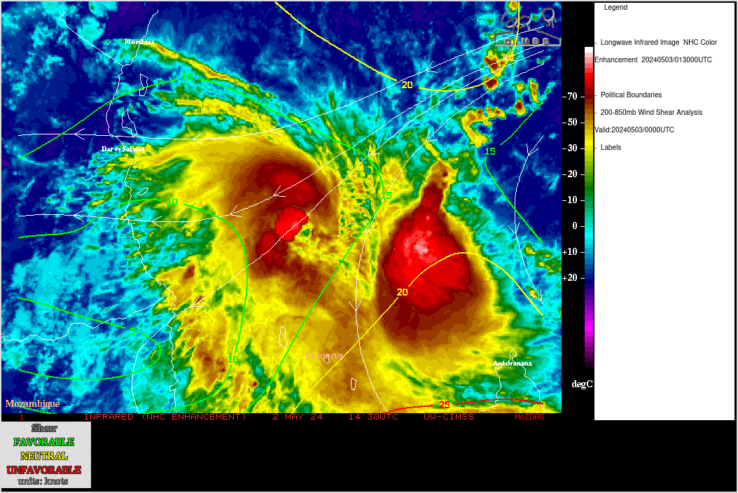
Meteosat-9 Infrared Window images, with contours and streamlines of deep-layer wind shear at 0000 UTC on 03 May [click to enlarge]
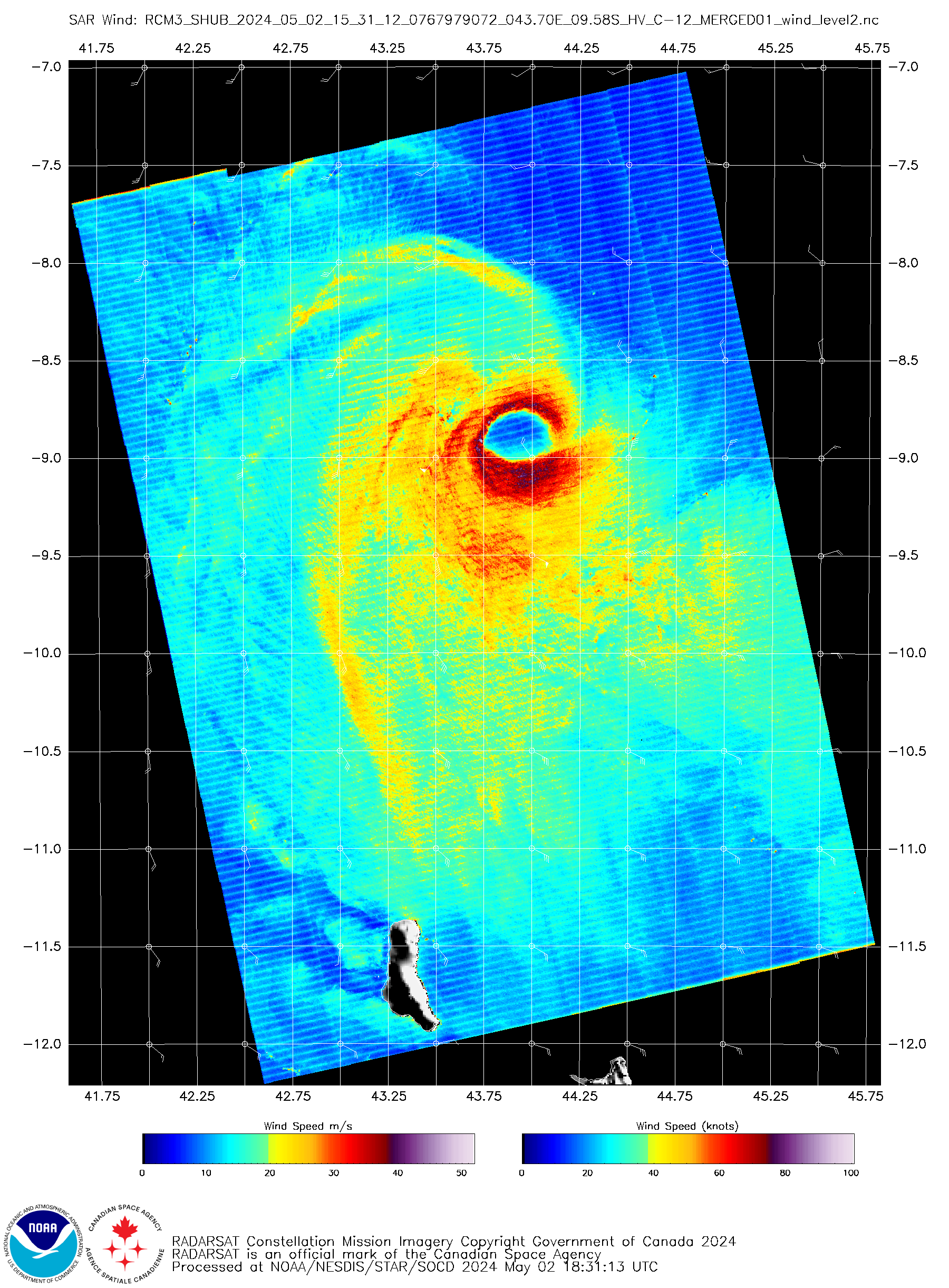
RCM-3 SAR image at 1531 UTC on 02 May [click to enlarge]
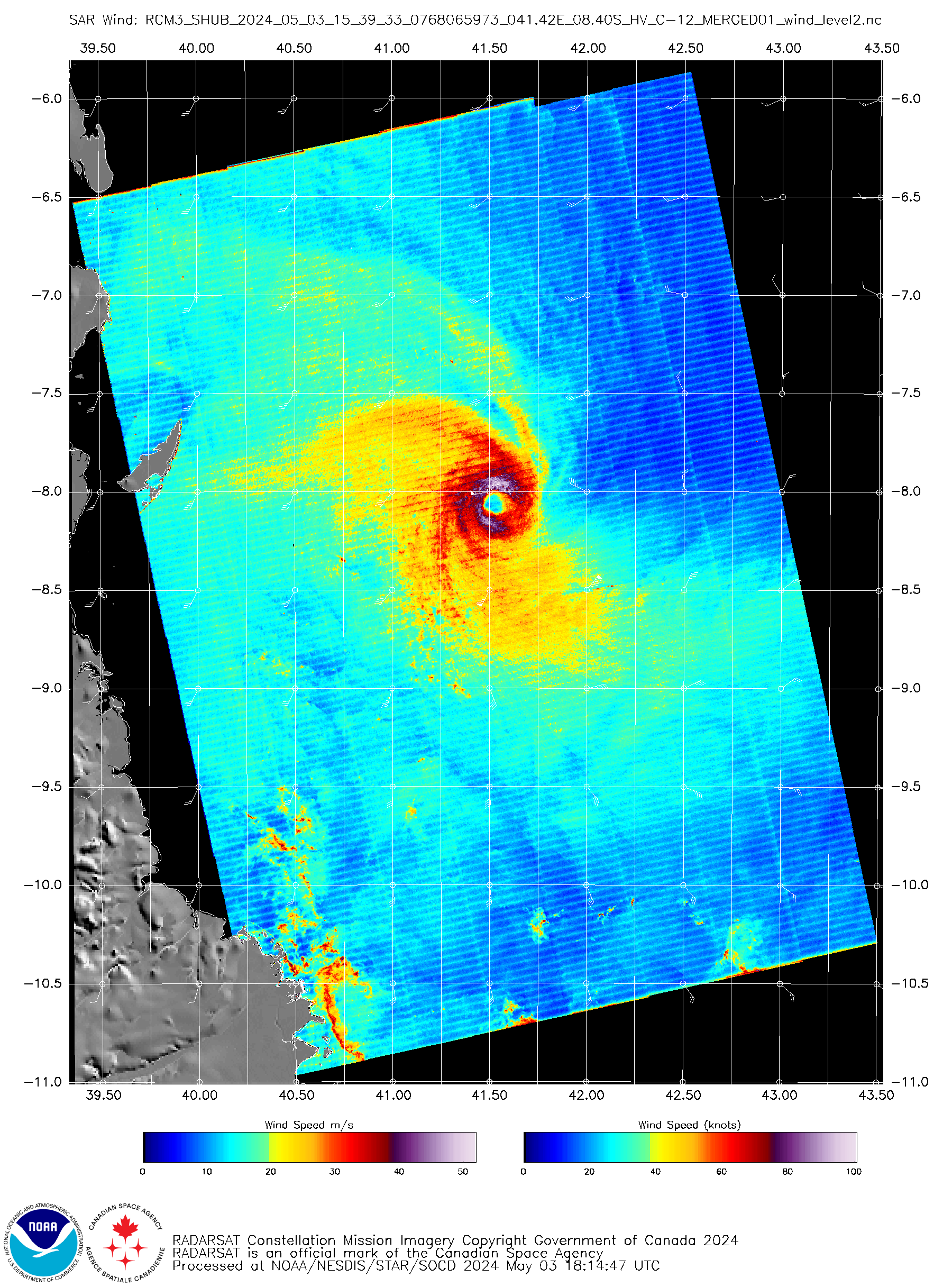
RCM-3 SAR image at 1539 UTC on 03 May [click to enlarge]
===== 04 May Update =====
EUMETSAT Meteosat-9 Infrared Window (10.8 µm) images, from 1200 UTC on 03 May to 1200 UTC on 04 May [click to play animated GIF | MP4]