Google Earth Imagery from SSEC
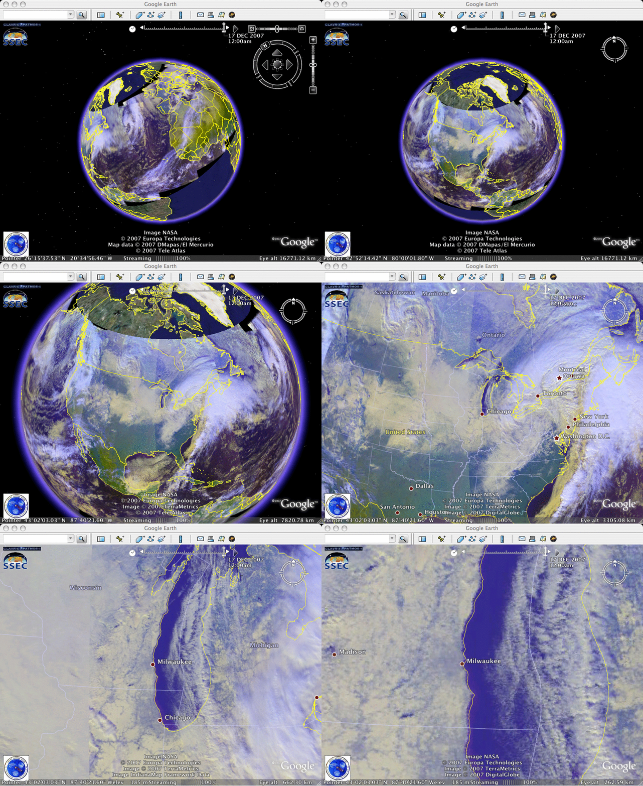
Two new sources of Google Earth satellite imagery are now available from SSEC: AVHRR images from the NOAA operational polar orbiting satellites, and MODIS images from the NASA Terra and Aqua satellites. An example of the AVHRR “false color” imagery (above) zooms in to show the deep snow cover that existed over much of the Upper Midwest on 17 December 2007. Note the darker appearance of the Chicago IL and Milwaukee WI metro areas; even though those cities had a significant amount of snow on the ground, the higher concentration of trees, buildings, and paved surfaces all contributed to a somewhat “darker” satellite scene in those urban areas (compared to the adjacent outlying rural areas). Also evident on the AVHRR image were well-defined lake-effect snow bands over Lake Michigan that were moving inland over portions of Michigan and Indiana — these snow bands were on the far western periphery of a large winter storm that was centered over the Northeast US.
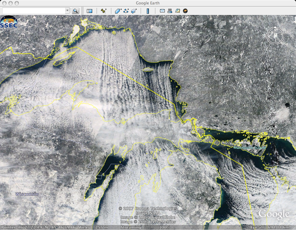
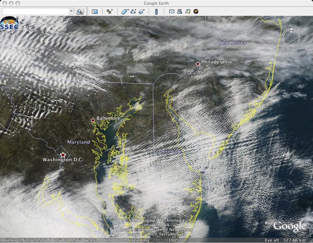
MODIS “true color” imagery from the MODIS Today site (above) revealed a large number of lake-effect snow (LES) bands over parts of Lake Superior, Lake Michigan, and Lake Huron as cold arctic air streamed southward across the Great Lakes on 14 December 2007; these LES bands produced 3-6 inches of snowfall at some locations in the Upper Peninsula of Michigan. On that same day, MODIS imagery farther to the east showed a variety of banded cloud features over the Mid-Atlantic states (below).


