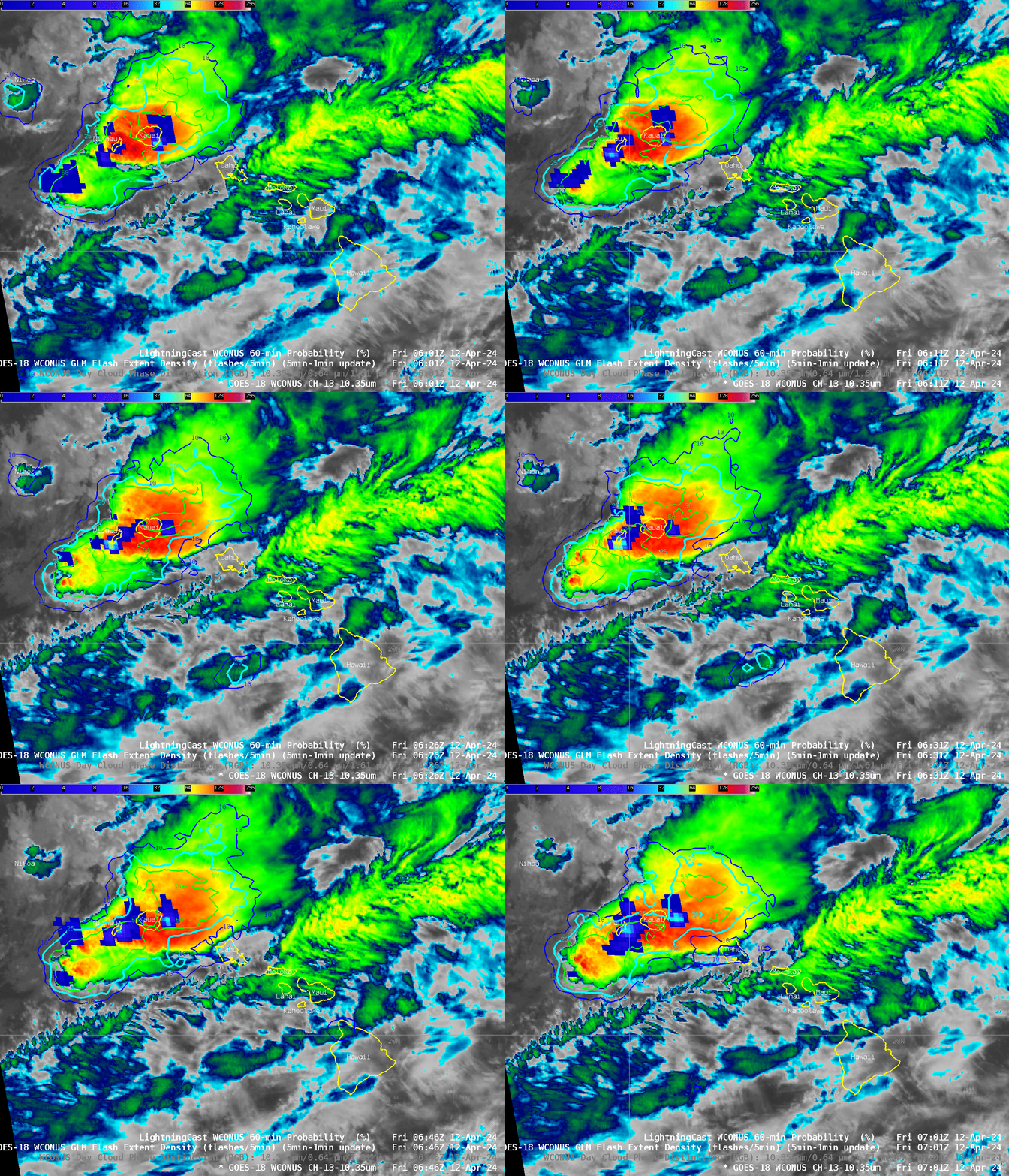
Severe weather over Niihau (and flooding on Kauai) in the Hawai’ian Islands
he NWS Forecast Office in Honolulu late on Thursday (8:33 PM local time 11 April, or 0633 UTC on 12 April) issued a Severe Thunderstorm warning for the island of Niihau to the southwest of Kauai. Subsequently, flood warnings were issued for Kauai. The animation above (from the southwest corner of the GOES-18 PACUS domain) shows the development of the convection to the southwest of the Hawai’ian Islands that intensified as it approached Niihau and Kauai. Note especially the increase in FED that occurred after 0616 UTC just east of Niiahu, as shown below in an animation that steps more slowly from 0621 to 0636 UTC, overlapping the time of warning issuance. Peak FED occurs at 0636 UTC (87), having ramped up from 19 at 0606 UTC!
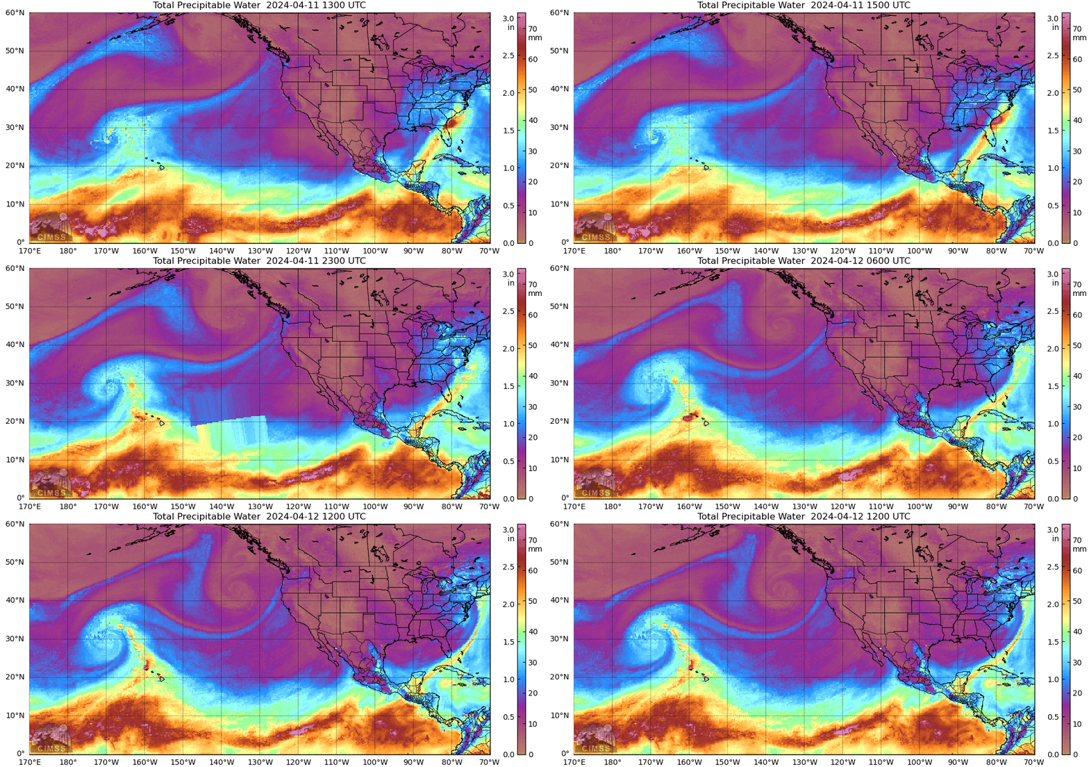
The thunderstorms accompanied a significant moistening of the atmosphere as depicted below by MIMIC Total Precipitable water fields. Deep moisture moved northward through the western Hawai’ian islands; the moisture was drawn northward by a strong storm northwest of the main Hawai’ian Islands readily apparent as the cyclonic swirl in the TPW fields.
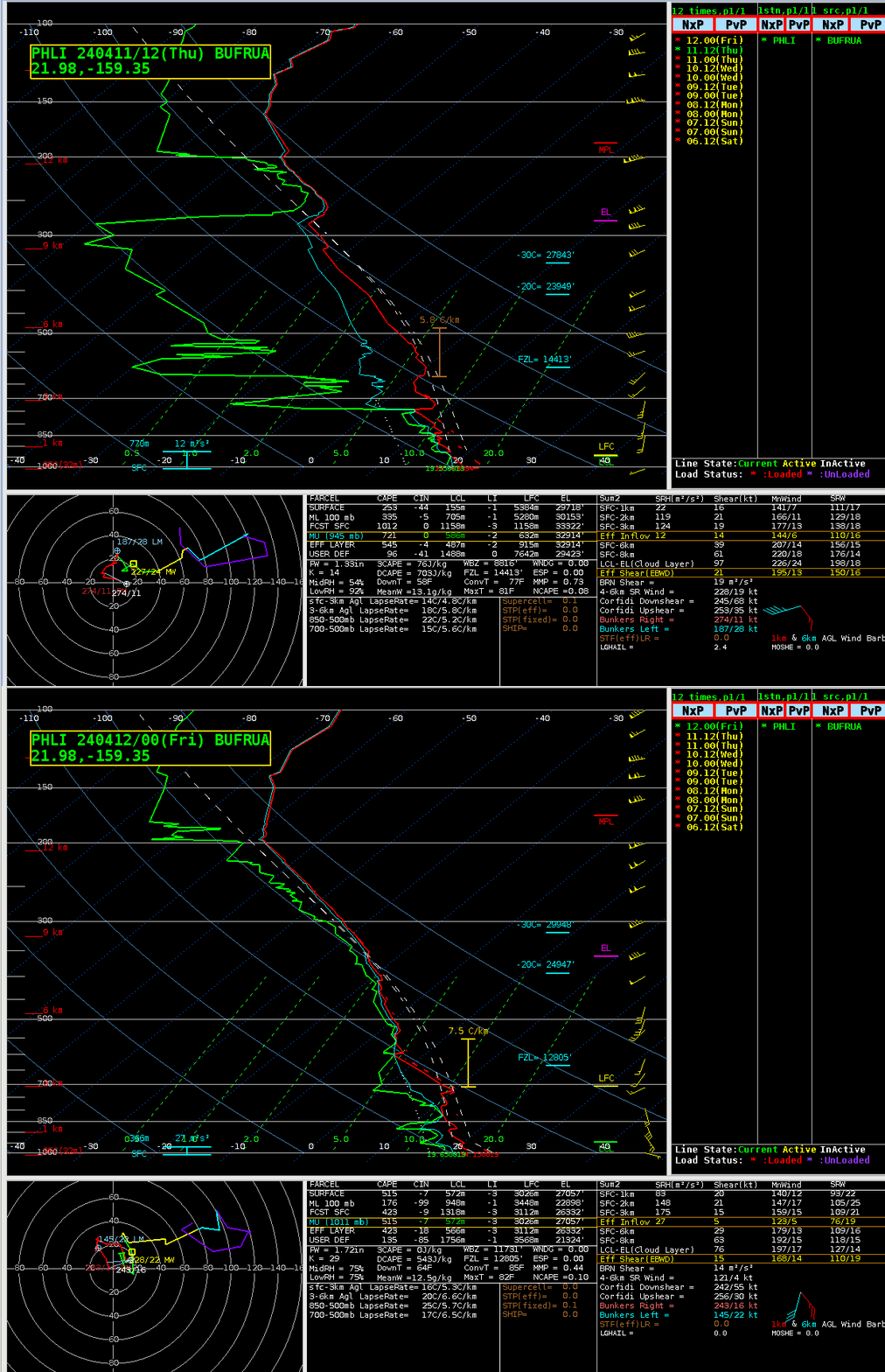
The moistening is also apparent in the soundings from Lihue on the island of Kauai, shown below. Total Precipitable Water jumps from 1.3 to 1.7″ in the 12 hours shown; note also how the low-level winds become more favorable for severe weather with the increase of low-level southeasterlies.
Microwave estimates of Rain Rate computed from Direct Broadcast data in Honolulu (at this site), shows the significant increase in rain rates after 0700 UTC, with heavy rain diagnosed over Kauai!
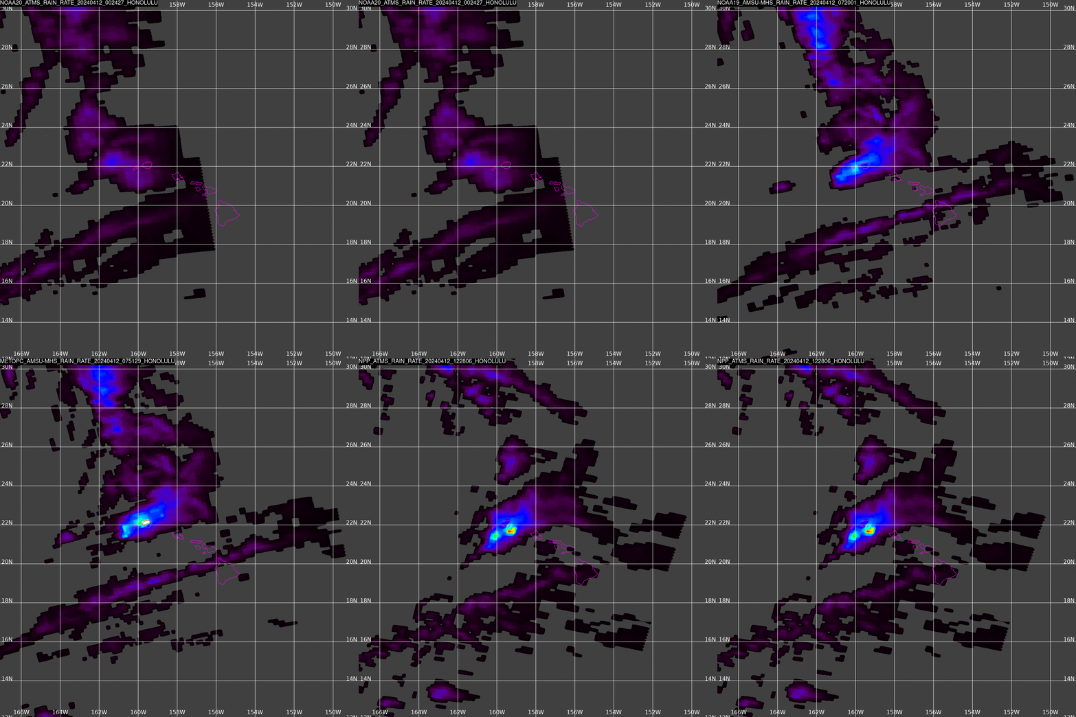
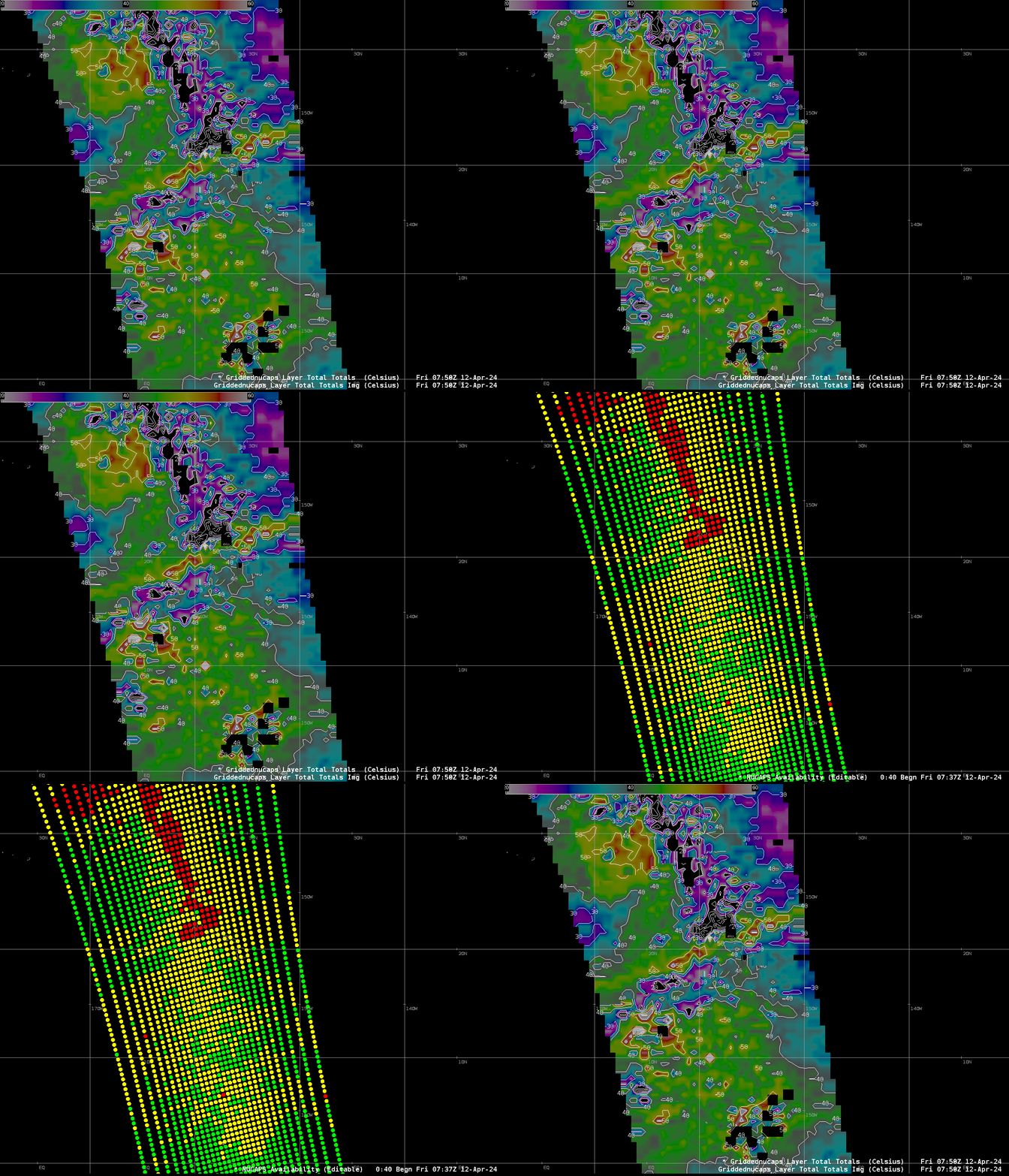
MetopC overflew the Hawai’ian islands at around 0750 UTC (Rain Rate from that overpass is in the animation above); NUCAPS profiles from MetopC are now in AWIPS, complementing the fields from NOAA-20 (and soon (sometime after 1 May), NOAA-21) that occur closer to 00/12 UTC. The Total Totals index from those profiles, below, shows considerably instability to the southwest of the Hawai’ian Islands. Although this pass was too late for the Severe Weather warning issuance, information in the profiles can be used to ascertain how the convection might evolve in the near future.
The rain over the island of Kauai was very heavy, as might be expected given the MIMIC TPW fields and the snapshot views of Rain Rate shown above. Rainfall totals are discussed here.
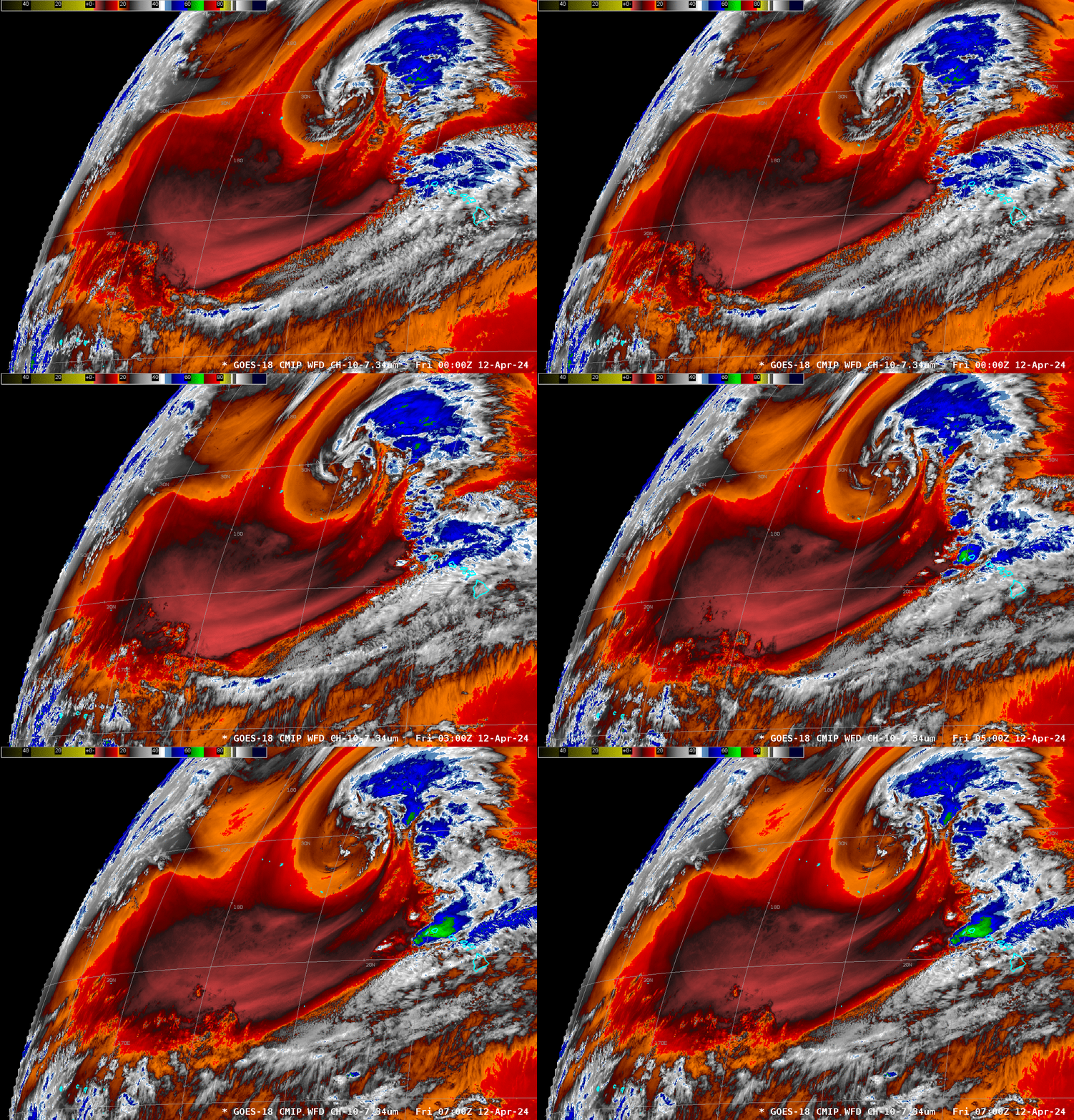
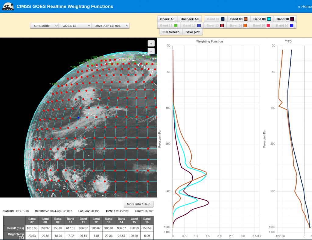
An interesting question was posed at the online Honolulu forecast office weather briefing on Friday: Does the 0000 UTC Sounding at Lihue (shown above in a toggle, and also here) have an Elevated Mixed Layer (EML)? The very steep lapse rate between about 720 and 600 mb and the nearly constant moisture content are both consistent with the presence of an EML. The GOES-18 Band 10 infrared imagery (7.34 µm, the ‘low-level’ water vapor band), below, is also suggestive of an EML; in the color enhancement used, deep reds are often associated with EMLs. Convection over Niihau and Kauai develops along the leading edge of the warm region in the water vapor imagery. The Band 10 weighting function, at bottom (from this website), shows a peak contribution in Band 10 (drawn in dark magenta) from about 620 mb, in the middle of the steep lapse rate shown at Lihue at the same time.
