Wet weather continues in Samoa
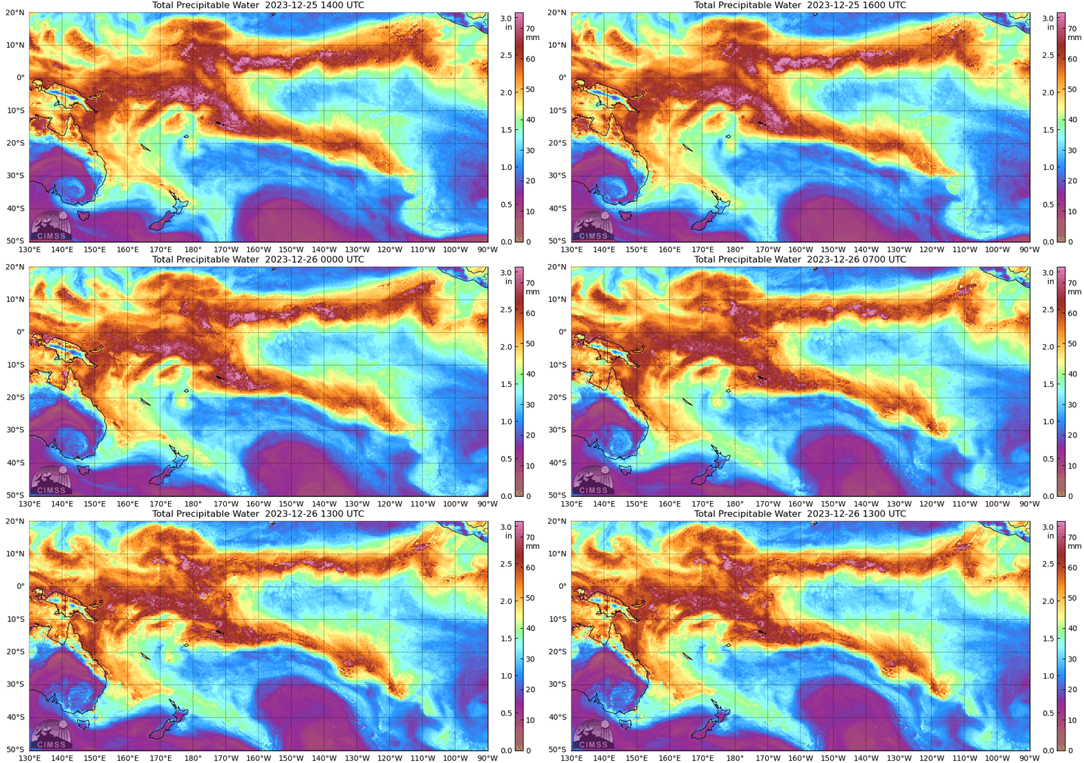
MIMIC Total Preciptable Water (TPW) Fields (from this site), below, for the 24 hours ending 1300 UTC on 26 December 2023, show the Samoan Islands (at 13-14oS, ~172oW) in the middle of the South Pacific Convergence Zone (SPCZ) that stretches east-southeastward across the South Pacific. Pago Pago has received more than 20″ of rain in December so far, with 2.36″ falling on Christmas Day. (Average rainfall in December is near 15″).
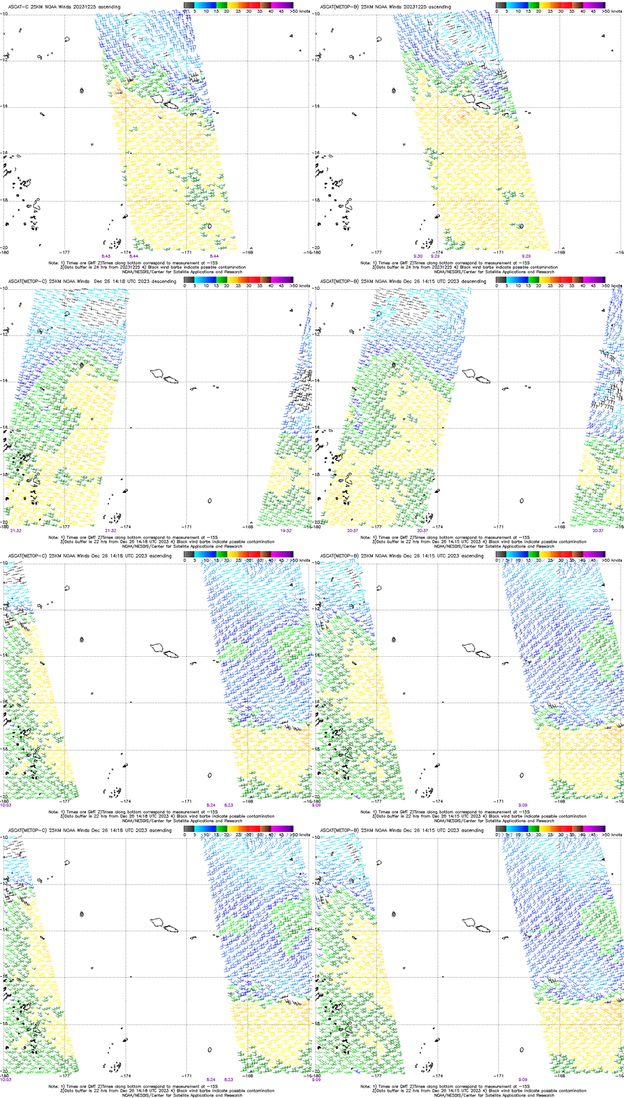
Rain on Christmas Day was supported by strong low-level convergence near the Samoan Islands, as shown below in the animation of Advanced Scatterometer (ASCAT) winds from MetopB and MetopC. Strong convergence is apparent over the islands at the start of the animation, but that zone of convergence has moved south by the 26th.
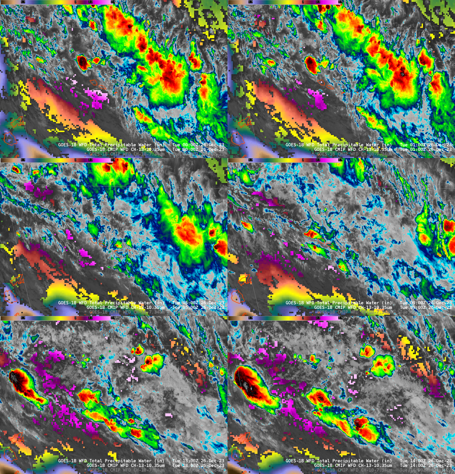
GOES-18 Clean Window imagery, below, overlain on top of Level 2 TPW (scaled from 1-2.5 inches in the figure), also show the slow southward sag of the leading edge of the convergence (inferred by the development of strong convection). Low-level water vapor infrared imagery (Band 10, 7.34 µm) also shows the southward motion of the moisture between 0000 and 1400 UTC on 26 December 2023. The leading edge of the surface convergence has moved south, and strong convection associated with that leading edge has also moved south. However, strong convection continues in the moist air north of the strong convergence, including over the Samoan Islands. A Flood Watch continues over American Samoa through Tuesday (WSO PPG website).
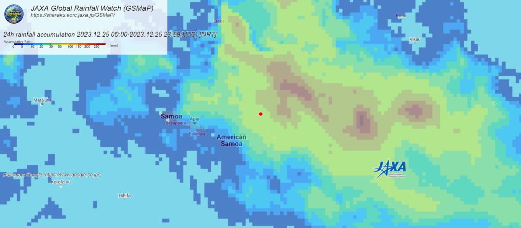
Microwave estimates of 24-precipitation on Christmas Day from JAXA’s GsMap site (below) show that the heaviest rain on that day fell over the Manu’a Islands with even larger totals over the ocean to the north.
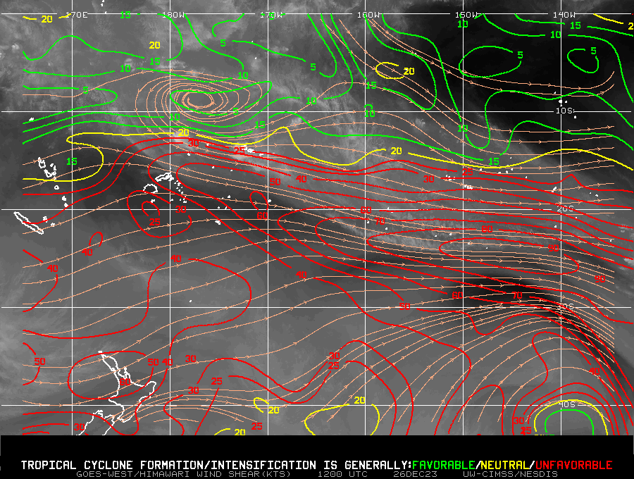
The Samoan Islands are currently under strong shear, so it would be a surprise if the convection over and south of Samoa developed into a tropical cyclone. However, shear is favorable to the northwest of the Samoan Islands. (Shear image taken from the SSEC/CIMSS Tropical Weather Website).
