Explosive eruption of Mount Shishaldin in Alaska
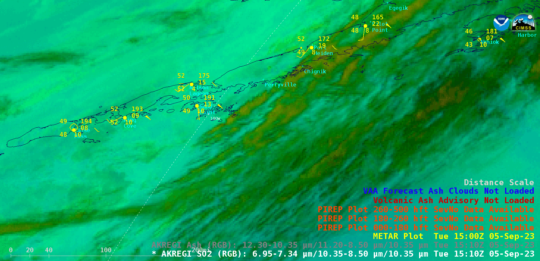
GOES-18 SO2 RGB and Ash RGB images, with plots of Pilot Reports and Volcanic Ash Advisory/Forecast polygons [click to play animated GIF | MP4]
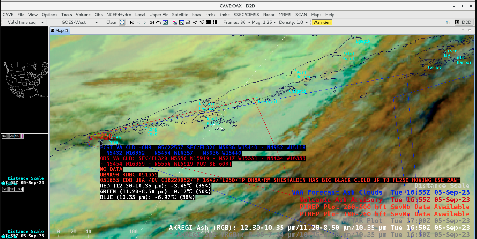
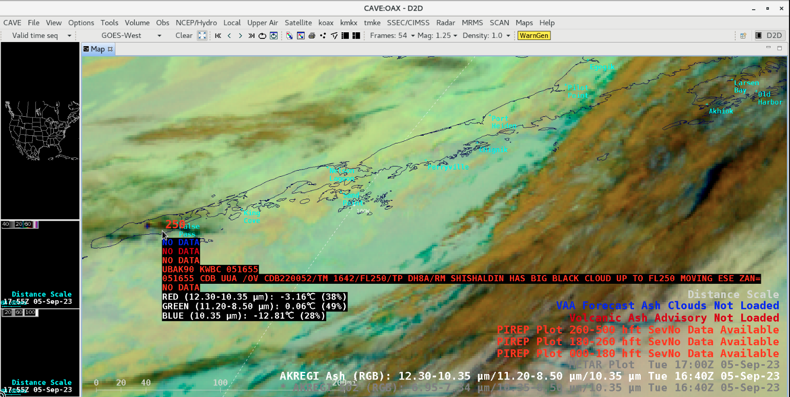
A Pilot Report issued at 1642 UTC (below) highlighted a volcanic cloud extending to an altitude of 25000 feet. The initial Volcanic Ash Advisory and Forecast advised of ash between the surface and 32000 feet. A Special Marine Statement mentioned the possibility of ash fall to the southeast of Umiak Island.
GOES-18 Ash RGB image at 1640utc, with cursor sampling of a 1642 UTC Pilot Report [click to enlarge]
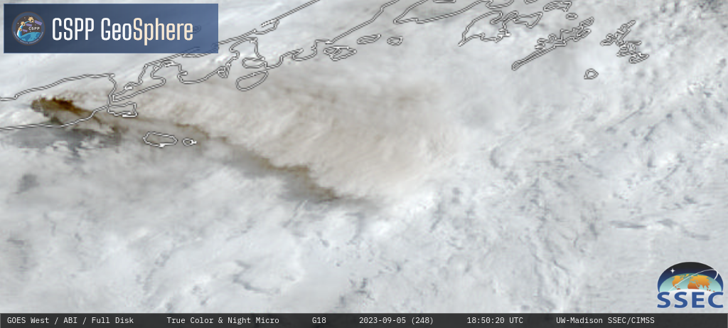
GOES-18 Nighttime Microphysics RGB and daytime True Color RGB images [click to play MP4 animation]